|
|
Title | Date | Type | Setname |
| 1 |
 |
A man and a young boy and girl standing in front of a hogan | 1970; 1971; 1972; 1973; 1974; 1975; 1976; 1977; 1978; 1979; 1980; 1981; 1982; 1983; 1984; 1985; 1986; 1987; 1988; 1989 | Image/StillImage | uaida_main |
| 2 |
 |
A Precarious Balance: The Northern Utes And The Black Hawk War | 1989 | Text | uaida_main |
| 3 |
 |
An Anguished Odyssey: the Flight of the Utes, 1906-1908 | 1968 | Text | uaida_main |
| 4 |
 |
Appeal to the People for the Water - Goshute Tribal Chairman | | Image/MovingImage | uaida_main |
| 5 |
 |
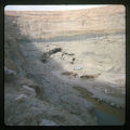
Artician Well No.3 Bluff, Utah 100 Gal per minute | | Image/StillImage | uaida_main |
| 6 |
 |
Blue and white truck parked in canyon, river | 1970; 1971; 1972; 1973; 1974; 1975; 1976; 1977; 1978; 1979; 1980; 1981; 1982; 1983; 1984; 1985; 1986; 1987; 1988; 1989 | Image/StillImage | uaida_main |
| 7 |
 |
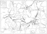
Boundary of Shoshone Indian Territory according to Swanton, 1952 | 1952 | Image/StillImage | uaida_main |
| 8 |
 |
Boundary of Shoshone Indian Territory and Neighboring Tribes | 1957 | Image/StillImage | uaida_main |
| 9 |
 |
Boundary of Shoshone Indian Territory, Linguistic Boundaries of Shoshone and Bannock. | 1941 | Image/StillImage | uaida_main |
| 10 |
 |
Boundary of Shoshone Indian Territory, showing the locations of the Bannock | 1957 | Image/StillImage | uaida_main |
| 11 |
 |
Boundary of Shoshone Indian Territory, showing the locations of the Bannock from 1819 to 1951 | 1957 | Image/StillImage | uaida_main |
| 12 |
 |
Boundary of Shoshone Indian Territory, showing the locations where the Bannock and Shoshone reported together 1819-1956 | 1957 | Image/StillImage | uaida_main |
| 13 |
 |
Boundary of Shoshone Indian Territory; Doty Map of 1863 Indian Claims Commission | 1957 | Image/StillImage | uaida_main |
| 14 |
 |
Father Escalante and the Utah Indians | 1928; 1929; 1930; 1931; 1932; 1933 | Text | uaida_main |
| 15 |
 |
Father Liebler looking down over the mission | 1970; 1971; 1972; 1973; 1974; 1975; 1976; 1977; 1978; 1979; 1980; 1981; 1982; 1983; 1984; 1985; 1986; 1987; 1988; 1989 | Image/StillImage | uaida_main |
| 16 |
 |
Fort Duchesne's Beginnings | 1928; 1929; 1930; 1931; 1932; 1933 | Text | uaida_main |
| 17 |
 |
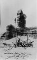
Goodridges Oil Well No. 1, San Juan Oil fields, Utah Struck High Grade Oil here March 4, 1908 | | Image/StillImage | uaida_main |
| 18 |
 |
Group Portrait | 1962-05-02 | Image | dha_scp |
| 19 |
 |
Indian Country | 1971 | Text | uaida_main |
| 20 |
|
Indian Reminiscences | 1928; 1929; 1930; 1931; 1932; 1933 | Text | uaida_main |
| 21 |
|
Indian Reservations in Utah, and Uintah and Ouray Indian Agency, Fort Duchesne, Utah | 1928; 1929; 1930; 1931; 1932; 1933 | Text | uaida_main |
| 22 |
|
Indians on the Old Spanish Trail | 1928; 1929; 1930; 1931; 1932; 1933 | Text | uaida_main |
| 23 |
|
Interview with Roy Atine | 1968-08-07 | Sound | uaida_main |
| 24 |
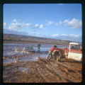 |
Man standing next to a car that is buried in mud. Two men, one wearing a red shirt, trying to push a red and white truck | 1970; 1971; 1972; 1973; 1974; 1975; 1976; 1977; 1978; 1979; 1980; 1981; 1982; 1983; 1984; 1985; 1986; 1987; 1988; 1989 | Image/StillImage | uaida_main |
| 25 |
 |
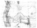
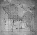
Map of a portion of the Uncompahgre Ute Indian Reservation | 1908 | Image/StillImage | uaida_main |
| 26 |
 |
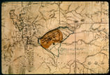
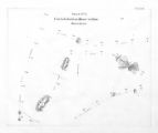
Map of a portion of the Uncompahgre Ute Indian Reservation, surveyed and subdivided for allotments to the Uncompahgre Ute Indians in accordance with the Act approved June 1880 by authority of Honorable N. C. McFarland, Commissioner General Land Office Daniel G. Major U.S. Surveyor 1882-1883 | 1882; 1883 | Image/StillImage | uaida_main |
| 27 |
 |
Map of Chief Washakie's Hunting and Fighting Territory, prepare by Oscar Mosserly, 1930 | | Image/StillImage | uaida_main |
| 28 |
 |
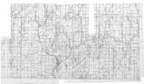
Map of Dry Gulch Irrigation District, Uintah Indian Reservation, Utah | | Image/StillImage | uaida_main |
| 29 |
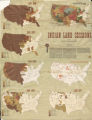 |
Map of Indian Land Cessions in the United States | | Image/StillImage | uaida_main |
| 30 |
 |
Map of Indian Reservation in the West, 1929 | | Image/StillImage | uaida_main |
| 31 |
 |
Map of Indian Reservation. 1884 | | Image/StillImage | uaida_main |
| 32 |
 |
Map of Indian Reservations in the Western United States | | Image/StillImage | uaida_main |
| 33 |
 |
Map of Indian Territory in the Western United States | | Image/StillImage | uaida_main |
| 34 |
 |
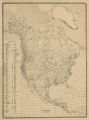
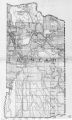
Map of Indian Tribes of North America | | Image/StillImage | uaida_main |
| 35 |
 |
Map of Navajo, Ute, and Jicarilla Apache Indian Reserves | | Image/StillImage | uaida_main |
| 36 |
 |
Map of North America and Original Inhabitants' Territory. | | Image/StillImage | uaida_main |
| 37 |
 |
Map of Part of the West Boundary of the Uncompahgre Ute Indian Reservation as Surveyed by William B. Dougall | | Image/StillImage | uaida_main |
| 38 |
 |
Map of Reservations of the Western United States and the Religions that Worked on the Reservations 1870's | 1873 | Image/StillImage | uaida_main |
| 39 |
 |
Map of Shoshone Indian Territory, and the Division of Shoshone Boundaries in Nevada | | Image/StillImage | uaida_main |
| 40 |
 |
Map of Shoshone Territory; Prepared by Doty, 1859 | | Image/StillImage | uaida_main |
| 41 |
 |
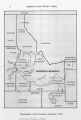
Map of Southern Colorado and the Ute Mountain Ute Reservation | | Image/StillImage | uaida_main |
| 42 |
 |
Map of Stock Mining Claims in the Uintah Basin | | Image/StillImage | uaida_main |
| 43 |
 |
Map of the Four Corners Region and the Reservation of the Ute Mountain Ute Tribe | | Image/StillImage | uaida_main |
| 44 |
 |
Map of the Homelands of Northern Shoshone, 1863 | | Image/StillImage | uaida_main |
| 45 |
 |
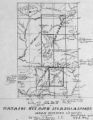
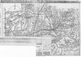
Map of the Northern Part of the Former Uintah Indian Reservation Showing the Irrigation System | | Image/StillImage | uaida_main |
| 46 |
 |
Map of the original range of the Bannock Indians according to Bureau of Indian Affairs, 1952. | | Image/StillImage | uaida_main |
| 47 |
 |
Map of the Shoshone Tribes | | Image/StillImage | uaida_main |
| 48 |
 |
Map of the South West Boundary of the Uintah Indian Reserve Utah Territory. | | Image/StillImage | uaida_main |
| 49 |
 |
Map of the Southern Part of the Former Uintah Indian Reservation Showing the Irrigation System of Indian Allotments | | Image/StillImage | uaida_main |
| 50 |
 |
Map of the Uintah Basin and the Uintah Ouray Reservation | | Image/StillImage | uaida_main |
| 51 |
 |
Map of Uintah Irrigation Project June 1926 Myton, Utah | | Image/StillImage | uaida_main |
| 52 |
 |
Map of Uintah Reservation. Green River Area | | Image/StillImage | uaida_main |
| 53 |
 |
Map of Uintah Valley Reserve, formed by order of President Abraham Lincoln, 1861. | | Image/StillImage | uaida_main |
| 54 |
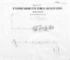 |
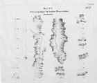
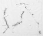
Map of Uncompahgre Ute Indian Reservation Boundaries, Sheet Number 1, 1889 | | Image/StillImage | uaida_main |
| 55 |
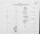 |
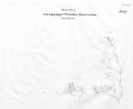
Map of Uncompahgre Ute Indian Reservation Boundaries, Sheet Number 2, 1889 | | Image/StillImage | uaida_main |
| 56 |
 |
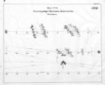
Map of Uncompahgre Ute Indian Reservation Boundaries, Sheet Number 3, 1889 | | Image/StillImage | uaida_main |
| 57 |
 |
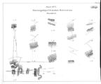
Map of Uncompahgre Ute Indian Reservation Boundaries, Sheet Number 4, 1889 | | Image/StillImage | uaida_main |
| 58 |
 |
Map of Uncompahgre Ute Indian Reservation Boundaries, Sheet Number 5, 1889 | | Image/StillImage | uaida_main |
| 59 |
 |
Map of Uncompahgre Ute Indian Reservation Boundaries, Sheet Number 6, 1889 | | Image/StillImage | uaida_main |
| 60 |
 |
Map of Uncompahgre Ute Indian Reservation Boundaries, Sheet Number 7, 1889 | | Image/StillImage | uaida_main |
| 61 |
 |
Map of Uncompahgre Ute Indian Reservation Boundaries, Sheet Number 8, 1889 | | Image/StillImage | uaida_main |
| 62 |
 |
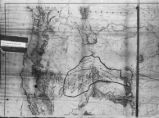
Map of Ute Reservation in Western Colorado, and Lands Ceded Over Time | 1882 | Image/StillImage | uaida_main |
| 63 |
 |
Map of Ute Territory by Band | | Image/StillImage | uaida_main |
| 64 |
 |
Map of Ute Territory in Utah and Colorado by Band Name and Location | | Image/StillImage | uaida_main |
| 65 |
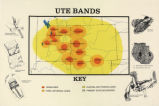 |
Map titled "Ute Bands Map" | | Image/StillImage | uaida_main |
| 66 |
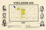 |
Map titled "Ute Lands, 1876" | | Image/StillImage | uaida_main |
| 67 |
 |
Map titled, "Northern Ute Lands, 1905" | | Image/StillImage | uaida_main |
| 68 |
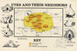 |
Map titled, "Utes and Their Neighbors" | | Image/StillImage | uaida_main |
| 69 |
 |
Moody's Land Office | | Image | dc_bpc |
| 70 |
|
No Place To Pitch Their Teepees: Shoshone Adaptation To Mormon Settlers In Cache Valley, 1855-1870 | 1995 | Text | uaida_main |
| 71 |
 |
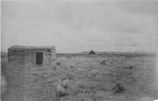
No. 1 Bluff, Utah | | Image/StillImage | uaida_main |
| 72 |
 |
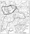
The Seasonal Movements of the Shoshone-Bannock Peoples | | Image/StillImage | uaida_main |
| 73 |
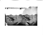 |
Threshing scene, Bannock Tribe, 1872 | 1872 | Image/StillImage | uaida_main |
| 74 |
 |
Topographic and Hydrographic Map of Uinta Indian Reservation Utah, May 1905 | | Image/StillImage | uaida_main |
| 75 |
 |
Uinta Indian Reservation Utah Showing Irrigation Systems. | | Image/StillImage | uaida_main |
| 76 |
 |
Uinta Indian Reservation Utah, under act of March 3, 1905 and President's Proclamation dated July 14, 1905 | | Image/StillImage | uaida_main |
| 77 |
|
Uintah and Ouray Indian Agency, Fort Duchesne, Utah | 1928; 1929; 1930; 1931; 1932; 1933 | Text | uaida_main |
| 78 |
 |
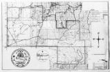
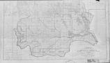
Uintah Indian Reservation and the Three Band Divisions 1903. | 1903 | Image/StillImage | uaida_main |
| 79 |
 |
Uintah Indian Reservation Boundaries Sheet Number 4 | | Image/StillImage | uaida_main |
| 80 |
 |
Uintah Indian Reservation Boundaries; Sheet Number 2 | | Image/StillImage | uaida_main |
| 81 |
 |
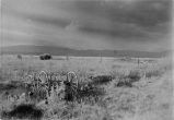
Uintah Ute Indian Canvass Tepee, Summer '09 | | Image/StillImage | uaida_main |
| 82 |
|
Ute Indians: Before and after White Contact | 1966 | Text | uaida_main |
| 83 |
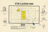 |
Ute Lands, 1868 | | Image/StillImage | uaida_main |
| 84 |
 |
View near White Rocks, Summer '09 | | Image/StillImage | uaida_main |
| 85 |
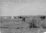 |
View near White Rocks, Summer '09 | | Image/StillImage | uaida_main |
| 86 |
 |
View near White Rocks, Summer '09 | | Image/StillImage | uaida_main |
| 87 |
 |
View Near White Rocks, Summer '09 | | Image/StillImage | uaida_main |
| 88 |
 |
View of White Rocks, Summer '09 | | Image/StillImage | uaida_main |