1 - 25 of 73
Number of results to display per page
TitleDateType
1 A man and a young boy and girl standing in front of a hogan1970; 1971; 1972; 1973; 1974; 1975; 1976; 1977; 1978; 1979; 1980; 1981; 1982; 1983; 1984; 1985; 1986; 1987; 1988; 1989Image/StillImage
2 Artician Well No.3 Bluff, Utah 100 Gal per minuteImage/StillImage
3 Blue and white truck parked in canyon, river1970; 1971; 1972; 1973; 1974; 1975; 1976; 1977; 1978; 1979; 1980; 1981; 1982; 1983; 1984; 1985; 1986; 1987; 1988; 1989Image/StillImage
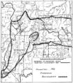
4 Boundary of Shoshone Indian Territory according to Swanton, 19521952Image/StillImage
5 Boundary of Shoshone Indian Territory and Neighboring Tribes1957Image/StillImage
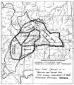
6 Boundary of Shoshone Indian Territory, Linguistic Boundaries of Shoshone and Bannock.1941Image/StillImage
7 Boundary of Shoshone Indian Territory, showing the locations of the Bannock1957Image/StillImage
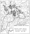
8 Boundary of Shoshone Indian Territory, showing the locations of the Bannock from 1819 to 19511957Image/StillImage
9 Boundary of Shoshone Indian Territory, showing the locations where the Bannock and Shoshone reported together 1819-19561957Image/StillImage
10 Boundary of Shoshone Indian Territory; Doty Map of 1863 Indian Claims Commission1957Image/StillImage
11 Father Liebler looking down over the mission1970; 1971; 1972; 1973; 1974; 1975; 1976; 1977; 1978; 1979; 1980; 1981; 1982; 1983; 1984; 1985; 1986; 1987; 1988; 1989Image/StillImage
12 Goodridges Oil Well No. 1, San Juan Oil fields, Utah Struck High Grade Oil here March 4, 1908Image/StillImage
13 Man standing next to a car that is buried in mud. Two men, one wearing a red shirt, trying to push a red and white truck1970; 1971; 1972; 1973; 1974; 1975; 1976; 1977; 1978; 1979; 1980; 1981; 1982; 1983; 1984; 1985; 1986; 1987; 1988; 1989Image/StillImage
14 Map of a portion of the Uncompahgre Ute Indian Reservation1908Image/StillImage
15 Map of a portion of the Uncompahgre Ute Indian Reservation, surveyed and subdivided for allotments to the Uncompahgre Ute Indians in accordance with the Act approved June 1880 by authority of Honorable N. C. McFarland, Commissioner General Land Office Daniel G. Major U.S. Surveyor 1882-18831882; 1883Image/StillImage
16 Map of Chief Washakie's Hunting and Fighting Territory, prepare by Oscar Mosserly, 1930Image/StillImage
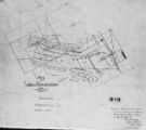
17 Map of Dry Gulch Irrigation District, Uintah Indian Reservation, UtahImage/StillImage
18 Map of Indian Land Cessions in the United StatesImage/StillImage
19 Map of Indian Reservation in the West, 1929Image/StillImage
20 Map of Indian Reservation. 1884Image/StillImage
21 Map of Indian Reservations in the Western United StatesImage/StillImage
22 Map of Indian Territory in the Western United StatesImage/StillImage
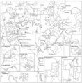
23 Map of Indian Tribes of North AmericaImage/StillImage
24 Map of Navajo, Ute, and Jicarilla Apache Indian ReservesImage/StillImage
25 Map of North America and Original Inhabitants' Territory.Image/StillImage
1 - 25 of 73