Home
Browse
Ask Us
Chat
Harmful Language Statement
Log in
Art and Art History
Advanced Search
About
Curriculum-based images for use in teaching, research, and learning.
Type
Image
7
Format
image/jpeg
7
Collection
Art and Art History
7
Filters:
Format:
"image/jpeg"
Style Period:
"20th Century Art"
Subject:
"Maps"
1
-
25
of
7
Gallery view
Number of results to display per page
10
25
50
100
200
Sort by Relevance
Sort by Title A-Z
Sort by Title Z-A
Sort by Date Ascending
Sort by Date Descending
Sort by Last Modified Ascending
Sort by Last Modified Descending
Title
Date
Type
1
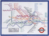
Map of London Underground, After Re-Design
Image
2
Map showing three locations of Zhuang Hui's site-specific project "Longitude 109.88°E and Latitude 31.09°N
Image
3
Map: British Empire, excluding Americas, 1921 CE
Image
4
Map: Locations of 1937 Paris World's Fair, the Berlin Olympics, Nuremberg Rallies, and Great German and Degenerate Art Exhibits
Image
5
Map: Mediterranean and Northern Africa
Image
6
Map: Osogbo
Image
7
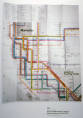
New York Metropolitan Transit Authority Subway Guide
Image
1
-
25
of
7