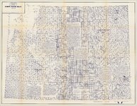
The Federal Resources Corporation records (1930-1989) contain the "dead files" of a company that, through a long series of mergers and acquisitions, most of which took place in the 1960s, became a force in the world of mineral exploration, development, and mining. While the company dealt with the extraction of various metals and minerals over the years including gold, silver, copper, beryllium, and fluorspar, the focus of the materials in this collection is primarily uranium. The collection materials reflect the company's focus on the western states of Alaska, Arizona, California, Idaho, Montana, Nevada, New Mexico, Oregon, Texas, Washington, and, especially, Utah and Wyoming.
1 - 25 of 11
Number of results to display per page
1 - 25 of 11


