| Title | Date | Type | Setname | ||
|---|---|---|---|---|---|
| 476 |
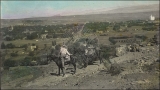 |
Rufus Johnson viewing St. George by horseback from Black Ridge. | 1909-09-15 | uum_map | |
| 477 |
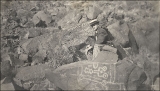 |
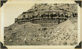
Rufus Johnson with "picture rocks on Black Ridge." | 1909-09 | uum_map | |
| 478 |
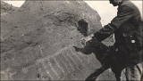 |
Rufus Johnson with "picture rocks on Black Ridge." | 1909-09 | uum_map | |
| 479 |
 |
Saint George, Utah and surroundings | 1937; 1938; 1939; 1940; 1941; 1942; 1943; 1944; 1945; 1946; 1947; 1948; 1949; 1950; 1951; 1952; 1953; 1954; 1955; 1956; 1957; 1958; 1959; 1960; 1961; 1962; 1963; 1964; 1965; 1966; 1967; 1968; 1969; 1970; 1971; 1972; 1973; 1974; 1975; 1976; 1977; 1978; 1979; 1980 | Image | uum_map_rr |
| 480 |
 |
Saint George, Utah and surroundings | 1937; 1938; 1939; 1940; 1941; 1942; 1943; 1944; 1945; 1946; 1947; 1948; 1949; 1950; 1951; 1952; 1953; 1954; 1955; 1956; 1957; 1958; 1959; 1960; 1961; 1962; 1963; 1964; 1965; 1966; 1967; 1968; 1969; 1970; 1971; 1972; 1973; 1974; 1975; 1976; 1977; 1978; 1979; 1980 | Image | uum_map_rr |
| 481 |
 |
Sally Rice Snow | 1920-05-20 | Image | wc_pc |
| 482 |
 |
Same as 2738. Walls and towers of Navajo sandstone; Chinle formation on slopes | 1940 | Image | uum_map |
| 483 |
 |
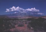
Same as 795 (Row of basalt capped Moenkopi mesas near the crest of Hurricane Cliffs south of Hurricane; Sugar loaf in lower right; Pine Valley Mountain) but showing also in foreground Workman Wash border by low cliffs of Virgin limestone, Moenkopi. Washington County, Utah, 1937. | 1937 | Image | uum_map |
| 484 |
 |
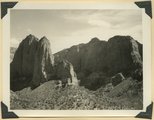
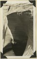
Same as G717 [Perched potholes in Navajo sandstone Pine Creek, Zion National Park, Utah, 1932.] | 1932 | Image | uum_map |
| 485 |
 |
Same as G717 [Perched potholes in Navajo sandstone Pine Creek, Zion National Park, Utah, 1932.] | 1932 | Image | uum_map |
| 486 |
 |
Same as G717 [Perched potholes in Navajo sandstone Pine Creek, Zion National Park, Utah, 1932.] | 1932 | Image | uum_map |
| 487 |
 |
Same as G717 [Perched potholes in Navajo sandstone Pine Creek, Zion National Park, Utah, 1932.] | 1932 | Image | uum_map |
| 488 |
 |
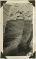
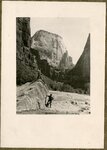
Sandstone cliffs, Zion | 1928; 1929; 1930; 1931; 1932 | uum_map | |
| 489 |
 |
Sandstone in Chinle marls, Springdale, 1936. | 1936 | Image | uum_map |
| 490 |
 |
Sandstone ledges in upper part of Moenkopi. Shinarump conglomerate at extreme top. Rockville, Washington County, Utah, 1936. | 1936 | Image | uum_map |
| 491 |
 |
Santa Clara Creek | 1931-10-17 | Image | dc_bpc |
| 492 |
 |
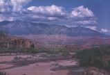
Santa Clara Valley and Red Mountains, Washington County, Utah | 1950; 1951; 1952; 1953; 1954; 1955; 1956; 1957; 1958; 1959; 1960; 1961; 1962; 1963; 1964; 1965; 1966; 1967; 1968; 1969; 1970; 1971; 1972; 1973; 1974; 1975; 1976; 1977; 1978; 1979; 1980 | Image | uum_map_rr |
| 493 |
 |
Santa Clara Valley and Red Mountains, Washington County, Utah [1] | 1950; 1951; 1952; 1953; 1954; 1955; 1956; 1957; 1958; 1959; 1960; 1961; 1962; 1963; 1964; 1965; 1966; 1967; 1968; 1969; 1970; 1971; 1972; 1973; 1974; 1975; 1976; 1977; 1978; 1979; 1980 | Image | uum_map_rr |
| 494 |
 |
Santa Clara Valley and Red Mountains, Washington County, Utah [3] | 1950; 1951; 1952; 1953; 1954; 1955; 1956; 1957; 1958; 1959; 1960; 1961; 1962; 1963; 1964; 1965; 1966; 1967; 1968; 1969; 1970; 1971; 1972; 1973; 1974; 1975; 1976; 1977; 1978; 1979; 1980 | Image | uum_map_rr |
| 495 |
 |
Santa Clara, 20 miles west of St. George, UT. New canyon cut through lava fill of old valley. Washington County, UT. 1922 | 1922 | Image | uum_map |
| 496 |
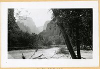 |
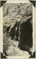
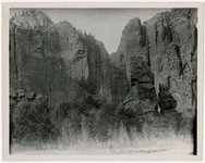
Scenes in Zion Canyon, 1920s [01] | 1920; 1921; 1922; 1923 | uum_map | |
| 497 |
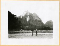 |
Scenes in Zion Canyon, 1920s [02] | 1920; 1921; 1922; 1923 | uum_map | |
| 498 |
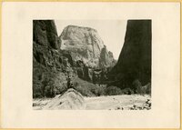 |
Scenes in Zion Canyon, 1920s [03] | 1920; 1921; 1922; 1923 | uum_map | |
| 499 |
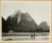 |
Scenes in Zion Canyon, 1920s [04] | 1920; 1921; 1922; 1923 | uum_map | |
| 500 |
 |
Scenes in Zion Canyon, 1920s [05] | 1920; 1921; 1922; 1923 | uum_map |