Home
Browse
Ask Us
Chat
Harmful Language Statement
Log in
Photo Archives
Advanced Search
About
Over 90,000 photos covering a variety of topics from Marriott Library Special Collections.
Year
1911
1912
1913
1914
1915
TO
1911
1912
1913
1914
1915
Type
Image
154
Format
image/jpeg
154
Collection
Photo Archives
154
Filters:
Format:
"image/jpeg"
Spatial Coverage:
"South America"
126
-
150
of
154
<
1
2
3
4
5
6
7
>
Gallery view
Number of results to display per page
10
25
50
100
200
Sort by Relevance
Sort by Title A-Z
Sort by Title Z-A
Sort by Date Ascending
Sort by Date Descending
Sort by Last Modified Ascending
Sort by Last Modified Descending
Title
Date
Type
126
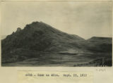
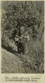
Peru mountain
1912; 1913; 1914; 1915
Image
127
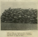
Pile of Yareta on the railroad between Mollendo and Juliaca, a resinous root which is used as fuel.
1911
Image
128
Pisac. Portrait of Indian man.
1911
Image
129
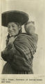
Pisac. Portrait of Indian woman and baby.
1911
Image
130
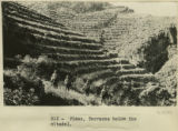
Pisac. Terraces below the citadel.
1911
Image
131
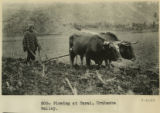
Plowing at Tarai, Urubamba valley.
1911
Image
132
Quechua children and woman in front of house at the farm 'Urco' near Calca.
1912; 1913; 1914; 1915
Image
133
Quechua children in front of house at the farm 'Urco' near Calca.
1912; 1913; 1914; 1915
Image
134
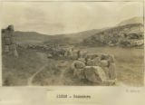
Rodadero
1911; 1912; 1913; 1914; 1915
Image
135
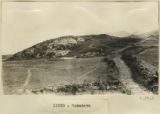
Rodadero
1911; 1912; 1913; 1914; 1915
Image
136
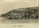
Rodadero
1911; 1912; 1913; 1914; 1915
Image
137
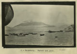
Salaverry, harbor and pier
1911
Image
138
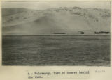
Salaverry. View of desert behind the town.
1911
Image
139
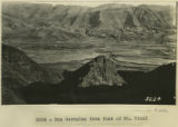
San Geronimo from foot of Mt. Picol
1912
Image
140
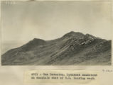
San Geronimo. Upturned sandstone on mountain east of S.G. looking west
1912; 1913; 1914; 1915
Image
141
Santa Ana. View looking up the valley of the Urubamba about 1 league south of Santa Ana.
1911
Image
142
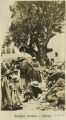
Sunday market at Calca.
1912; 1913; 1914; 1915
Image
143
Sunday market at Calca.
1912; 1913; 1914; 1915
Image
144
Sunday market, Calca.
1912; 1913; 1914; 1915
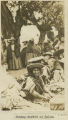
Image
145
Titicaca Island. 'Sacrificial Table.' (Near Chala). Showing Prof. Gregory.
1912; 1913; 1914; 1915
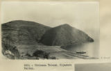
Image
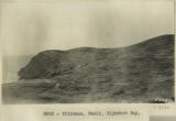
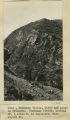
146
Titicaca Island. Hijadero Valley.
1912
Image
147
Titicaca. Fault. Hijadero Bay.
1912
Image
148
Urubamba to Cuzco. Cargo trains of relics from Machu Picchu.
1911
Image
149
Urubamba Valley, cliff and gorge on Urubamba. Huatenay Divide, looking SW, 4 miles N. of Angostura. Elev. 14,000 ft.
1912; 1913; 1914; 1915
Image
150
View across flat in which La Paz Valley is sunk. Taken from Alto Station, looking NE.
1912; 1913; 1914; 1915
Image
126
-
150
of
154
<
1
2
3
4
5
6
7
>