Home
Browse
Ask Us
Chat
Harmful Language Statement
Log in
Photo Archives
Advanced Search
About
Over 90,000 photos covering a variety of topics from Marriott Library Special Collections.
Year
1911
1912
1913
1914
1915
TO
1911
1912
1913
1914
1915
Type
Image
154
Format
image/jpeg
154
Collection
Photo Archives
154
Filters:
Format:
"image/jpeg"
Spatial Coverage:
"South America"
51
-
75
of
154
<
1
2
3
4
5
6
7
>
Gallery view
Number of results to display per page
10
25
50
100
200
Sort by Relevance
Sort by Title A-Z
Sort by Title Z-A
Sort by Date Ascending
Sort by Date Descending
Sort by Last Modified Ascending
Sort by Last Modified Descending
Title
Date
Type
51
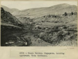
Cuzco Valley. Ongapata. Looking upstream. Note terraces
1912; 1913; 1914; 1915
Image
52
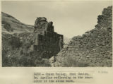
Cuzco Valley. Rumi Colca. Dr. Aguilar reflecting on the character of the stone work.
1911; 1912; 1915
Image
53
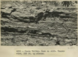
Cuzco Valley. Same as 2976. Nearer view, 200 ft. upstream
1912; 1913; 1914; 1915
Image
54
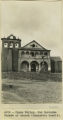
Cuzco Valley. San Geronimo Facade of church (Juancatio basalt)
1912; 1913; 1914; 1915
Image
55
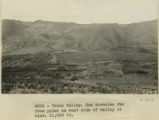
Cuzco Valley. San Geronimo fan from point on east side of valley at elev 11,000 feet.
1912; 1913; 1914; 1915
Image
56
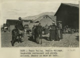
Cuzco Valley. Saylla village. Road-side restaurant and chicha sellers. Bestor in mule at left.
1911; 1912; 1915
Image
57
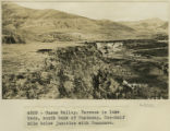
Cuzco Valley. Terrace in lake beds, south bank of Huatanay. One-half mile below junction with Huancaro
1912; 1913; 1914; 1915
Image
58
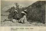
Cuzco Valley. Tipon. Young goatherds
1911; 1912; 1915
Image
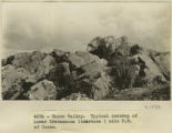
59
Cuzco Valley. Typical outcrop of lower Cretaceous limestone, 1 mile NE of Cuzco
1912; 1913; 1914; 1915
Image
60
Cuzco Valley. Upper part of Angostura Narrows from a point on north side of Narrows, elev. 11,000 ft. (Looking down valley)
1912; 1913; 1914; 1915
Image
61
Cuzco Valley. Upper part of Angostura Narrows looking upstream.
1912; 1913; 1914; 1915
Image
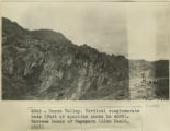
62
Cuzco Valley. Vertical conglomerate beds (part of syncline shown in 2987). Extreme heads of Ongapata
1912; 1913; 1914; 1915
Image
63
Cuzco Valley. Vilcanata Canyon, looking down stream NW from Sierra Bella.
1912; 1913; 1914; 1915
Image
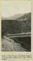
64
Cuzco, 9:15 A.M. Brick Yard San Sebastian 50 ft. S. Wly
1912
Image
65
Cuzco, Indians carrying timber.
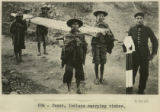
1911
Image
66
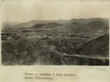
Cuzco, looking S from heights above Ttica-ttica.
1912; 1913; 1914; 1915
Image
67
Cuzco. "Rodadero" showing change in direction of fluting. N 30 degrees E and E 60 degrees W in close proximity
1912; 1913; 1914; 1915
Image
68
Cuzco. "Rodadero" showing sharp break in continuity of fluting
1912; 1913; 1914; 1915
Image
69
Cuzco. "Rodadero", looking NW across flutings
1912; 1913; 1914; 1915
Image
70
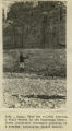
Cuzco. Ayahuaycco quebrada. Portion of buried wall.
1911; 1912; 1915
Image
71
Cuzco. In the convent of San Domingo
1911
Image
72
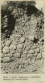
Cuzco. Inca rubble wall 100 feet farther east on the same street as St. Dominicks N.Wall. 8 ft.
1912
Image
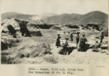
73
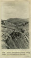
Cuzco. Native Indians harvesting the barley crop, taking it to the threshing floor. Dr. Eaton and Lieut. Sotomayor on horseback.
1911; 1912; 1915
Image
74
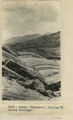
Cuzco. Near the railway station. A bluff washed by the Huantanay River. Shows Lieutenant Sotomayor pointing to a stratum containing fossil shells
1911; 1912; 1915
Image
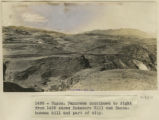
75
Cuzco. Rodadero Hill and Sacsahuaman hill and part of city.
1911; 1912; 1915
Image
51
-
75
of
154
<
1
2
3
4
5
6
7
>