Home
Browse
Ask Us
Chat
Harmful Language Statement
Log in
Photo Archives
Advanced Search
About
Over 90,000 photos covering a variety of topics from Marriott Library Special Collections.
Year
1911
1912
1913
1914
1915
TO
1911
1912
1913
1914
1915
Type
Image
154
Format
image/jpeg
154
Collection
Photo Archives
154
Filters:
Format:
"image/jpeg"
Spatial Coverage:
"South America"
26
-
50
of
154
<
1
2
3
4
5
6
7
>
Gallery view
Number of results to display per page
10
25
50
100
200
Sort by Relevance
Sort by Title A-Z
Sort by Title Z-A
Sort by Date Ascending
Sort by Date Descending
Sort by Last Modified Ascending
Sort by Last Modified Descending
Title
Date
Type
26
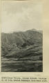
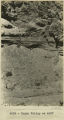
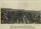
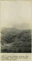
Cuzco Valley. Choquo branch. Looking S or SE across Huancaro from west side.
1912; 1913; 1914; 1915
Image
27
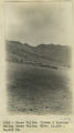
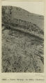
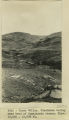
Cuzco Valley. Cirque & Moraine facing Carao Valley. Elev. 13,500-14,000 ft.
1912; 1913; 1914; 1915
Image
28
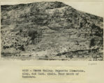
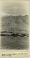
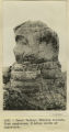
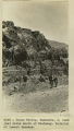
Cuzco Valley. Deposits limestone, clay, and Cast. shale. Near mouth of Huancaro
1912; 1913; 1914; 1915
Image
29
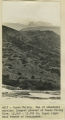
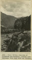
Cuzco Valley. Detail alluvium. N. of San Sebastian [1]
1912; 1913; 1914; 1915
Image
30
Cuzco Valley. Detail alluvium. N. of San Sebastian [2]
1912; 1913; 1914; 1915
Image
31
Cuzco Valley. Detail.
1912; 1913; 1914; 1915
Image
32
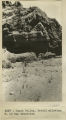
Cuzco Valley. Divided spurs. Carao Valley
1912; 1913; 1914; 1915
Image
33
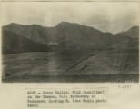
Cuzco Valley. End of abandoned moraine. Largest glacier of Cuzco Valley, Elev. 13,500-13,700 ft. Upper right hand branch of Junajaneha
1912; 1913; 1914; 1915
Image
34
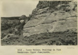
Cuzco Valley. Erosion feature. Pink sandstone. 3 miles north of Angostura
1912; 1913; 1914; 1915
Image
35
Cuzco Valley. Faulting in Pink Sandstone. Upper Junajaneha
1912; 1913; 1914; 1915
Image
36
Cuzco Valley. Fold (syncline) on the Choquo, SE tributary of Huancaro. Looking east [1]
1912; 1913; 1914; 1915
Image
37
Cuzco Valley. Fold (syncline) on the Choquo, SE tributary of Huancaro. Looking east [2]
1912; 1913; 1914; 1915
Image
38
Cuzco Valley. Fold on Paruro-Cuzco road, just beyond Huancaro divide.
1912; 1913; 1914; 1915
Image
39
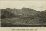
Cuzco Valley. Glaciated valley near head of Junajaneha stream. Elev 13,500-13,800 ft.
1912; 1913; 1914; 1915
Image
40
Cuzco Valley. Huancaro, S. bank just below mouth of Huatanay. Material of lowest terrace.
1912; 1913; 1914; 1915
Image
41
Cuzco Valley. Junction of Vilcanata and Huatanay, looking down Huatanay. Note high rock cut terrace.
1912; 1913; 1914; 1915
Image
42
Cuzco Valley. Looking down Huatanay, from above Anta Branch, 1 mile NW of Cuzco.
1912; 1913; 1914; 1915
Image
43
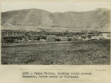
Cuzco Valley. Looking south across Huancaro, below mouth of Huatanay
1912; 1913; 1914; 1915
Image
44
Cuzco Valley. Mouth of Huatanay, looking upstream from East side Vilcanata. Note terrace and gorge
1912; 1913; 1914; 1915
Image
45
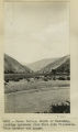
Cuzco Valley. Narrows, looking upstream from 1,000 feet below Angostura.
1912; 1913; 1914; 1915
Image
46
Cuzco Valley. North bank of the Hautanay, showing buried wall South of San Sebastian.
1912; 1913; 1914; 1915
Image
47
Cuzco Valley. North bank of the Huatanay, south of San Sebastian.
1912; 1913; 1914; 1915
Image
48
Cuzco Valley. North limb of syncline on Choquo
1912; 1913; 1914; 1915
Image
49
Cuzco Valley. North limb, vertical, of syncline west of Ongapata (same as syncline shown in 2996-2997) but three miles further south
1912; 1913; 1914; 1915
Image
50
Cuzco Valley. North-flowing, subsequent tributary to Huatanay, entering south side of valley at West (upper) end of Narrows.
1912; 1913; 1914; 1915
Image
26
-
50
of
154
<
1
2
3
4
5
6
7
>