Home
Browse
Ask Us
Chat
Harmful Language Statement
Log in
Advanced Search
Year
1937
1938
1939
1940
1941
1942
1943
1944
1945
1946
1947
1948
1949
1950
1951
1952
1953
1954
1955
1956
1957
1958
1959
1960
1961
1962
1963
1964
1965
1966
1967
1968
1969
1970
1971
1972
1973
1974
1975
1976
1977
1978
1979
1980
1981
1982
1983
1984
1985
1986
1987
1988
1989
1990
1991
1992
1993
1994
1995
1996
1997
1998
1999
2000
2001
2002
2003
2004
2005
2006
2007
TO
1937
1938
1939
1940
1941
1942
1943
1944
1945
1946
1947
1948
1949
1950
1951
1952
1953
1954
1955
1956
1957
1958
1959
1960
1961
1962
1963
1964
1965
1966
1967
1968
1969
1970
1971
1972
1973
1974
1975
1976
1977
1978
1979
1980
1981
1982
1983
1984
1985
1986
1987
1988
1989
1990
1991
1992
1993
1994
1995
1996
1997
1998
1999
2000
2001
2002
2003
2004
2005
2006
2007
Type
Image
338
Image/StillImage
334
Format
image/jpeg
700
Collection
Glen Canyon
331
Photo Archives
248
Ski and Snow Sports Photo Archives
4
University Archival Photographs (P0305)
1
Utah River Running Photo Archives
116
Filters:
Format:
"image/jpeg"
Spatial Coverage:
"Powell, Lake (Utah and Ariz.)"
626
-
650
of
700
<
19
20
21
22
23
24
25
26
27
28
>
Gallery view
Number of results to display per page
10
25
50
100
200
Sort by Relevance
Sort by Title A-Z
Sort by Title Z-A
Sort by Date Ascending
Sort by Date Descending
Sort by Last Modified Ascending
Sort by Last Modified Descending
Title
Date
Type
Setname
626
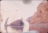
Rising Lake Powell
1964-05
Image
uum_map
627
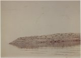
Rising Lake Powell: rocky island
1964-05
Image
uum_map
628
Rising Lake Powell: rocky island
1964-05
Image
uum_map
629
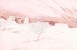
Ruin in Moqui Canyon [1]
1965-09-21
Image
uum_map
630
Ruin in Moqui Canyon [2]
1965-09-21
Image
uum_map
631
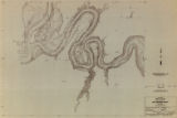
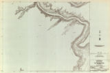
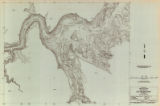
San Juan River survey, topography: San Juan River strip 518-400-12 sheet 01 out of 40
1947
Image
uu_gc
632
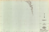
San Juan River survey, topography: San Juan River strip 518-400-12 sheet 02 out of 40
1947
Image/StillImage
uu_gc
633
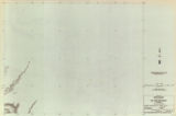
San Juan River survey, topography: San Juan River strip 518-400-12 sheet 03 out of 40
1947
Image/StillImage
uu_gc
634
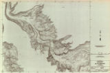
San Juan River survey, topography: San Juan River strip 518-400-12 sheet 04 out of 40
1947
Image/StillImage
uu_gc
635
San Juan River survey, topography: San Juan River strip 518-400-12 sheet 05 out of 40
1947
Image/StillImage
uu_gc
636
San Juan River survey, topography: San Juan River strip 518-400-12 sheet 06 out of 40
1947
Image/StillImage
uu_gc
637
San Juan River survey, topography: San Juan River strip 518-400-12 sheet 07 out of 40
1947
Image/StillImage
uu_gc
638
San Juan River survey, topography: San Juan River strip 518-400-12 sheet 08 out of 40
1947
Image/StillImage
uu_gc
639
San Juan River survey, topography: San Juan River strip 518-400-12 sheet 09 out of 40
1947
Image/StillImage
uu_gc
640
San Juan River survey, topography: San Juan River strip 518-400-12 sheet 10 out of 40
1947
Image/StillImage
uu_gc
641
San Juan River survey, topography: San Juan River strip 518-400-12 sheet 11 out of 40
1947
Image/StillImage
uu_gc
642
San Juan River survey, topography: San Juan River strip 518-400-12 sheet 12 out of 40
1947
Image/StillImage
uu_gc
643
San Juan River survey, topography: San Juan River strip 518-400-12 sheet 13 out of 40
1947
Image/StillImage
uu_gc
644
San Juan River survey, topography: San Juan River strip 518-400-12 sheet 14 out of 40
1947
Image/StillImage
uu_gc
645
San Juan River survey, topography: San Juan River strip 518-400-12 sheet 15 out of 40
1947
Image/StillImage
uu_gc
646
San Juan River survey, topography: San Juan River strip 518-400-12 sheet 16 out of 40
1947
Image/StillImage
uu_gc
647
San Juan River survey, topography: San Juan River strip 518-400-12 sheet 17 out of 40
1947
Image/StillImage
uu_gc
648
San Juan River survey, topography: San Juan River strip 518-400-12 sheet 18 out of 40
1947
Image/StillImage
uu_gc
649
San Juan River survey, topography: San Juan River strip 518-400-12 sheet 19 out of 40
1947
Image/StillImage
uu_gc
650
San Juan River survey, topography: San Juan River strip 518-400-12 sheet 20 out of 40
1947
Image/StillImage
uu_gc
626
-
650
of
700
<
19
20
21
22
23
24
25
26
27
28
>