Home
Browse
Ask Us
Chat
Harmful Language Statement
Log in
Advanced Search
Year
1937
1938
1939
1940
1941
1942
1943
1944
1945
1946
1947
1948
1949
1950
1951
1952
1953
1954
1955
1956
1957
1958
1959
1960
1961
1962
1963
1964
1965
1966
1967
1968
1969
1970
1971
1972
1973
1974
1975
1976
1977
1978
1979
1980
1981
1982
1983
1984
1985
1986
1987
1988
1989
1990
1991
1992
1993
1994
1995
1996
1997
1998
1999
2000
2001
2002
2003
2004
2005
2006
2007
TO
1937
1938
1939
1940
1941
1942
1943
1944
1945
1946
1947
1948
1949
1950
1951
1952
1953
1954
1955
1956
1957
1958
1959
1960
1961
1962
1963
1964
1965
1966
1967
1968
1969
1970
1971
1972
1973
1974
1975
1976
1977
1978
1979
1980
1981
1982
1983
1984
1985
1986
1987
1988
1989
1990
1991
1992
1993
1994
1995
1996
1997
1998
1999
2000
2001
2002
2003
2004
2005
2006
2007
Type
Image
338
Image/StillImage
334
Format
image/jpeg
700
Collection
Glen Canyon
331
Photo Archives
248
Ski and Snow Sports Photo Archives
4
University Archival Photographs (P0305)
1
Utah River Running Photo Archives
116
Filters:
Format:
"image/jpeg"
Spatial Coverage:
"Powell, Lake (Utah and Ariz.)"
476
-
500
of
700
<
15
16
17
18
19
20
21
22
23
24
>
Gallery view
Number of results to display per page
10
25
50
100
200
Sort by Relevance
Sort by Title A-Z
Sort by Title Z-A
Sort by Date Ascending
Sort by Date Descending
Sort by Last Modified Ascending
Sort by Last Modified Descending
Title
Date
Type
Setname
476
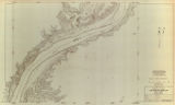
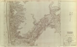
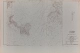
Glen Canyon unit, Lake Powell topography: sheet 557-414-91
1960
Image/StillImage
uu_gc
477
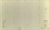
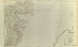
Glen Canyon unit, Lake Powell topography: sheet 557-414-92
1960
Image/StillImage
uu_gc
478
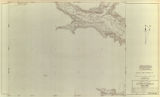
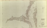
Glen Canyon unit, Lake Powell topography: sheet 557-414-93
1960
Image/StillImage
uu_gc
479
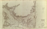
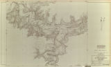
Glen Canyon unit, Lake Powell topography: sheet 557-414-94
1960
Image/StillImage
uu_gc
480
Glen Canyon unit, Lake Powell topography: sheet 557-414-95
1960
Image/StillImage
uu_gc
481
Glen Canyon unit, Lake Powell topography: sheet 557-414-96
1960
Image/StillImage
uu_gc
482
Glen Canyon unit, Lake Powell topography: sheet 557-414-97
1960
Image/StillImage
uu_gc
483
Glen Canyon unit, Lake Powell topography: sheet 557-414-98
1960
Image/StillImage
uu_gc
484
Glen Canyon unit, Lake Powell topography: sheet 557-414-99
1960
Image/StillImage
uu_gc
485
Glen Canyon unit, Lake Powell topography: sheet 557-414-310
1960
Image/StillImage
uu_gc
486
Glen Canyon, close up of where Padre Creek joins Colorado River
1963-03-14
Image
uum_map
487
Glen Canyon, closeup where Kane Creek joins the Colorado River
1963-03-14
Image
uum_map
488
Glen Canyon, Colorado River at Kane Creek
1963-03-14
Image
uum_map
489
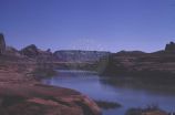
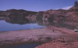
Glen Canyon, early Lake Powell
1964-05
Image
uum_map
490
Glen Canyon, foot markers up to 3,260 at Kane Creek
1963-03-14
Image
uum_map
491
Glen Canyon, looking down Kane Crrek to where it joins the Colorado
1963-03-14
Image
uum_map
492
Glen Canyon, looking down the Colorado toward Padre Creek from Kane Creek
1963-03-14
Image
uum_map
493
Glen Canyon, looking up the Colorado at Kane Creek
1963-03-14
Image
uum_map
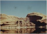
494
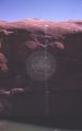
Glen Canyon, Music Temple and Hidden Passage, Navajo sandstone, 1963.
1963
Image
uum_map
495
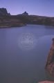
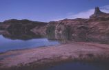
Glen Canyon, rising Lake Powell at Crossing of the Fathers
1963-03-14
Image
uum_map
496
Glen Canyon, sandbar from where boats are launched at Kane Creek mouth
1963-03-14
Image
uum_map
497
Glen Canyon, water starting to cover sandbar at Kane Creek
1963-03-14
Image
uum_map
498
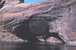
Gregory Natural Bridge during lake rise [1]
1965-09-21
Image
uum_map
499
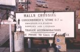
Halls Crossing sign at launching area
1965-09-21
Image
uum_map
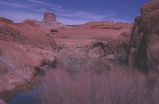
500
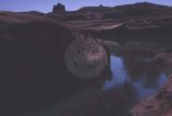
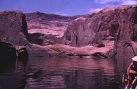
Hidden Passage Cove
1963; 1964; 1965; 1966; 1967
uum_map_rr
476
-
500
of
700
<
15
16
17
18
19
20
21
22
23
24
>