| Title | Date | Type | Setname | ||
|---|---|---|---|---|---|
| 51 |
 | Another view of Photo G213. VI, 38 (Photo G213A) | 1911 | Image | uum_map |
| 52 |
 | Apache Devil Dancers | Image | dc_bpc | |
| 53 |
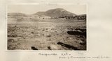 | Baigaiche Mt. | 1913 | Image | uum_map |
| 54 |
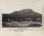 | Baigaiche Mt. from "Beast" dike (Photo G388) | 1913 | Image | uum_map |
| 55 |
 | Baigaiche Mt. from "Beast" dike (Photo G388) | 1913 | Image | uum_map |
| 56 |
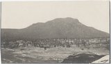
 | Baigaiche Mt., looking south across mouth of Black creek where it emerges from Todilto Park. Mrs. Gregory, photo. 1911 (Photo N-M118) | 1911 | Image | uum_map |
| 57 |
 | Bennett Peak, NM, looking northwest. Shaler, photo | 1890; 1891; 1892; 1893; 1894; 1895; 1896; 1897; 1898; 1899; 1900; 1901; 1902; 1903; 1904; 1905 | Image | uum_map |
| 58 |
 | Boeing B-29 Superfortress (Enola Gay) P.5 | Image | dha_cp | |
| 59 |
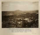
 | Camp and Indian pasture, Da-dat-soe. East terrace of Choiskai Mt., NM. 1911 | 1911 | Image | uum_map |
| 60 |
 | Camp at base of Baigaiche Mt. VI, 45. 1911 (Photo N-M113) | 1911 | Image | uum_map |
| 61 |
 | Carson, Christopher (Kit)-Gravestone P.1 | Image | dha_cp | |
| 62 |
 | Carson, Josephine-Grave P.1 | Image | dha_cp | |
| 63 |
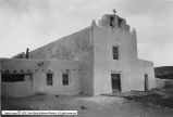 | Catholic Churches p.1 | 1930; 1931; 1932; 1933; 1934; 1935; 1936; 1937; 1938; 1939 | Image | dha_cp |
| 64 |
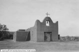 | Catholic Churches p.2 | 1930; 1931; 1932; 1933; 1934; 1935; 1936; 1937; 1938; 1939 | Image | dha_cp |
| 65 |
 | Catholic Churches p.3 | 1930; 1931; 1932; 1933; 1934; 1935; 1936; 1937; 1938; 1939 | Image | dha_cp |
| 66 |
 | Charles Bent | Image | dha_cp | |
| 67 |
 | Chirine Njeim [01] | 2007-02-09; 2007-02-10; 2008-02-08 | Image/StillImage | uum_map_usa |
| 68 |
 | Chirine Njeim [02] | 2007-02-09; 2007-02-10; 2008-02-08 | Image/StillImage | uum_map_usa |
| 69 |
 | Chirine Njeim, Hermann Lager | 2007-02-09; 2007-02-10; 2008-02-08 | Image/StillImage | uum_map_usa |
| 70 |
 | Chirine Njeim, Mikaela Grassl, Peter Shaffer, Unknown (most right is unknown) | 2007-02-09; 2007-02-10; 2008-02-08 | Image/StillImage | uum_map_usa |
| 71 |
 | Chirine Njeim, Mikaela Grassl, Unknown | 2007-02-09; 2007-02-10; 2008-02-08 | Image/StillImage | uum_map_usa |
| 72 |
 | Chirine Njeim, Thomas Zumbrunn | 2007-02-09; 2007-02-10; 2008-02-08 | Image/StillImage | uum_map_usa |
| 73 |
 | Cleopatra's Needle, Todilto Park, New Mexico | 1950; 1951; 1952; 1953; 1954; 1955; 1956; 1957; 1958; 1959; 1960; 1961; 1962; 1963; 1964; 1965; 1966; 1967; 1968; 1969; 1970; 1971; 1972; 1973; 1974; 1975; 1976; 1977; 1978; 1979; 1980 | Image | uum_map |
| 74 |
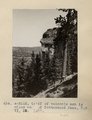 | Cliff of volcanic ash 1 1/2 miles west of Cottonwood Pass, NM. VI, 35. 1911 (Photo N-M112) | 1911 | Image | uum_map |
| 75 |
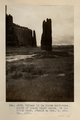 | Column in La Plata sandstone, mouth of Black Creek canon, in Todilto Park. Heald or Mrs. G, photo. 1911 (Photo G217) | 1911 | Image | uum_map |