| | Title | Date | Type | Setname |
|---|
| 1 | 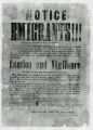 | "Notice to Emigrants" poster warning travelers of Indian attacks issued by Governor Brigham Young, 1852. | | Image | uum_map |
| 2 |  | "Utah-Nevada state line. West Wendover, Nevada after Smith started his gas station" | 1941; 1942; 1943; 1944 | Image | uum_map |
| 3 |  | 1908 U. S. Land Office Map of the State of Nevada; showing location of Fairview, Churchill County, Nevada | 1908 | Image | uum_map |
| 4 |  | A discussion of modernization and tradition | 2009 | Image/MovingImage | uaida_main |
| 5 |  | Abandoned airport [01] | 1987 | Image/StillImage | uum_map_rr |
| 6 |  | Abandoned airport [02] | 1987 | Image/StillImage | uum_map_rr |
| 7 | 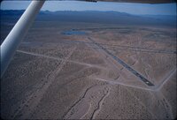 | Abandoned airport [03] | 1987 | Image/StillImage | uum_map_rr |
| 8 | 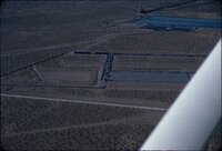 | Abandoned airport [04] | 1987 | Image/StillImage | uum_map_rr |
| 9 |  | Abandoned airport [05] | 1987 | Image/StillImage | uum_map_rr |
| 10 |  | Abandoned airport [06] | 1987 | Image/StillImage | uum_map_rr |
| 11 |  | Abandoned airport [07] | 1987 | Image/StillImage | uum_map_rr |
| 12 | 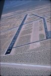 | Abandoned airport [08] | 1987 | Image/StillImage | uum_map_rr |
| 13 | 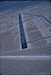 | Abandoned airport [09] | 1987 | Image/StillImage | uum_map_rr |
| 14 | 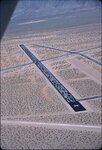 | Abandoned airport [10] | 1987 | Image/StillImage | uum_map_rr |
| 15 | 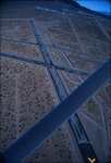 | Abandoned airport [11] | 1987 | Image/StillImage | uum_map_rr |
| 16 | 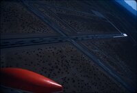 | Abandoned airport [12] | 1987 | Image/StillImage | uum_map_rr |
| 17 |  | Abandoned airport [13] | 1987 | Image/StillImage | uum_map_rr |
| 18 | 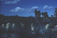 | Agaves and Joshua trees | 1940; 1941; 1942; 1943; 1944; 1945; 1946; 1947; 1948; 1949; 1950; 1951; 1952; 1953; 1954; 1955; 1956; 1957; 1958; 1959; 1960; 1961; 1962; 1963; 1964; 1965; 1966; 1967; 1968; 1969; 1970; 1971; 1972; 1973; 1974; 1975; 1976; 1977; 1978; 1979; 1980 | Image | uum_map_rr |
| 19 | 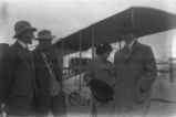 | Airplanes-Wright Brothers P.2 | 1911-02-10 | Image | dha_cp |
| 20 |  | Al "Mustang" Nickols | 1929-09-15 | Image | dha_cp |
| 21 | 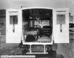 | Ambulance Interior | 1918-04-01 | Image | dha_scp |
| 22 | 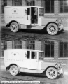 | Ambulance Side View | 1918-04-01 | Image | dha_scp |
| 23 |  | Art Gallenson family and friends, 1990s [18] | 1994; 1995; 1996; 1997 | Image/StillImage | uum_map_rr |
| 24 |  | Auerbach Bros. P.15 | 1863 | Image/StillImage | dha_cp |
| 25 |  | Awards ceremony at the Special Olympics, 1989. | 1989 | | uum_map_usa |
| 26 | 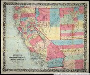 | Bancroft's map of California, Nevada, Utah and Arizona | 1864 | Image | uu_awm |
| 27 |  | Bigler, Henry W.--Inscription P.1 | | Image | dha_cp |
| 28 | 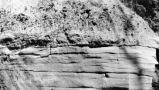 | Bigler, Henry W.--Inscription P.2 | | Image | dha_cp |
| 29 |  | Bigler, Henry W.--Inscription P.3 | | Image | dha_cp |
| 30 |  | Bigler, Henry W.--Inscription P.5 | | Image | dha_cp |
| 31 | 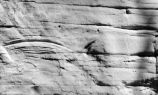 | Bigler, Henry W.--Inscription P.6 | | Image | dha_cp |
| 32 | 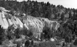 | Bigler, Henry W.--Inscription P.7 | | Image | dha_cp |
| 33 | 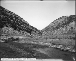 | Bishop Canyon, Wells, Nevada | 1910-08-23 | Image | dha_scp |
| 34 |  | Bishop Creek Dam p.1 | | Image | dha_cp |
| 35 | 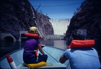 | Black Canyon rafting, 1982 [01] | 1982 | Image/StillImage | uum_map_rr |
| 36 | 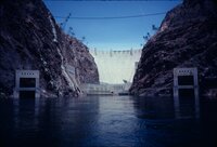 | Black Canyon rafting, 1982 [02] | 1982 | Image/StillImage | uum_map_rr |
| 37 | 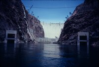 | Black Canyon rafting, 1982 [03] | 1982 | Image/StillImage | uum_map_rr |
| 38 | 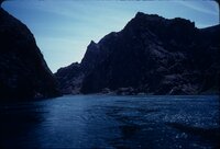 | Black Canyon rafting, 1982 [04] | 1982 | Image/StillImage | uum_map_rr |
| 39 | 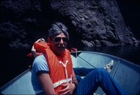 | Black Canyon rafting, 1982 [05] | 1982 | Image/StillImage | uum_map_rr |
| 40 | 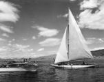 | Boating--Lake Mead P.1 | | Image | dha_cp |
| 41 |  | Boulder City Airport 2004 | 2004 | Image/StillImage | uum_map_rr |
| 42 |  | Boulder City airport, 1960s [01] | 1961; 1962; 1963; 1964 | Image/StillImage | uum_map_rr |
| 43 |  | Boulder City airport, 1960s [02] | 1961; 1962; 1963; 1964 | Image/StillImage | uum_map_rr |
| 44 |  | Boulder City airport, 1960s [03] | 1961; 1962; 1963; 1964 | Image/StillImage | uum_map_rr |
| 45 |  | Boulder City airport, 1960s [04] | 1961; 1962; 1963; 1964 | Image/StillImage | uum_map_rr |
| 46 | 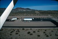 | Boulder City airport, 1960s [05] | 1961; 1962; 1963; 1964 | Image/StillImage | uum_map_rr |
| 47 | 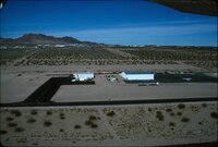 | Boulder City airport, 1960s [06] | 1961; 1962; 1963; 1964 | Image/StillImage | uum_map_rr |
| 48 |  | Boulder City Airport, summer 2004 | 2004 | Image/StillImage | uum_map_rr |
| 49 | 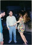 | Boulder City social event 1997 [01] | 1997-10 | Image/StillImage | uum_map_rr |
| 50 |  | Boulder City social event 1997 [02] | 1997-10 | Image/StillImage | uum_map_rr |
| 51 |  | Boulder City social event 1997 [03] | 1997-10 | Image/StillImage | uum_map_rr |
| 52 |  | Boulder City social event 1997 [04] | 1997-10 | Image/StillImage | uum_map_rr |
| 53 |  | Boulder City social event 1997 [05] | 1997-10 | Image/StillImage | uum_map_rr |
| 54 |  | Boulder Dam. | 1956 | Image | uum_map |
| 55 |  | Boundary of Shoshone Indian Territory according to Swanton, 1952 | 1952 | Image/StillImage | uaida_main |
| 56 |  | Boundary of Shoshone Indian Territory, Linguistic Boundaries of Shoshone and Bannock. | 1941 | Image/StillImage | uaida_main |
| 57 |  | Boundary of Shoshone Indian Territory, showing the locations of the Bannock | 1957 | Image/StillImage | uaida_main |
| 58 |  | Boundary of Shoshone Indian Territory, showing the locations of the Bannock from 1819 to 1951 | 1957 | Image/StillImage | uaida_main |
| 59 |  | Boundary of Shoshone Indian Territory, showing the locations where the Bannock and Shoshone reported together 1819-1956 | 1957 | Image/StillImage | uaida_main |
| 60 |  | Boundary of Shoshone Indian Territory; Doty Map of 1863 Indian Claims Commission | 1957 | Image/StillImage | uaida_main |
| 61 |  | Bovine Peak, Nevada p.1 | 1940; 1941; 1942; 1943; 1944; 1945; 1946; 1947; 1948; 1949; 1950 | Image/StillImage | dha_cp |
| 62 |  | Buildings at Bishop Creek, Wells, Nevada | 1910-08-23 | Image | dha_scp |
| 63 | 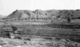 | Caliente, Nevada P.1 | | Image | dha_cp |
| 64 | 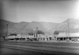 | Caliente, Nevada P.2 | | Image | dha_cp |
| 65 |  | California Trail P.1 | | Image | dha_cp |
| 66 |  | California Trail P.2 | | Image | dha_cp |
| 67 |  | California Trail P.3 | 1941 | Image | dha_cp |
| 68 |  | California Trail P.4 | 1937-06 | Image | dha_cp |
| 69 | 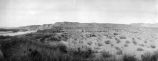 | Callville, Nevada P.2 | | Image | dha_cp |
| 70 |  | Callville, Nevada P.3 | | Image | dha_cp |
| 71 |  | Camp, Ely | 1906-12 | Image | dha_scp |
| 72 |  | Captions, Pyramid Lake | 1945; 1946; 1947; 1948; 1949; 1950; 1951; 1952; 1953; 1954; 1955; 1956; 1957; 1958; 1959; 1960; 1961; 1962; 1963; 1964; 1965 | Image | uum_map |
| 73 | 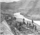 | Central Pacific R.R. -- Construction P.16 | 1868 | Image/StillImage | dha_cp |
| 74 | 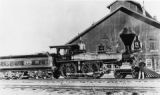 | Central Pacific RR - Locomotives P.10 | 1891; 1892; 1893; 1894; 1895 | Image/StillImage | dha_cp |
| 75 |  | Central Pacific RR - Locomotives P.9 | 1865; 1866; 1867; 1868; 1869 | Image/StillImage | dha_cp |
| 76 |  | Chef, George J. Douvos at Lake Mead Lodge [01] | 1950; 1951; 1952; 1953; 1954; 1955; 1956; 1957; 1958; 1959; 1960; 1961; 1962; 1963; 1964; 1965; 1966; 1967; 1968; 1969; 1970; 1971; 1972; 1973; 1974; 1975; 1976; 1977; 1978; 1979; 1980 | Image | uum_map |
| 77 | 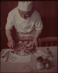 | Chef, George J. Douvos at Lake Mead Lodge [02] | 1950; 1951; 1952; 1953; 1954; 1955; 1956; 1957; 1958; 1959; 1960; 1961; 1962; 1963; 1964; 1965; 1966; 1967; 1968; 1969; 1970; 1971; 1972; 1973; 1974; 1975; 1976; 1977; 1978; 1979; 1980 | Image | uum_map |
| 78 |  | Cobre, Nevada | | Image | uum_map |
| 79 |  | Color photocopy from "Sports Illustrated" of ceremonies taking place in Reno, 1955. | 1955 | Image | uum_map_usa |
| 80 |  | Consolidated Copper Mines Company P.1 | 1929-10-06 | Image | dha_cp |
| 81 |  | Consolidated Copper Mines Company P.2 | 1929-10-06 | Image | dha_cp |
| 82 |  | Consolidated Copper Mines Company P.3 | 1929-10-06 | Image | dha_cp |
| 83 |  | Consolidated Copper Mines Company P.4 | 1929-10-06 | Image | dha_cp |
| 84 |  | Consolidated Copper Mines Company P.5 | 1929-10-06 | Image | dha_cp |
| 85 |  | Consolidated Copper Mines Company P.6 | 1929-10-06 | Image | dha_cp |
| 86 |  | Consolidated Copper Mines Company P.7 | 1929-10-06 | Image | dha_cp |
| 87 |  | Consolidated Copper Mines Company P.8 | 1929-10-06 | Image | dha_cp |
| 88 |  | Consolidated wash materials in canyon east side Death Valley near Mormon Point | 1925 | Image | uum_map |
| 89 | 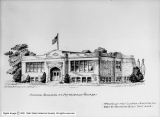 | Copy of Drawing of School Building, Pacific Reclamation Company | 1912-03-02 | Image | dha_scp |
| 90 | 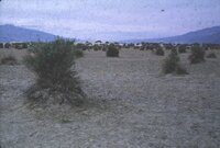 | Creosote bushes [1] | 1937; 1938; 1939; 1940; 1941; 1942; 1943; 1944; 1945; 1946; 1947; 1948; 1949; 1950; 1951; 1952; 1953; 1954; 1955; 1956; 1957; 1958; 1959; 1960; 1961; 1962; 1963; 1964; 1965; 1966; 1967; 1968; 1969; 1970; 1971; 1972; 1973; 1974; 1975; 1976; 1977; 1978; 1979; 1980 | Image | uum_map_rr |
| 91 |  | Creosote bushes [2] | 1937; 1938; 1939; 1940; 1941; 1942; 1943; 1944; 1945; 1946; 1947; 1948; 1949; 1950; 1951; 1952; 1953; 1954; 1955; 1956; 1957; 1958; 1959; 1960; 1961; 1962; 1963; 1964; 1965; 1966; 1967; 1968; 1969; 1970; 1971; 1972; 1973; 1974; 1975; 1976; 1977; 1978; 1979; 1980 | Image | uum_map_rr |
| 92 |  | Crystals in a cave? | 1978; 1979; 1980; 1981; 1982 | Image/StillImage | uum_map |
| 93 |  | Death Valley | 1925 | Image | uum_map |
| 94 |  | DeLamar, Nevada P.1 | | Image | dha_cp |
| 95 |  | Desert near Las Vegas, Nevada? | 1937; 1938; 1939; 1940; 1941; 1942; 1943; 1944; 1945; 1946; 1947; 1948; 1949; 1950; 1951; 1952; 1953; 1954; 1955; 1956; 1957; 1958; 1959; 1960; 1961; 1962; 1963; 1964; 1965; 1966; 1967; 1968; 1969; 1970; 1971; 1972; 1973; 1974; 1975; 1976; 1977; 1978; 1979; 1980 | Image | uum_map_rr |
| 96 |  | Desert pavement south end of Death Valley. Dr. Levi Noble standing. Inyo County, CA. 1922 | 1922 | Image | uum_map |
| 97 | 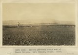 | Desert pavement south end of Death Valley. Inyo County, CA. 1922 | 1922 | Image | uum_map |
| 98 |  | Desert pavement south end of Death Valley. Inyo County, CA. 1922 | 1922 | Image | uum_map |
| 99 | 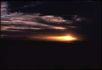 | Desert sunrise or sunset | 1978; 1979; 1980; 1981; 1982 | Image/StillImage | uum_map |
| 100 |  | Desert tree | 1978; 1979; 1980; 1981; 1982 | Image/StillImage | uum_map |