Home
Browse
Ask Us
Chat
Harmful Language Statement
Log in
Advanced Search
Year
1890
1891
1892
1893
1894
1895
1896
1897
1898
1899
1900
1901
1902
1903
1904
1905
1906
1907
1908
1909
1910
1911
1912
1913
1914
1915
1916
1917
1918
1919
1920
1921
1922
1923
1924
1925
1926
1927
1928
1929
1930
1931
1932
1933
1934
1935
1936
1937
1938
1939
1940
1941
1942
1943
1944
1945
1946
1947
1948
1949
1950
1951
1952
1953
1954
1955
1956
1957
1958
1959
1960
1961
1962
1963
1964
1965
1966
1967
1968
1969
1970
1971
1972
1973
1974
1975
1976
1977
1978
1979
1980
1981
1982
1983
1984
1985
1986
1987
TO
1890
1891
1892
1893
1894
1895
1896
1897
1898
1899
1900
1901
1902
1903
1904
1905
1906
1907
1908
1909
1910
1911
1912
1913
1914
1915
1916
1917
1918
1919
1920
1921
1922
1923
1924
1925
1926
1927
1928
1929
1930
1931
1932
1933
1934
1935
1936
1937
1938
1939
1940
1941
1942
1943
1944
1945
1946
1947
1948
1949
1950
1951
1952
1953
1954
1955
1956
1957
1958
1959
1960
1961
1962
1963
1964
1965
1966
1967
1968
1969
1970
1971
1972
1973
1974
1975
1976
1977
1978
1979
1980
1981
1982
1983
1984
1985
1986
1987
Type
Image
111
Image/StillImage
5
Format
image/jpeg
149
Collection
Beckwith Photograph Collection
88
Photo Archives
60
Ski and Snow Sports Archives
1
Filters:
Format:
"image/jpeg"
Spatial Coverage:
"Juab County (Utah)"
Format:
image
Setname:
!(ir* OR ehsl*)
101
-
125
of
149
<
1
2
3
4
5
6
>
Gallery view
Number of results to display per page
10
25
50
100
200
Sort by Relevance
Sort by Title A-Z
Sort by Title Z-A
Sort by Date Ascending
Sort by Date Descending
Sort by Last Modified Ascending
Sort by Last Modified Descending
Title
Date
Type
Setname
101
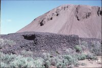
Remains of the Knight smelter slag dump at Silver City, Utah, Tintic mining district
1980-05-19
uum_map
102
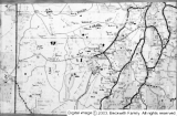
Road map 3 Utah counties
1948
Image
dc_bpc
103
Salt Creek flooding : Looking up stream across Salt Creek upper barrier after it had been in operation two years [and] Spillway through above barrier
1932
Image/StillImage
uum_map
104
Salt Creek flooding : Lower barrier on Salt Creek above Nephi at the beginning of the third season of operation [and] Salt Creek out of bounds at Plaster Mill above Nephi, on the evening of Aug. 13, 1923
1923; 1932
Image/StillImage
uum_map
105
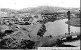
Sevier Bridge Reservoir
1902; 1903; 1904
Image
dc_bpc
106
Sevier Bridge Reservoir
1902; 1903; 1904
Image
dc_bpc
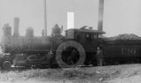
107
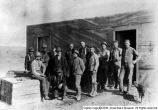
Sevier Bridge Reservoir workers
1907
Image
dc_bpc
108
Some man! Tatow
1949
Image
dc_bpc
109
Three old-timers
1949-04-15
Image
dc_bpc
110
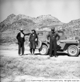
Tintic district
Image
dc_bpc
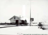
111
Tintic Junction
Image
dc_bpc
112
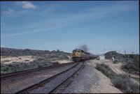
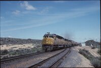
Tintic, Utah
Image
dc_bpc
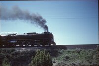
113
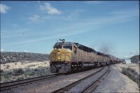
Union Pacific EMD DD40AX #6935 going south along SR-36 [01]
1980-05-19
uum_map
114
Union Pacific EMD DD40AX #6935 going south along SR-36 [02]
1980-05-19
uum_map
115
Union Pacific EMD DD40AX #6935 going south along SR-36 [03]
1980-05-19
uum_map
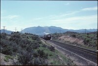
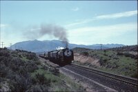
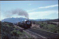
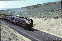
116
Union Pacific Northern #8444 going north along SR-36 [06]
1980-05-19
uum_map
117
Union Pacific Northern #8444 going north along SR-36 [07]
1980-05-19
uum_map
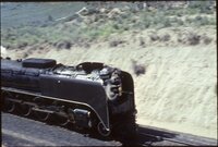
118
Union Pacific Northern #8444 going north along SR-36 [08]
1980-05-19
uum_map
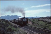
119
Union Pacific Northern #8444 going north along SR-36 [09]
1980-05-19
uum_map
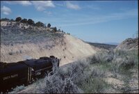
120
Union Pacific Northern #8444 going north along SR-36 [10]
1980-05-19
uum_map
121
Union Pacific Northern #8444 going north along SR-36 [11]
1980-05-19
uum_map
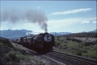
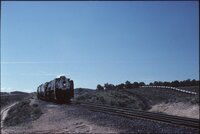
122
Union Pacific Northern #8444 going north along SR-36 [12]
1980-05-19
uum_map
123
Union Pacific Northern #8444 going north along SR-36 [13]
1980-05-19
uum_map
124
Union Pacific Northern #8444 going north along SR-36 [14]
1980-05-19
uum_map
125
Union Pacific Northern #8444 going north along SR-36 [15]
1980-05-19
uum_map
101
-
125
of
149
<
1
2
3
4
5
6
>