Home
Browse
Ask Us
Chat
Harmful Language Statement
Log in
Advanced Search
Year
1853
1854
1855
1856
1857
1858
1859
1860
1861
1862
1863
1864
1865
1866
1867
1868
1869
1870
1871
1872
1873
1874
1875
1876
1877
1878
1879
1880
1881
1882
1883
1884
1885
1886
1887
1888
1889
1890
1891
1892
1893
1894
1895
1896
1897
1898
1899
1900
1901
1902
1903
1904
1905
1906
1907
1908
1909
1910
1911
1912
1913
1914
1915
1916
1917
1918
1919
1920
1921
1922
1923
1924
1925
1926
1927
1928
1929
1930
1931
1932
1933
1934
1935
1936
1937
1938
1939
1940
1941
1942
1943
1944
1945
1946
1947
1948
1949
1950
1951
1952
1953
1954
1955
1956
1957
1958
1959
1960
1961
1962
1963
1964
1965
1966
1967
1968
1969
1970
1971
1972
1973
1974
1975
1976
1977
1978
1979
1980
1981
1982
1983
1984
1985
1986
1987
1988
1989
1990
1991
1992
1993
1994
1995
1996
1997
1998
TO
1853
1854
1855
1856
1857
1858
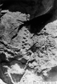
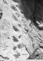
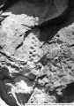
1859
1860
1861
1862
1863
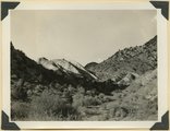
1864
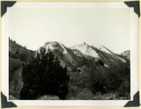
1865
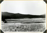
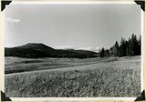
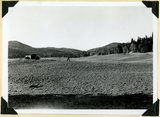
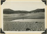
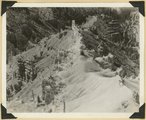
1866
1867
1868
1869
1870
1871
1872
1873
1874
1875
1876
1877
1878
1879
1880
1881
1882
1883
1884
1885
1886
1887
1888
1889
1890
1891
1892
1893
1894
1895
1896
1897
1898
1899
1900
1901
1902
1903
1904
1905
1906
1907
1908
1909
1910
1911
1912
1913
1914
1915
1916
1917
1918
1919
1920
1921
1922
1923
1924
1925
1926
1927
1928
1929
1930
1931
1932
1933
1934
1935
1936
1937
1938
1939
1940
1941
1942
1943
1944
1945
1946
1947
1948
1949
1950
1951
1952
1953
1954
1955
1956
1957
1958
1959
1960
1961
1962
1963
1964
1965
1966
1967
1968
1969
1970
1971
1972
1973
1974
1975
1976
1977
1978
1979
1980
1981
1982
1983
1984
1985
1986
1987
1988
1989
1990
1991
1992
1993
1994
1995
1996
1997
1998
Type
Image
210
Format
image/jpeg
210
Collection
Beckwith Photograph Collection
48
Photo Archives
154
Ski and Snow Sports Archives
4
Westminster College Photographs
4
Filters:
Format:
"image/jpeg"
Spatial Coverage:
"Iron County (Utah)"
Type:
"Image"
151
-
175
of
210
<
1
2
3
4
5
6
7
8
9
>
Gallery view
Number of results to display per page
10
25
50
100
200
Sort by Relevance
Sort by Title A-Z
Sort by Title Z-A
Sort by Date Ascending
Sort by Date Descending
Sort by Last Modified Ascending
Sort by Last Modified Descending
Title
Date
Type
Setname
151
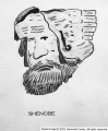
Shenobe
Image
dc_bpc
152
Shnabkaib member of the Moenkopi formation upturned in a fold which involves upper red beds (right), Coal Canyon. Iron County, UT. 1940
1940
Image
uum_map
153
Shnabkaib member of the Moenkopi formation upturned in a fold which involves upper red beds (right), Coal Canyon. Iron County, UT. 1940
1940
Image
uum_map
154
Shnabkaib member of the Moenkopi formation, chiefly gypsiferous beds, tilted in the Kanarra fold. Branch of Shurtz Creek, Iron County, UT. 1942
1942
Image
uum_map
155
Shurtz Creek alcove. Pyramids of upturned Navajo sandstone (center; Triassic below; upper Jurassic Cretaceous and basalt above. Strata involved in the Kanarra fold. Iron County, UT
1942
Image
uum_map
156
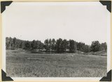
Sidney Valley near head of Castle Creek. Ponds and kame-like accumulation resulting from glaciation. Iron County, UT
1941; 1942
Image
uum_map
157
Sidney Valley near head of Castle Creek. Ponds and kame-like accumulation resulting from glaciation. Iron County, UT
1941; 1942
Image
uum_map
158
Sidney Valley. Ponds and mounds produced by glaciation. Iron County
1941
Image
uum_map
159
Sidney Valley. Ponds and mounds produced by glaciation. Iron County
1941
Image
uum_map
160
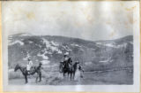
Six people and three horses - on Cedar Mtn, perhaps on the way from Esplin ranch to Cedar City
Image
uum_map
161
Snake in relief [1]
1939
Image
dc_bpc
162
Snake in relief [2]
1939
Image
dc_bpc
163
Snake in relief [3]
1939
Image
dc_bpc
164
Spring Creek. From open valley (foreground) on Carmel limestone passes into canyon in Navajo sandstone that in part forms Hurricane Cliffs. Typical stream on western Kolob Terrace, Washington County, UT, 1939
1939
Image
uum_map
165
Spur on wall of canyon. Wasatch limestone. Cedar Breaks National Monument
1937; 1938
Image
uum_map
166
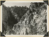
Straight Cliffs sandstone (Cretaceous) Wall of Ashdown Canyon, Iron County, UT. 1941
1941
Image
uum_map
167
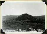
Sugar loaf on outlier of Markagunt Plateau on divide between Parowan and Coal Creek drainage areas. Iron County
1941; 1942
Image
uum_map
168
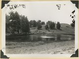
Summit Ridge. Pond supplied chiefly by melting snow. Iron County
1941; 1942
Image
uum_map
169
Summit Ridge. Pond supplied chiefly by melting snow. Iron County
1941; 1942
Image
uum_map
170
Summit Ridge. Undissected highland 9000 feet near head of Summit Canyon, Iron County
1941; 1942
Image
uum_map
171
Summit Ridge. View looking south across Braffitts Canyon. Iron County, UT
1941; 1942
Image
uum_map
172
Surface of Kolob Terrace developed on Cretaceous strata. Three Knolls (basalt) on skyline. Iron County, UT, 1942
1942
Image
uum_map
173
Surface of Kolob Terrace looking southeast near Pryor Knoll, Iron County, UT. 1941
1941
Image
uum_map
174
Surface of Kolob Terrace near head of Crystal Creek. Developed on Tropic shale
1941; 1942
Image
uum_map
175
Surface of Kolob Terrace near Pryor Knoll, Iron County
1941; 1942
Image
uum_map
151
-
175
of
210
<
1
2
3
4
5
6
7
8
9
>