Home
Browse
Ask Us
Chat
Harmful Language Statement
Log in
Advanced Search
Year
1853
1854
1855
1856
1857
1858
1859
1860
1861
1862
1863
1864
1865
1866
1867
1868
1869
1870
1871
1872
1873
1874
1875
1876
1877
1878
1879
1880
1881
1882
1883
1884
1885
1886
1887
1888
1889
1890
1891
1892
1893
1894
1895
1896
1897
1898
1899
1900
1901
1902
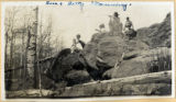
1903
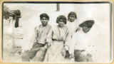
1904
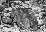
1905
1906
1907
1908
1909
1910
1911
1912
1913
1914
1915
1916
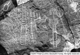
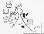
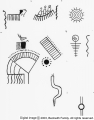
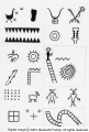
1917
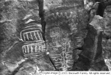
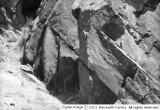
1918
1919
1920
1921
1922
1923
1924
1925
1926
1927
1928
1929
1930
1931
1932
1933
1934
1935
1936
1937
1938
1939
1940
1941
1942
1943
1944
1945
1946
1947
1948
1949
1950
1951
1952
1953
1954
1955
1956
1957
1958
1959
1960
1961
1962
1963
1964
1965
1966
1967
1968
1969
1970
1971
1972
1973
1974
1975
1976
1977
1978
1979
1980
1981
1982
1983
1984
1985
1986
1987
1988
1989
1990
1991
1992
1993
1994
1995
1996
1997
1998
TO
1853
1854
1855
1856
1857
1858
1859
1860
1861
1862
1863
1864
1865
1866
1867
1868
1869
1870
1871
1872
1873
1874
1875
1876
1877
1878
1879
1880
1881
1882
1883
1884
1885
1886
1887
1888
1889
1890
1891
1892
1893
1894
1895
1896
1897
1898
1899
1900
1901
1902
1903
1904
1905
1906
1907
1908
1909
1910
1911
1912
1913
1914
1915
1916
1917
1918
1919
1920
1921
1922
1923
1924
1925
1926
1927
1928
1929
1930
1931
1932
1933
1934
1935
1936
1937
1938
1939
1940
1941
1942
1943
1944
1945
1946
1947
1948
1949
1950
1951
1952
1953
1954
1955
1956
1957
1958
1959
1960
1961
1962
1963
1964
1965
1966
1967
1968
1969
1970
1971
1972
1973
1974
1975
1976
1977
1978
1979
1980
1981
1982
1983
1984
1985
1986
1987
1988
1989
1990
1991
1992
1993
1994
1995
1996
1997
1998
Type
Image
210
Format
image/jpeg
210
Collection
Beckwith Photograph Collection
48
Photo Archives
154
Ski and Snow Sports Archives
4
Westminster University Photographs
4
Filters:
Format:
"image/jpeg"
Spatial Coverage:
"Iron County (Utah)"
Type:
"Image"
51
-
75
of
210
<
1
2
3
4
5
6
7
8
9
>
Gallery view
Number of results to display per page
10
25
50
100
200
Sort by Relevance
Sort by Title A-Z
Sort by Title Z-A
Sort by Date Ascending
Sort by Date Descending
Sort by Last Modified Ascending
Sort by Last Modified Descending
Title
Date
Type
Setname
51
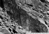
Fault on Rim Point Wasatch formation. Cedar Break National Monument
1937; 1938
Image
uum_map
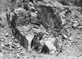
52
Fault, Wasatch limestone (extreme right) in horizontal contact with undifferentiated Cretaceous. Parowan Canyon. Iron County, UT
1941
Image
uum_map
53
Fault, Wasatch limestone (extreme right) in horizontal contact with undifferentiated Cretaceous. Parowan Canyon. Iron County, UT
1941
Image
uum_map
54
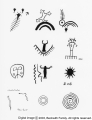
Fine sun emblem [1]
1939
Image
dc_bpc
55
Fine sun emblem [2]
1939-11-04
Image
dc_bpc
56
Five children -Cedar City
Image
uum_map
57
Fossiliferous Straight Cliffs sandstone, Kolob Terrace, Washington County, UT, 1939
1939
Image
uum_map
58
Four people sitting on a boulder - likely Cedar Mountain
Image
uum_map
59
Four Piaute children in Cedar City
Image
uum_map
60
The Gap [01]
1929
Image
dc_bpc
61
The Gap [02]
1939
Image
dc_bpc
62
The Gap [03]
1929-10-12
Image
dc_bpc
63
The Gap [04]
Image
dc_bpc
64
The Gap [05]
1939
Image
dc_bpc
65
The Gap [06]
1939
Image
dc_bpc
66
The Gap [07]
1938
Image
dc_bpc
67
The Gap [08]
1939-03-16
Image
dc_bpc
68
The Gap [09]
1938-11
Image
dc_bpc
69
The Gap [10]
1928-11
Image
dc_bpc
70
The Gap [11]
1939
Image
dc_bpc
71
The Gap [12]
1929-10-12
Image
dc_bpc
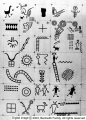
72
Gap chart series
1939-03-16
Image
dc_bpc
73
Gap Sipapu
1938-10
Image
dc_bpc
74
General view of eroded Pink Cliffs (Wasatch formation) near Cedar Breaks, Iron County, UT
1941
Image
uum_map
75
Glacial till, Castle Creek below Sidney Valley. Top of Markagunt Plateau. Iron County, UT. 1941
1941
Image
uum_map
51
-
75
of
210
<
1
2
3
4
5
6
7
8
9
>