Home
Browse
Ask Us
Chat
Harmful Language Statement
Log in
Advanced Search
Year
1899
1900
1901
1902
1903
1904
1905
1906
1907
1908
1909
1910
1911
1912
1913
1914
1915
1916
1917
1918
1919
1920
1921
1922
1923
1924
1925
1926
1927
1928
1929
1930
1931
1932
1933
1934
1935
1936
1937
1938
1939
1940
1941
1942
1943
1944
1945
1946
1947
1948
1949
1950
1951
1952
1953
1954
1955
1956
1957
1958
1959
1960
1961
1962
1963
1964
1965
1966
1967
1968
1969
1970
1971
1972
1973
1974
1975
1976
1977
1978
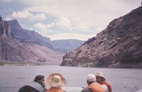
1979
1980
1981
1982
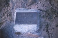
1983
1984
1985
1986
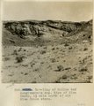
1987
1988
1989
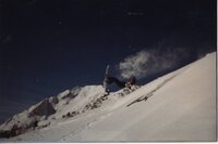
1990
1991
1992
1993
1994
1995
1996
1997
1998
TO
1899
1900
1901
1902
1903
1904
1905
1906
1907
1908
1909
1910
1911
1912
1913
1914
1915
1916
1917
1918
1919
1920
1921
1922
1923
1924
1925
1926
1927
1928
1929
1930
1931
1932
1933
1934
1935
1936
1937
1938
1939
1940
1941
1942
1943
1944
1945
1946
1947
1948
1949
1950
1951
1952
1953
1954
1955
1956
1957
1958
1959
1960
1961
1962
1963
1964
1965
1966
1967
1968
1969
1970
1971
1972
1973
1974
1975
1976
1977
1978
1979
1980
1981
1982
1983
1984
1985
1986
1987
1988
1989
1990
1991
1992
1993
1994
1995
1996
1997
1998
Type
Image
1,250
Image/StillImage
990
Format
image/jpeg
2,307
Collection
Beckwith Photograph Collection
3
Photo Archives
830
Ski and Snow Sports Photo Archives
3
Utah River Running Photo Archives
1,471
Filters:
Format:
"image/jpeg"
Spatial Coverage:
"Coconino County (Ariz.)"
76
-
100
of
2,307
<
1
2
3
4
5
6
7
8
9
10
>
Gallery view
Number of results to display per page
10
25
50
100
200
Sort by Relevance
Sort by Title A-Z
Sort by Title Z-A
Sort by Date Ascending
Sort by Date Descending
Sort by Last Modified Ascending
Sort by Last Modified Descending
Title
Date
Type
Setname
76
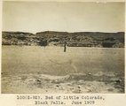
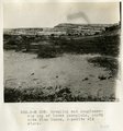
Bed of Little Colorado, Black Falls, June 1909 (photo G-92)
1909
Image
uum_map
77
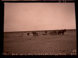
Bed of Little Colorado, Leupp, Ariz. (negative for photo G-90)
1909
Image
uum_map
78
Bed of Little Colorado, Leupp, Arizona (negative for photo G-89)
1909
Image
uum_map
79
Bed of Little Colorado, Leupp, Arizona, June 1909 (photo G-89)
1909
Image
uum_map
80
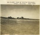
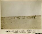
Bed of Little Colorado, Leupp, Arizona, May 1909 (photo G-90)
1909
Image
uum_map
81
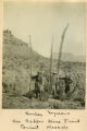
Beecher, Seymour on Copper Mine Trail, Giant Mescals
1900
Image
uum_map
82
Beginning cloudburst
1971-08
Image
uum_map_rr
83
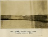
Bekishibito: dunes blocking canyon, 1914
1914
Image
uum_map
84
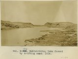
Bekishibito: lake formed by drifting sand, 1914
1914
Image
uum_map
85
Below Kanab Creek
1909-09; 1909-10; 1909-11
Image
uum_map
86
Below Lava Falls
1909-09; 1909-10; 1909-11
Image
uum_map
87
Below Lava Falls
1965-06
Image
uum_map_rr
88
Below Little Colorado
1970-04; 1970-05
Image
uum_map_rr
89
Below Little Colorado
1970-04; 1970-05
Image
uum_map_rr
90
Below Little Colorado River, Grand Canyon
1909-09; 1909-10; 1909-11
Image
uum_map
91
Below Phantom [ranch] and above Bass
1971-05-09
Image
uum_map_rr
92
Bert Loper plaque
1965-06
Image
uum_map_rr
93
Between Clear Creek and Phantom Ranch; early
1971-05-09
Image
uum_map_rr
94
Between Phantom [ranch] and Bass
1971-05-09
Image
uum_map_rr
95
Between Phantom [ranch] and Bass
1971-05-09
Image
uum_map_rr
96
Beveling and conglomerate cap of lower peneplain, north side Blue Canon, opposite old store.
1913
Image
uum_map
97
Beveling below Black Falls, looking north.
1913
Image
uum_map
98
Beveling of McElmo and conglomerate cap. Edge of Blue Canon, 1 1/2 mile north of old Blue Canon store.
1913
Image
uum_map
99
Billy Diet at Powdergun, Flagstaff's Bowl.
1984; 1985
uum_map_usa
100
Billy Diet snowboarding at Powdergun.
1983; 1984
uum_map_usa
76
-
100
of
2,307
<
1
2
3
4
5
6
7
8
9
10
>