1 - 25 of 7
Number of results to display per page
| Title | Date | Type | Setname | ||
|---|---|---|---|---|---|
| 1 | 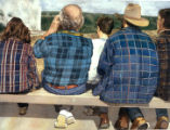 | Faithful Watch | Image/StillImage | uu_uap | |
| 2 | 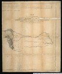 | Map of an exploring expedition to the Rocky Mountains in the year 1842 and to Oregon & North California in the years 1843-44 | 1845 | Image/StillImage | uu_awm |
| 3 | 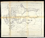 | Sketch of the country between South Pass and the Great Salt Lake. | 1857 | Image/StillImage | uu_awm |
| 4 | 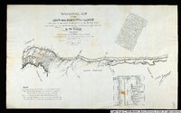 | Topographical Map of the Road From Missouri To Oregon Commencing at the Mouth of the Kansas in the Missouri River and Ending at the Mouth of the Wallah-Wallah in the Columbia. Section 3 | 1846 | Image/StillImage | uu_awm |
| 5 | 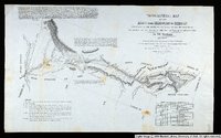 | Topographical Map of the Road From Missouri To Oregon Commencing at the Mouth of the Kansas in the Missouri River and Ending at the Mouth of the Wallah-Wallah in the Columbia. Section 4 | 1846 | Image/StillImage | uu_awm |
| 6 | 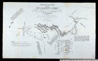 | Topographical Map of the Road From Missouri To Oregon Commencing at the Mouth of the Kansas in the Missouri River and Ending at the Mouth of the Wallah-Wallah in the Columbia. Section 5 | 1846 | Image/StillImage | uu_awm |
| 7 | 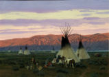 | Ute Camp - Southwest Wyoming | 1991 | Image/StillImage | uu_uap |
1 - 25 of 7