The Federal Resources Corporation records (1930-1989) contain the "dead files" of a company that, through a long series of mergers and acquisitions, most of which took place in the 1960s, became a force in the world of mineral exploration, development, and mining. While the company dealt with the extraction of various metals and minerals over the years including gold, silver, copper, beryllium, and fluorspar, the focus of the materials in this collection is primarily uranium. The collection materials reflect the company's focus on the western states of Alaska, Arizona, California, Idaho, Montana, Nevada, New Mexico, Oregon, Texas, Washington, and, especially, Utah and Wyoming.
1 - 25 of 8
| Title | Date | File Number | ||
|---|---|---|---|---|
| 1 |
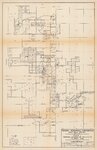 | Federal Resources Corp., Dewey area, Plate I: proposed exploration drilling in the Dewey area | 1970-01 | 1513_049_006_007 |
| 2 |
 | Federal Resources Corporation Black Hills project: Ackerman area, proposed drilling 1971 | 1970-09 | 1513_048B_007_001 |
| 3 |
 | Federal Resources Corporation Black Hills project: Clifton area, exploration drilling map [1971] [2] | 1970-12 | 1513_048B_007_003 |
| 4 |
 | Federal Resources Corp., Dewey area, Plate IIa: bottom hole location detail map | 1970-02-24 | 1513_049_006_005 |
| 5 |
 | Federal Resources Corporation Black Hills project: Clifton area, land ownership map | 1970-08-05 | 1513_048B_007_002 |
| 6 |
 | Gamma ray counts per second: Federal Resources, Black Hills project, hole: 43-60-30-13-1 | 1970-06-30 | 1513_049_003_014 |
| 7 |
 | Moore Hill property map, Niobrara County, Wyoming, showing drill holes, profiles and outcrop pattern | 1970-07-15 | 1513_086_012_001 |
| 8 |
 | Wyoming uranium project index map | 1970; 1971; 1972; 1973; 1974; 1975; 1976 | 1513_088_002_001 |
1 - 25 of 8