Home
Browse
Ask Us
Chat
Harmful Language Statement
Log in
Uintah County Regional History Center Maps
Advanced Search
Year
1913
1914
1915
1916
1917
1918
1919
1920
1921
1922
1923
1924
1925
1926
1927
1928
1929
1930
1931
1932
1933
1934
1935
1936
1937
1938
1939
1940
1941
1942
1943
1944
1945
1946
1947
1948
1949
1950
1951
1952
1953
1954
1955
1956
1957
1958
1959
1960
1961
1962
1963
1964
1965
1966
1967
1968
1969
1970
1971
1972
1973
1974
1975
1976
1977
1978
1979
1980
1981
1982
1983
1984
1985
1986
1987
1988
1989
1990
1991
1992
1993
1994
1995
1996
1997
1998
1999
2000
2001
2002
2003
2004
2005
2006
2007
2008
2009
2010
2011
2012
TO
1913
1914
1915
1916
1917
1918
1919
1920
1921
1922
1923
1924
1925
1926
1927
1928
1929
1930
1931
1932
1933
1934
1935
1936
1937
1938
1939
1940
1941
1942
1943
1944
1945
1946
1947
1948
1949
1950
1951
1952
1953
1954
1955
1956
1957
1958
1959
1960
1961
1962
1963
1964
1965
1966
1967
1968
1969
1970
1971
1972
1973
1974
1975
1976
1977
1978
1979
1980
1981
1982
1983
1984
1985
1986
1987
1988
1989
1990
1991
1992
1993
1994
1995
1996
1997
1998
1999
2000
2001
2002
2003
2004
2005
2006
2007
2008
2009
2010
2011
2012
Type
Image/StillImage
16
Format
image/jpeg
16
Collection
Uintah County Regional History Center...
16
Filters:
Format:
"image/jpeg"
Collection:
"ucl_maps"
1
-
25
of
16
Gallery view
Number of results to display per page
10
25
50
100
200
Sort by Relevance
Sort by Title A-Z
Sort by Title Z-A
Sort by Date Ascending
Sort by Date Descending
Sort by Last Modified Ascending
Sort by Last Modified Descending
Title
Date
Type
1
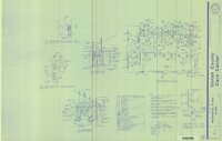
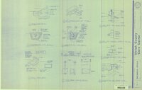
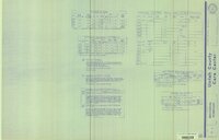
Uintah County Care Center Addition 1991 (Sheet P-0)
1991
Image/StillImage
2
Uintah County Care Center Addition 1991 (Sheet P-1)
1991
Image/StillImage
3
Ashley National Forest - Analysis Units - High Uintas Roadless Area Study
Image/StillImage
4
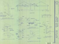
Uintah County Care Center Addition 1991 (Sheet P-2)
1991
Image/StillImage
5
Ashley National Forest, Utah - Salt Lake and Uinta Special Meridians 1962
1962
Image/StillImage
6
Ashley National Forest, Utah - Salt Lake and Uinta Special Meridians
1962
Image/StillImage
7
Uintah County Care Center Addition 1991 (Sheet M-1)
1991
Image/StillImage
8
Plat of the Townsite of Lapoint, Utah - 1913
1913
Image/StillImage
9
Road Commission - Highway 40 Jensen To Vernal 1930
1930
Image/StillImage
10
Uintah County Care Center Addition 1991 (Sheet M-2)
1991
Image/StillImage
11
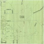
Vernal City Roads - Vernal Ave East to County Landfill & Diamond Mountain Road 2012
2012
Image/StillImage
12
Fish Lake US DOI BLM 1978
1978
Image/StillImage
13
Uintah County Care Center Addition 1991 (Sheet M-3)
1991
Image/StillImage
14
Uintah County Care Center Addition 1991 (Sheet M-4)
1991
Image/StillImage
15
Ashley National Forest Map
1945
Image/StillImage
16
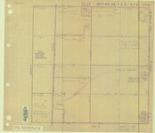
Moffat Townsite (Gusher) Section 24, T2S R1E, USM
Image/StillImage
1
-
25
of
16