Home
Browse
Ask Us
Chat
Harmful Language Statement
Log in
Uintah County Regional History Center Maps
Advanced Search
Year
1859
1860
1861
1862
1863
1864
1865
1866
1867
1868
1869
1870
1871
1872
1873
1874
1875
1876
1877
1878
1879
1880
1881
1882
1883
1884
1885
1886
1887
1888
1889
1890
1891
1892
1893
1894
1895
1896
1897
1898
1899
1900
1901
1902
1903
1904
1905
1906
1907
1908
1909
1910
1911
1912
1913
1914
1915
1916
1917
1918
1919
1920
1921
1922
1923
1924
1925
1926
1927
1928
1929
1930
1931
1932
1933
1934
1935
1936
1937
1938
1939
1940
1941
1942
1943
1944
1945
1946
1947
1948
1949
1950
1951
1952
1953
1954
1955
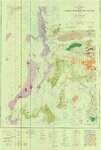
1956
1957
1958
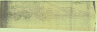
1959
1960
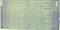
1961
1962
1963
1964
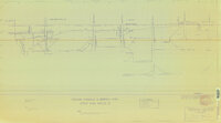
1965
1966
1967
1968
1969
1970
1971
1972
1973
1974
1975
1976
1977
1978
1979
1980
1981
1982
1983
1984
1985
1986
1987
1988
1989
1990
1991
1992
1993
1994
1995
1996
1997
1998
1999
2000
2001
2002
2003
2004
2005
2006
2007
2008
2009
2010
2011
2012
2013
2014
TO
1859
1860
1861
1862
1863
1864
1865
1866
1867
1868
1869
1870
1871
1872
1873
1874
1875
1876
1877
1878
1879
1880
1881
1882
1883
1884
1885
1886
1887
1888
1889
1890
1891
1892
1893
1894
1895
1896
1897
1898
1899
1900
1901
1902
1903
1904
1905
1906
1907
1908
1909
1910
1911
1912
1913
1914
1915
1916
1917
1918
1919
1920
1921
1922
1923
1924
1925
1926
1927
1928
1929
1930
1931
1932
1933
1934
1935
1936
1937
1938
1939
1940
1941
1942
1943
1944
1945
1946
1947
1948
1949
1950
1951
1952
1953
1954
1955
1956
1957
1958
1959
1960
1961
1962
1963
1964
1965
1966
1967
1968
1969
1970
1971
1972
1973
1974
1975
1976
1977
1978
1979
1980
1981
1982
1983
1984
1985
1986
1987
1988
1989
1990
1991
1992
1993
1994
1995
1996
1997
1998
1999
2000
2001
2002
2003
2004
2005
2006
2007
2008
2009
2010
2011
2012
2013
2014
Type
Image/StillImage
266
Format
image/jpeg
266
Collection
Uintah County Regional History Center...
266
Filters:
Format:
"image/jpeg"
Collection:
"ucl_maps"
Year End:
2016
101
-
125
of
266
<
1
2
3
4
5
6
7
8
9
10
>
Gallery view
Number of results to display per page
10
25
50
100
200
Sort by Relevance
Sort by Title A-Z
Sort by Title Z-A
Sort by Date Ascending
Sort by Date Descending
Sort by Last Modified Ascending
Sort by Last Modified Descending
Title
Date
Type
101
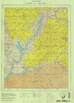
Lake Powell US DOI BLM 1976
1976
Image/StillImage
102
Little Bonanza Gilsonite Mines Layout Plat - Ziegler Chemical & Mineral Corp
1987; 1995; 1996
Image/StillImage
103
Little Bonanza Mine #1 Combined with Shaft #8 & #8-A (Ziegler Chemical & Mineral Corp)
1991
Image/StillImage
104
Little Bonanza Mine - Ziegler Chemical & Mineral Corp
1991
Image/StillImage
105
Little Emma Middle #1 - Ziegler Chemical & Mineral Corp
1992
Image/StillImage
106
Map 37 - Simple Bouguer Gravity Anomaly Map of Utah
1975
Image/StillImage
107
Map 68 Energy Resources Map of Utah 1983
1983
Image/StillImage
108
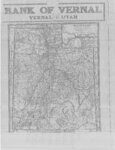
Map of a Portion of Plat "A" of Hayden, Utah, Townsite 1908
1908
Image/StillImage
109
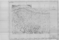
Map of a Reconnoissance between Fort Leavenworth on the Missouri River, and the Great Salt Lake in the Territory of Utah
1949; 1950
Image/StillImage
110
Map of Dragon Mine - American Asphalt Association - Dragon, Utah
1919
Image/StillImage
111
Map of the First Addition to the Town of Moffat 1905
1905
Image/StillImage
112
Map of Utah with the 1920 Census Index
1920
Image/StillImage
113
The Mary L. Naylor Hotel Gusher 1994
1994
Image/StillImage
114
Maybell (Planimetric) NW-8 (US DOI BLM) 1974
1974
Image/StillImage
115
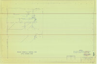
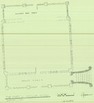
Merkley Home Floor Plan 1994
1994
Image/StillImage
116
Moffat School House - Floor Plan 1994
1994
Image/StillImage
117
Moffat School House - Outside Front View 1994
1994
Image/StillImage
118
Monticello US DOI BLM 1978
1978
Image/StillImage
119
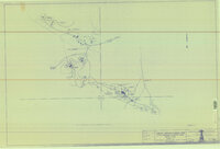
Moon Lake Project Deserado Mine Sheet 1
1981
Image/StillImage
120
Moon Lake Project Deserado Mine Sheet 2
1981
Image/StillImage
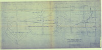
121
Muse K Harris Cabin, Gusher - Floor Plan
1994
Image/StillImage
122
Myton, Duchesne County, Utah; Sanborn Map Company, April 1917
1917
Image/StillImage
123
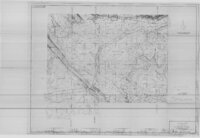
Myton, Utah - 1964
1964
Image/StillImage
124
Myton-Duchesne (Planimetric) NE-12 (US DOI BLM) 1977 (revised)
1977
Image/StillImage
125
Naples, Utah in the 1940s
1940; 1941; 1942; 1943; 1944; 1945; 1946; 1947; 1948; 1949
Image/StillImage
101
-
125
of
266
<
1
2
3
4
5
6
7
8
9
10
>