Home
Browse
Ask Us
Chat
Harmful Language Statement
Log in
Uintah County Regional History Center Maps
Advanced Search
Year
1859
1860
1861
1862
1863
1864
1865
1866
1867
1868
1869
1870
1871
1872
1873
1874
1875
1876
1877
1878
1879
1880
1881
1882
1883
1884
1885
1886
1887
1888
1889
1890
1891
1892
1893
1894
1895
1896
1897
1898
1899
1900
1901
1902
1903
1904
1905
1906
1907
1908
1909
1910
1911
1912
1913
1914
1915
1916
1917
1918
1919
1920
1921
1922
1923
1924
1925
1926
1927
1928
1929
1930
1931
1932
1933
1934
1935
1936
1937
1938
1939
1940
1941
1942
1943
1944
1945
1946
1947
1948
1949
1950
1951
1952
1953
1954
1955
1956
1957
1958
1959
1960
1961
1962
1963
1964
1965
1966
1967
1968
1969
1970
1971
1972
1973
1974
1975
1976
1977
1978
1979
1980
1981
1982
1983
1984
1985
1986
1987
1988
1989
1990
1991
1992
1993
1994
1995
1996
1997
1998
1999
2000
2001
2002
2003
2004
2005
2006
2007
2008
2009
2010
2011
2012
2013
2014
TO
1859
1860
1861
1862
1863
1864
1865
1866
1867
1868
1869
1870
1871
1872
1873
1874
1875
1876
1877
1878
1879
1880
1881
1882
1883
1884
1885
1886
1887
1888
1889
1890
1891
1892
1893
1894
1895
1896
1897
1898
1899
1900
1901
1902
1903
1904
1905
1906
1907
1908
1909
1910
1911
1912
1913
1914
1915
1916
1917
1918
1919
1920
1921
1922
1923
1924
1925
1926
1927
1928
1929
1930
1931
1932
1933
1934
1935
1936
1937
1938
1939
1940
1941
1942
1943
1944
1945
1946
1947
1948
1949
1950
1951
1952
1953
1954
1955
1956
1957
1958
1959
1960
1961
1962
1963
1964
1965
1966
1967
1968
1969
1970
1971
1972
1973
1974
1975
1976
1977
1978
1979
1980
1981
1982
1983
1984
1985
1986
1987
1988
1989
1990
1991
1992
1993
1994
1995
1996
1997
1998
1999
2000
2001
2002
2003
2004
2005
2006
2007
2008
2009
2010
2011
2012
2013
2014
Type
Image/StillImage
266
Format
image/jpeg
266
Collection
Uintah County Regional History Center...
266
Filters:
Format:
"image/jpeg"
Collection:
"ucl_maps"
Year End:
2016
26
-
50
of
266
<
1
2
3
4
5
6
7
8
9
10
>
Gallery view
Number of results to display per page
10
25
50
100
200
Sort by Relevance
Sort by Title A-Z
Sort by Title Z-A
Sort by Date Ascending
Sort by Date Descending
Sort by Last Modified Ascending
Sort by Last Modified Descending
Title
Date
Type
26
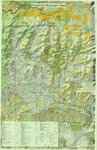
Bonanza (Planimetric) NE-14 (US DOI BLM) 1975 (revised)
1975
Image/StillImage
27
Book Cliffs US DOI BLM 1979
1979
Image/StillImage
28
Bountiful (Planimetric) NW-12 (US DOI BLM) 1975
1975
Image/StillImage
29
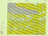
Brennan Basin Quad 1999 - National Wetlands Inventory
1999
Image/StillImage
30
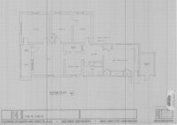
Caldwell Home Floor Plan
1989
Image/StillImage
31
Camp Floyd, Utah 1859
1859
Image/StillImage
32
Canyon of Lodore, Colorado 1979
1979
Image/StillImage
33
Canyon of Lodore, Colorado 1993
1993
Image/StillImage
34
Carbon US DOI BLM 1967
1967
Image/StillImage
35
Carbon US DOI BLM 1978
1978
Image/StillImage
36
Cat Creek & Pebble Puppy Placer Gold Claims, Uintah County, Utah 1994
1994
Image/StillImage
37
Central Business District Vernal, Utah - 1970s
1970; 1971; 1972; 1973; 1974; 1975; 1976; 1977; 1978; 1979
Image/StillImage
38
Collett Francke Home Floor Plan
1989
Image/StillImage
39
Coltharp Home 1989
1989
Image/StillImage
40
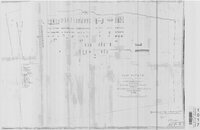
Cowboy-Eureka Gilsonite Vein Plane Table Survey, 1980
1980
Image/StillImage
41
Craig, Colorado 1979
1979
Image/StillImage
42
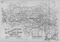
The Denver Northwestern and Pacific Railway, Moffat Road and Projected Lines 1911
1911
Image/StillImage
43
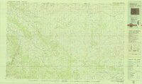
Diamond Mountain (Planimetric) NE-10 (US DOI BLM) 1975
1975
Image/StillImage
44
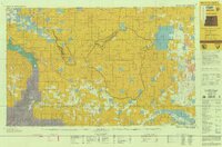
Diamond Mountain 2001
2001
Image/StillImage
45
Diamond Mountain 2012
2012
Image/StillImage
46
Diamond Mountain 2012
2012
Image/StillImage
47
Diamond Mountain Landowners 1935-1940
1935; 1936; 1937; 1938; 1939; 1940
Image/StillImage
48
Diamond Mountain Landowners 1991
1991
Image/StillImage
49
Diamond Mountain Landowners 1993
1993
Image/StillImage
50
Dinosaur (Planimetric) NW-7 (US DOI BLM) 1975
1975
Image/StillImage
26
-
50
of
266
<
1
2
3
4
5
6
7
8
9
10
>