Home
Browse
Ask Us
Chat
Harmful Language Statement
Log in
Uintah County Regional History Center Maps
Advanced Search
Year
1859
1860
1861
1862
1863
1864
1865
1866
1867
1868
1869
1870
1871
1872
1873
1874
1875
1876
1877
1878
1879
1880
1881
1882
1883
1884
1885
1886
1887
1888
1889
1890
1891
1892
1893
1894
1895
1896
1897
1898
1899
1900
1901
1902
1903
1904
1905
1906
1907
1908
1909
1910
1911
1912
1913
1914
1915
1916
1917
1918
1919
1920
1921
1922
1923
1924
1925
1926
1927
1928
1929
1930
1931
1932
1933
1934
1935
1936
1937
1938
1939
1940
1941
1942
1943
1944
1945
1946
1947
1948
1949
1950
1951
1952
1953
1954
1955
1956
1957
1958
1959
1960
1961
1962
1963
1964
1965
1966
1967
1968
1969
1970
1971
1972
1973
1974
1975
1976
1977
1978
1979
1980
1981
1982
1983
1984
1985
1986
1987
1988
1989
1990
1991
1992
1993
1994
1995
1996
1997
1998
1999
2000
2001
2002
2003
2004
2005
2006
2007
2008
2009
2010
2011
2012
2013
2014
TO
1859
1860
1861
1862
1863
1864
1865
1866
1867
1868
1869
1870
1871
1872
1873
1874
1875
1876
1877
1878
1879
1880
1881
1882
1883
1884
1885
1886
1887
1888
1889
1890
1891
1892
1893
1894
1895
1896
1897
1898
1899
1900
1901
1902
1903
1904
1905
1906
1907
1908
1909
1910
1911
1912
1913
1914
1915
1916
1917
1918
1919
1920
1921
1922
1923
1924
1925
1926
1927
1928
1929
1930
1931
1932
1933
1934
1935
1936
1937
1938
1939
1940
1941
1942
1943
1944
1945
1946
1947
1948
1949
1950
1951
1952
1953
1954
1955
1956
1957
1958
1959
1960
1961
1962
1963
1964
1965
1966
1967
1968
1969
1970
1971
1972
1973
1974
1975
1976
1977
1978
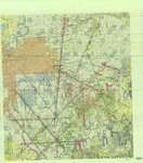
1979
1980
1981
1982
1983
1984
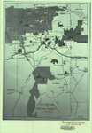
1985
1986
1987
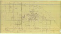
1988
1989
1990
1991
1992
1993
1994
1995
1996
1997
1998
1999
2000
2001
2002
2003
2004
2005
2006
2007
2008
2009
2010
2011
2012
2013
2014
Type
Image/StillImage
329
Format
image/jpeg
329
Collection
Uintah County Regional History Center...
329
Filters:
Format:
"image/jpeg"
Collection:
"ucl_maps"
276
-
300
of
329
<
5
6
7
8
9
10
11
12
13
14
>
Gallery view
Number of results to display per page
10
25
50
100
200
Sort by Relevance
Sort by Title A-Z
Sort by Title Z-A
Sort by Date Ascending
Sort by Date Descending
Sort by Last Modified Ascending
Sort by Last Modified Descending
Title
Setname
Type
276
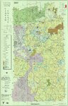
Uintah County Transportation 2014
ucl_maps
Image/StillImage
277
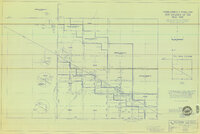
Uintah Railway Elevation Map 1930
ucl_maps
Image/StillImage
278
Uintah Railway Stagecoach and Toll Road
ucl_maps
Image/StillImage
279
Uintah School 1906-1940
ucl_maps
Image/StillImage
280
Uintah School District 1 thru 7, 1910-1917
ucl_maps
Image/StillImage
281
Uintah School District 12 and 13, 1910-1917
ucl_maps
Image/StillImage
282
Uintah Stake Tabernacle
ucl_maps
Image/StillImage
283
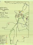
United States Civilian Conservation Corps - Vernal Camp - D6-31 Company 1507
ucl_maps
Image/StillImage
284
United States Department of the Interior Geological Survey, Dinosaur National Monument, Colorado - Utah, 1966
ucl_maps
Image/StillImage
285
United States Department of the Interior Geological Survey, Dinosaur National Monument, Colorado - Utah, 1971
ucl_maps
Image/StillImage
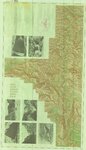
286
Upper Bear Riiver (Planimetric) NE-3 (US DOI BLM) 1975
ucl_maps
Image/StillImage
287
Utah - John Jarvie Historic Property - BLM
ucl_maps
Image/StillImage
288
Utah Aeronautical Chart 1970
ucl_maps
Image/StillImage
289
Utah County Map and Information Things to See and Do
ucl_maps
Image/StillImage
290
Utah Story Travel Council
ucl_maps
Image/StillImage
291
Utah! National Park State
ucl_maps
Image/StillImage
292
Vacation Map of Uintah County, Utah 1948
ucl_maps
Image/StillImage
293
Vein Location of the Neal Vein - Ziegler Chemical & Mineral Corp
ucl_maps
Image/StillImage
294
Veritus Seismec Surveying and Positioning
ucl_maps
Image/StillImage
295
Vernal City - no date
ucl_maps
Image/StillImage
296
Vernal City Office Blue Prints - Sheet 1
ucl_maps
Image/StillImage
297
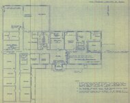
Vernal City Office Blue Prints - Sheet 2
ucl_maps
Image/StillImage
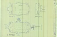
298
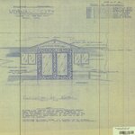
Vernal City Office Blue Prints - Sheet 3
ucl_maps
Image/StillImage
299
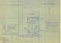
Vernal City Office Blue Prints - Sheet 4
ucl_maps
Image/StillImage
300
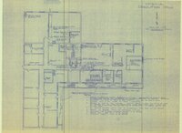
Vernal City Office Blue Prints - Sheet 5
ucl_maps
Image/StillImage
276
-
300
of
329
<
5
6
7
8
9
10
11
12
13
14
>