Home
Browse
Ask Us
Chat
Harmful Language Statement
Log in
Uintah County Regional History Center Maps
Advanced Search
Year
1878
1879
1880
1881
1882
1883
1884
1885
1886
1887
1888
1889
1890
1891
1892
1893
1894
1895
1896
1897
1898
1899
1900
1901
1902
1903
1904
1905
1906
1907
1908
1909
1910
1911
1912
1913
1914
1915
1916
1917
1918
1919
1920
1921
1922
1923
1924
1925
1926
1927
1928
1929
1930
1931
1932
1933
1934
1935
1936
1937
1938
1939
1940
1941
1942
1943
1944
1945
1946
1947
1948
1949
1950
1951
1952
1953
1954
1955
1956
1957
1958
1959
1960
1961
1962
1963
1964
1965
1966
1967
1968
1969
1970
1971
1972
1973
1974
1975
1976
1977
1978
1979
1980
1981
1982
1983
1984
1985
1986
1987
1988
1989
1990
1991
1992
1993
1994
1995
1996
1997
1998
1999
2000
2001
2002
2003
2004
2005
2006
2007
2008
2009
2010
2011
2012
2013
2014
TO
1878
1879
1880
1881
1882
1883
1884
1885
1886
1887
1888
1889
1890
1891
1892
1893
1894
1895
1896
1897
1898
1899
1900
1901
1902
1903
1904
1905
1906
1907
1908
1909
1910
1911
1912
1913
1914
1915
1916
1917
1918
1919
1920
1921
1922
1923
1924
1925
1926
1927
1928
1929
1930
1931
1932
1933
1934
1935
1936
1937
1938
1939
1940
1941
1942
1943
1944
1945
1946
1947
1948
1949
1950
1951
1952
1953
1954
1955
1956
1957
1958
1959
1960
1961
1962
1963
1964
1965
1966
1967
1968
1969
1970
1971
1972
1973
1974
1975
1976
1977
1978
1979
1980
1981
1982
1983
1984
1985
1986
1987
1988
1989
1990
1991
1992
1993
1994
1995
1996
1997
1998
1999
2000
2001
2002
2003
2004
2005
2006
2007
2008
2009
2010
2011
2012
2013
2014
Type
Image/StillImage
300
Format
image/jpeg
300
Collection
Uintah County Regional History Center...
300
Filters:
Format:
"image/jpeg"
Collection:
"ucl_maps"
Subject:
"Utah"
Type:
"Image/StillImage"
Format:
image
Setname:
!(ir* OR ehsl*)
276
-
300
of
300
<
3
4
5
6
7
8
9
10
11
12
>
Gallery view
Number of results to display per page
10
25
50
100
200
Sort by Relevance
Sort by Title A-Z
Sort by Title Z-A
Sort by Date Ascending
Sort by Date Descending
Sort by Last Modified Ascending
Sort by Last Modified Descending
Title
Date
Type
276
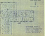
Vernal City Office Blue Prints - Sheet 8
Image/StillImage
277
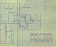
Vernal City Office Blue Prints - Sheet 9
Image/StillImage
278
Vernal City Official Zoning Map 1990
1990
Image/StillImage
279
Vernal City Reconnaissance Survey 1987
1987
Image/StillImage
280
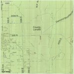
Vernal City Roads - Vernal Ave East to County Landfill & Diamond Mountain Road 2012
2012
Image/StillImage
281
Vernal City Roads 2012
2012
Image/StillImage
282
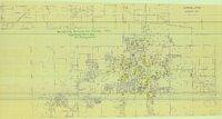
Vernal District Recreation Map, 1969
1969
Image/StillImage
283
Vernal, Utah 1993
1993
Image/StillImage
284
Vernal, Utah-Colorado 1980
1980
Image/StillImage
285
Vernal, Utah-Colorado 1982
1980; 1982
Image/StillImage
286
Wah Wah US DOI BLM 1978
1978
Image/StillImage
287
Wasatch US DOI BLM 1973
1973
Image/StillImage
288
Western Venture Corp Vernal Area
Image/StillImage
289
Westwater (Planimetric) SE-4 (US DOI BLM) 1975 (revised)
1975
Image/StillImage
290
Westwater (Planimetric) SE-4 (US DOI BLM) 1977
1977
Image/StillImage
291
Westwater, Utah-Colorado 1981
1980; 1981
Image/StillImage
292
White Home
1989
Image/StillImage
293
Whiterocks Ashley National Forest Structural Nose 1957
1957
Image/StillImage
294
Whiterocks Townsite 1967
1967
Image/StillImage
295
Windy Ridge, Utah - 1964
1964
Image/StillImage
296
Woodside (Planimetric) SE-2 (US DOI BLM) 1977
1977
Image/StillImage
297
Woodside (Planimetric) SE-3 (US DOI BLM) 1975 (revised)
1975
Image/StillImage
298
Workman Colton Home
1989
Image/StillImage
299
Workman Ratliff Home
1989
Image/StillImage
300
Zion National Park, Washington County (Brochure and Map)
Image/StillImage
276
-
300
of
300
<
3
4
5
6
7
8
9
10
11
12
>