1 - 25 of 11
| Title | Date | Type | ||
|---|---|---|---|---|
| 1 |
 |
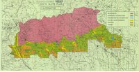
Ashley National Forest Wilderness Proposal 1967 - South Slope Plan | 1967 | Image/StillImage |
| 2 |
 |
Ashley National Forest Wilderness Proposal 1967 - South Slope Plan - Roadless Areas - Alternative 1 | 1967 | Image/StillImage |
| 3 |
 |
Ashley National Forest Wilderness Proposal 1967 - South Slope Plan - Roadless Areas - Alternative 2 | 1967 | Image/StillImage |
| 4 |
 |
Ashley National Forest Wilderness Proposal 1967 - South Slope Plan - Roadless Areas - Alternative 3 | 1967 | Image/StillImage |
| 5 |
 |
Ashley National Forest Wilderness Proposal 1967 - South Slope Plan - Roadless Areas - Alternative 4 | 1967 | Image/StillImage |
| 6 |
 |
Duchesne County Road Map | 2004 | Image/StillImage |
| 7 |
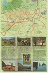 |
Duchesne County Tourism Map | Image/StillImage | |
| 8 |
 |
Duchesne US DOI BLM 1977 | 1977 | Image/StillImage |
| 9 |
 |
Myton, Duchesne County, Utah; Sanborn Map Company, April 1917 | 1917 | Image/StillImage |
| 10 |
 |
Myton, Utah - 1964 | 1964 | Image/StillImage |
| 11 |
 |
Ouray, Utah - 1964 | 1964 | Image/StillImage |
1 - 25 of 11