101 - 125 of 1,126
Number of results to display per page
TitleDateType
101 Columbia Steel Company ; Contour Map at Iron Mountain and Approximate Plant Site and Projected Location - Iron Mountain ; Contour Map and Projected Location Iron Mountain Railroad, LLB-110, Sheet #10, Tentative Location of Crushing Plant1934Image
102 Columbia Steel Company ; Contour Map at Iron Mountain and Approximate Plant Site and Projected Location - Iron Mountain ; Contour Map and Projected Location Iron Mountain Railroad, LLB-110, Sheet #11, Pinto Ore Body1934Image
103 Columbia Steel Company ; Contour Map at Iron Mountain and Approximate Plant Site and Projected Location - Iron Mountain ; Contour Map and Projected Location Iron Mountain Railroad, Crushing Plant , Full Area1934Image
104 Columbia Steel Company ; Contour Map at Iron Mountain and Approximate Plant Site and Projected Location - Iron Mountain ; Contour Map and Projected Location Iron Mountain Railroad, LLB-110, Sheet #4, Butte, Edited1934Image
105 Columbia Steel Company ; Contour Map at Iron Mountain and Approximate Plant Site and Projected Location - Iron Mountain ; Contour Map and Projected Location Iron Mountain Railroad, LLB-110, Sheet #3, Butte, Edited1934Image
106 Columbia Steel Company ; Contour Map at Iron Mountain and Approximate Plant Site and Projected Location - Iron Mountain ; Contour Map and Projected Location Iron Mountain Railroad, LLB-110, Sheet #5, Edited1934Image
107 Columbia Steel Company ; Contour Map at Iron Mountain and Approximate Plant Site and Projected Location - Iron Mountain ; Contour Map and Projected Location Iron Mountain Railroad, LLB-110, Sheet #6, Edited1934Image
108 Columbia Steel Company ; Contour Map at Iron Mountain and Approximate Plant Site and Projected Location - Iron Mountain ; Contour Map and Projected Location Iron Mountain Railroad, LLB-110, Sheet #7, Edited1934Image
109 Columbia Steel Company ; Contour Map at Iron Mountain and Approximate Plant Site and Projected Location - Iron Mountain ; Contour Map and Projected Location Iron Mountain Railroad, LLB-110, Sheet #1, Edited1934Image
110 Topography of Area Adjacet to Caselton Shaft ; Combined Metals Reduction Company [01]1937Image
111 Topography of Area Adjacet to Caselton Shaft ; Combined Metals Reduction Company [02]1937Image
112 Topography of Area Adjacet to Caselton Shaft ; Combined Metals Reduction Company [03]1937Image
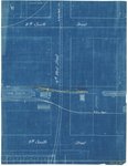
113 Denver and Rio Grand Railroad ; Detail of Fourth West between Eighth and Ninth South Railroad Crossings ; Salt Lake City, Utah1909-05-18Image
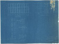
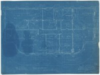
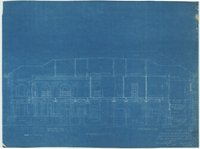
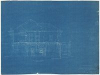
114 Denver and Rio Grande Western Railroad Company; Changes to Accomodate Superintendant's Offices ; Grand Junction Passenger Depot sheet 71939Image
115 Denver and Rio Grande Western Railroad Company; Changes to Accomodate Superintendant's Offices ; Grand Junction Passenger Depot sheet 51939Image
116 Denver and Rio Grande Western Railroad Company; Changes to Accomodate Superintendant's Offices ; Grand Junction Passenger Depot sheet 61939Image
117 Denver and Rio Grande Western Railroad Company; Changes to Accomodate Superintendant's Offices ; Grand Junction Passenger Depot sheet 11939Image
118 Denver and Rio Grande Western Railroad Company; Changes to Accomodate Superintendant's Offices ; Grand Junction Passenger Depot sheet 21939Image
119 Denver and Rio Grande Western Railroad Company; Changes to Accomodate Superintendant's Offices ; Grand Junction Passenger Depot sheet 31939Image
120 Denver and Rio Grande Western Railroad Company; Changes to Accomodate Superintendant's Offices ; Grand Junction Passenger Depot sheet 41939Image
121 Denver and Rio Grande Western Railroad Company ; 300,000 Gal. Water Treating Tank ; Details and Assembly ; Cedar City, Utah1942Image
122 Denver and Rio Grande Western Railroad Company ; Curve Record ; Main Line ; Salida Division ; Page 14Text
123 Denver and Rio Grande Western Railroad Company ; Curve Record ; Main Line ; Salida Division ; Page 15Text
124 Right of Way Map and Track Map ; Denver and Rio Grande Railroad ; Second Division; COLO. V-7-A 8; Sheet No. 8 of 241919Image
125 Right of Way Map and Track Map ; Denver and Rio Grande Railroad ; North Fork Branch; COLO. V-12-C 11; Sheet No. 11 of 111919; 1927Image
101 - 125 of 1,126