Home
Browse
Ask Us
Chat
Harmful Language Statement
Log in
Photo Archives
Advanced Search
About
Over 70,000 photos covering a variety of topics from Marriott Library Special Collections
Year
1995
TO
1995
Type
Image
84
Format
image/jpeg
84
Collection
Photo Archives
84
Filters:
Format:
"image/jpeg"
Collection Name:
"Utah Test and Training Range"
1
-
25
of
84
<
1
2
3
4
>
Gallery view
Number of results to display per page
10
25
50
100
200
Sort by Relevance
Sort by Title A-Z
Sort by Title Z-A
Sort by Date Ascending
Sort by Date Descending
Sort by Last Modified Ascending
Sort by Last Modified Descending
Title
Date
Type
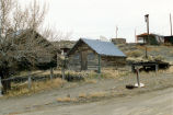
1
Abandoned buildings in Gold Hill, Utah (outside the UTTR)
1995-03-14
Image
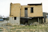
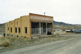
2
Abandoned store in Gold Hill, Utah (outside the UTTR)
1995-03-14
Image
3
Abandoned store in Gold Hill, Utah (outside the UTTR)
1995-03-14
Image
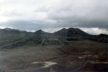
4
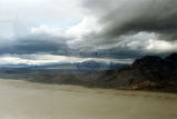
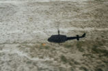
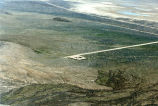
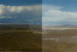
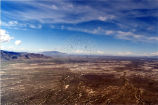
Aerial view inside UTTR
1995-03-14
Image
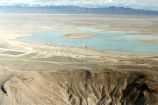
5
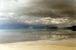
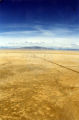
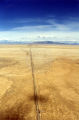
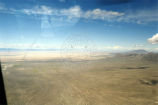
Aerial view of Bonneville Salt Flats
1995-03-14
Image
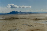
6
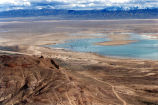
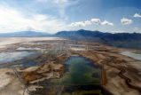
Aerial view of Great Salt Lake
1995-03-14
Image
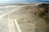
7
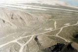
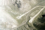
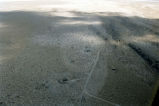
Aerial views of UTTR, including vehicles, fake villages and fake military installations that are used as targets.
1995-03-14
Image
8
Aerial views of UTTR, including vehicles, fake villages and fake military installations that are used as targets.
1995-03-14
Image
9
Aerial views of UTTR, including vehicles, fake villages and fake military installations that are used as targets.
1995-03-14
Image
10
Aerial views of UTTR, including vehicles, fake villages and fake military installations that are used as targets.
1995-03-14
Image
11
Aerial views of UTTR, including vehicles, fake villages and fake military installations that are used as targets.
1995-03-14
Image
12
Aerial views of UTTR, including vehicles, fake villages and fake military installations that are used as targets.
1995-03-14
Image
13
Aerial views of UTTR, including vehicles, fake villages and fake military installations that are used as targets.
1995-03-14
Image
14
Aerial views of UTTR, including vehicles, fake villages and fake military installations that are used as targets.
1995-03-14
Image
15
Aerial views of UTTR, including vehicles, fake villages and fake military installations that are used as targets.
1995-03-14
Image
16
Aerial views of UTTR, including vehicles, fake villages and fake military installations that are used as targets.
1995-03-14
Image
17
Aerial views of UTTR, including vehicles, fake villages and fake military installations that are used as targets.
1995-03-14
Image
18
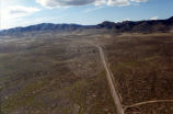
Aerial views of UTTR.
1995-03-14
Image
19
Aerial views of UTTR.
1995-03-14
Image
20
Aerial views of UTTR.
1995-03-14
Image
21
Aerial views of UTTR.
1995-03-14
Image
22
Aerial views of UTTR.
1995-03-14
Image
23
Aerial views of UTTR.
1995-03-14
Image
24
Aerial views of UTTR.
1995-03-14
Image
25
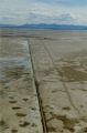
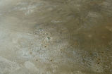
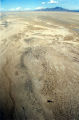
An ancient bed of river that drained into Lake Bonneville.
1995-03-14
Image
1
-
25
of
84
<
1
2
3
4
>