Home
Browse
Ask Us
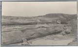
Chat
Harmful Language Statement
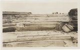
Log in
Advanced Search
Year
1872
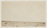
1873
1874
1875
1876
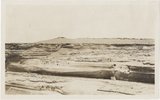
1877
1878
1879
1880
1881
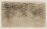
1882
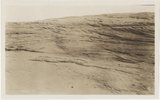
1883
1884
1885
1886
1887
1888
1889
1890
1891
1892
1893
1894
1895
1896
1897
1898
1899
1900
1901
1902
1903
1904
1905
1906
1907
1908
1909
1910
1911
1912
1913
1914
1915
1916
1917
1918
1919
1920
1921
1922
1923
1924
1925
1926
1927
1928
1929
1930
1931
1932
1933
1934
1935
1936
1937
1938
1939
1940
1941
1942
1943
1944
1945
1946
1947
1948
1949
1950
1951
1952
1953
1954
1955
1956
1957
1958
1959
1960
1961
1962
1963
1964
1965
1966
1967
1968
1969
1970
1971
1972
1973
1974
1975
1976
1977
1978
1979
1980
1981
1982
1983
1984
1985
1986
1987
1988
1989
1990
1991
1992
1993
TO
1872
1873
1874
1875
1876
1877
1878
1879
1880
1881
1882
1883
1884
1885
1886
1887
1888
1889
1890
1891
1892
1893
1894
1895
1896
1897
1898
1899
1900
1901
1902
1903
1904
1905
1906
1907
1908
1909
1910
1911
1912
1913
1914
1915
1916
1917
1918
1919
1920
1921
1922
1923
1924
1925
1926
1927
1928
1929
1930
1931
1932
1933
1934
1935
1936
1937
1938
1939
1940
1941
1942
1943
1944
1945
1946
1947
1948
1949
1950
1951
1952
1953
1954
1955
1956
1957
1958
1959
1960
1961
1962
1963
1964
1965
1966
1967
1968
1969
1970
1971
1972
1973
1974
1975
1976
1977
1978
1979
1980
1981
1982
1983
1984
1985
1986
1987
1988
1989
1990
1991
1992
1993
Type
Image
3,451
Image/StillImage
143
Format
image/jpeg
3,594
Collection
Photo Archives
3,451
UAIDA Main Collection
143
Filters:
Format:
"image/jpeg"
Collection Name:
"Herbert E. Gregory"
1
-
25
of
3,594
<
1
2
3
4
5
6
7
8
9
10
>
Gallery view
Number of results to display per page
10
25
50
100
200
Sort by Relevance
Sort by Title A-Z
Sort by Title Z-A
Sort by Date Ascending
Sort by Date Descending
Sort by Last Modified Ascending
Sort by Last Modified Descending
Title
Date
Type
Setname
1
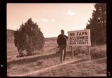
"No Japs allowed" sign, 1943
1943
Image
uum_map
2
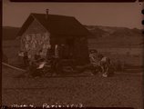
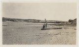
Paria Valley camp, 1943
1943
Image
uum_map
3
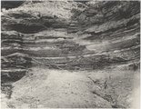
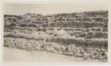
Gypsum seams near Holbrook E.C.Case, photo. (Moencopie)
1913
Image
uum_map
4
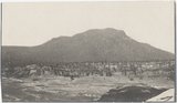
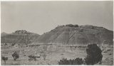
Baigaiche Mt. from "Beast" dike (Photo G388)
1913
Image
uum_map
5
Canyon de Chelly. Cross-bedding (III-9 just like this) (Photo G374)
1913
Image
uum_map
6
Canyon de Chelly. Shinarump capping Permian (Photo G373)
1913
Image
uum_map
7
Distant (10 mi.) view of Navaho Mt., southeast (Photo G368)
1913
Image
uum_map
8
Dunes filling Reservoir Canyon, Tuba (IV-8 in film book is also like this) (Photo G441)
1913
Image
uum_map
9
Flat between Little Colorado and Dolores cliff, Tolchaco. "Lake" shown is mirage (Photo G411)
1913
Image
uum_map
10
Grand Falls, Little Colorado (Photo N-M175)
1913
Image
uum_map
11
Grand Falls, panorama (Photos G415)
1913
Image
uum_map
12
Grand Falls, panorama (Photos G416)
1913
Image
uum_map
13
Gypsum in Permian. 2± mi. east of Holbrook (Photo G402)
1913
Image
uum_map
14
Peneplain; looking southeast from cliffs 5± mi. N 80 deg E, Black Falls (Photo N-M176 and G423)
1913
Image
uum_map
15
View from "Beast" dike north across Red Lake (Photo G391)
1913
Image
uum_map
16
View looking northeast up Black Creek from "Beast" dike (Photo G392)
1913
Image
uum_map
17
Waterhole in desert 1± mi. below Sunrise Spgs. (Photo G395)
1913
Image
uum_map
18
Wind carving Kaibab 2 mi. above Tolchaco (Photo G414)
1913
Image
uum_map
19
Wind erosion, La Plata, Tuba (Photo G435)
1913
Image
uum_map
20
Dolores Badlands 1 1/2 mile west of Nashlini. (I-5 & I-7 in film book just like this) (Photo N-M135)
1913
Image
uum_map
21
Same as 627 (LaPlata cross-bedding, Totocong, Photo G332)
1913
Image
uum_map
22
Totocong Spg., Chinlee valley, below Tsenakahn. LaPlata cross-bedding (Photo G331)
1913
Image
uum_map
23
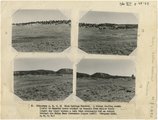
(Panorama A, B, C, D) Blue Springs Meadows. A stream leading south (left) to Mammoth Creek blocked by basalts from Miller Knoll (right sky line) became a lake that eventuallly cut an outlet through the Brian Head formation (upper left).
1944
Image
uum_map
24
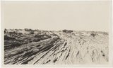
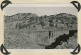
Alluvium valley fill trenched by stream since 1900. Lower Flood Canyon. Kane County, UT. 1943
1943
Image
uum_map
25
Basalt, head of Rock Creek. Old lava (foreground) and end of newer flow (center). Garfield County, UT, 1944
1944
Image
uum_map
1
-
25
of
3,594
<
1
2
3
4
5
6
7
8
9
10
>