Home
Browse
Ask Us
Chat
Harmful Language Statement
Log in
Advanced Search
Year
1905
1906
1907
1908
1909
1910
1911
1912
1913
1914
1915
1916
1917
1918
1919
1920
1921
1922
1923
1924
1925
1926
1927
1928
1929
1930
1931
1932
1933
1934
1935
1936
1937
1938
1939
1940
1941
1942
1943
1944
1945
1946
1947
1948
1949
1950
1951
1952
1953
1954
1955
1956
1957
1958
1959
1960
1961
1962
1963
1964
1965
1966
1967
1968
1969
1970
1971
1972
1973
1974
1975
1976
1977
1978
1979
1980
1981
1982
1983
1984
1985
1986
1987
1988
1989
1990
1991
1992
1993
1994
1995
1996
1997
1998
1999
2000
2001
2002
2003
2004
2005
2006
2007
2008
2009
2010
2011
2012
2013
2014
2015
2016
2017
2018
2019
2020
2021
2022
2023
2024
TO
1905
1906
1907
1908
1909
1910
1911
1912
1913
1914
1915
1916
1917
1918
1919
1920
1921
1922
1923
1924
1925
1926
1927
1928
1929
1930
1931
1932
1933
1934
1935
1936
1937
1938
1939
1940
1941
1942
1943
1944
1945
1946
1947
1948
1949
1950
1951
1952
1953
1954
1955
1956
1957
1958
1959
1960
1961
1962
1963
1964
1965
1966
1967
1968
1969
1970
1971
1972
1973
1974
1975
1976
1977
1978
1979
1980
1981
1982
1983
1984
1985
1986
1987
1988
1989
1990
1991
1992
1993
1994
1995
1996
1997
1998
1999
2000
2001
2002
2003
2004
2005
2006
2007
2008
2009
2010
2011
2012
2013
2014
2015
2016
2017
2018
2019
2020
2021
2022
2023
2024
Type
Text
233
Sound
6
Image/MovingImage
2
Image/StillImage
1
Format
application/pdf
435
Collection
American West Center Research Projects
5
Anthropological Papers
34
Athletics
4
Business Leaders Interviews
1
College of Law Publications
3
Continuum
1
Cycling Utah
22
Department of City and Metropolitan P...
3
Earl Douglass Papers
1
Electronic University Archive
32
Electronic University Archive (Restri...
1
Everett L. Cooley Oral History Project
10
Glen Canyon
1
Historic and Prehistoric Publications
97
Honors Theses Open Access
2
Institute for Clean and Secure Energy...
1
Intermountain Ski Instructors Associa...
4
Jacob Myers Sr. Papers, 1801-2009
1
Juanita Brooks Papers
3
Land Use - Transportation Scenario Pl...
1
Manuscripts
1
Marriott Library Digital Stacks
4
Mormon Settlement in Arizona
7
Network Magazine Records
1
Office of Undergraduate Research Library
1
Public Affairs of Health Sciences Center
1
Rare Books Collection
1
Rock Climbers Oral History Project
1
Sustainability U
1
Theses & Dissertations
36
UAIDA Main Collection
10
UScholar Works
6
University of Utah Press Open Access ...
2
Utah Historic Building Records
111
Utah Historic Building Reports
1
Utah Historical Society Oral History ...
3
Utah National Register Nomination Forms
1
Western Waters AZ. vs CA.
1
Western Waters Documents
2
Western Waters NEH
17
More
Filters:
Format:
"application/pdf"
1
-
25
of
435
<
1
2
3
4
5
6
7
8
9
10
>
Gallery view
Number of results to display per page
10
25
50
100
200
Sort by Relevance
Sort by Title A-Z
Sort by Title Z-A
Sort by Date Ascending
Sort by Date Descending
Sort by Last Modified Ascending
Sort by Last Modified Descending
Title
Date
Type
Setname
1
Land Allotments, White Mesa
Image/StillImage
uaida_main
2
Agreement of 1880
Text
uaida_main
3
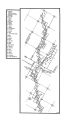
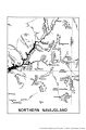
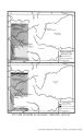
Map of Southern Utah, or Northern Navajoland
uaida_main
4
Map of United States Control of Ute Lands
uaida_main
5
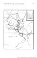
Map of Major Historical Trails of Southern Utah
uaida_main
6
Map of Ute Land Cessions in Colorado Territory, 1873-1876
uaida_main
7
Chapter V
uu_anthro
8
From R.H. Rutledge, District Forester to the Forester July 2, 1923
Text
uaida_main
9
Page 217
uum_manu
10
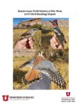
Bonderman Field Station at Rio Mesa 2019 Bird Banding Report
2019
Text
ir_su
11
page 064
wwdl_documents
12
Page 61
wwdl_neh
13
Chapter II
uu_anthro
14
page 12
uu_gc
15
bg_UHQ 1981 - VOL XLIX - no 3 - Book Notices
dha_hpp
16
Reconnaissance study of bituminous sandstone deposits, Trans*Dirty Devil, Wayne and Garfield Counties, Utah
1966-11
ir_eua
17
Pottery
uu_anthro
18
Chapter IV
uu_anthro
19
page 073
wwdl_documents
20
Energy resources map of Utah (no. 68)
1983-05
Text
ir_eua
21
Page 83
uaida_main
22
page vi
wwdl_azvca
23
131518
Text
dha_uhbr
24
AK_HX-10 Exhibit
wwdl_neh
25
Annual Report upon the Geographical and Geological Surveys and Explorations West of the 100th Meridian, in Nevada, Utah, Colorado, New Mexico, and Arizona - Page 160
uaida_main
1
-
25
of
435
<
1
2
3
4
5
6
7
8
9
10
>