Home
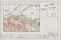
Browse
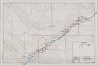
Ask Us
Chat
Harmful Language Statement
Log in
Advanced Search
Year
1885
1886
1887
1888
1889
1890
1891
1892
1893
1894
1895
1896
1897
1898
1899
1900
1901
1902
1903
1904
1905
1906
1907
1908
1909
1910
1911
1912
1913
1914
1915
1916
1917
1918
1919
1920
1921
1922
1923
1924
1925
1926
1927
1928
1929
1930
1931
1932
1933
1934
1935
1936
1937
1938
1939
1940
1941
1942
1943
1944
1945
1946
1947
1948
1949
1950
1951
1952
1953
1954
1955
1956
1957
1958
1959
1960
1961
1962
1963
1964
1965
1966
1967
1968
1969
1970
1971
1972
1973
1974
1975
1976
1977
1978
1979
1980
1981
1982
1983
1984
1985
1986
1987
1988
1989
1990
1991
1992
1993
1994
1995
1996
1997
1998
1999
2000
2001
2002
2003
2004
2005
2006
2007
2008
2009
2010
TO
1885
1886
1887
1888
1889
1890
1891
1892
1893
1894
1895
1896
1897
1898
1899
1900
1901
1902
1903
1904
1905
1906
1907
1908
1909
1910
1911
1912
1913
1914
1915
1916
1917
1918
1919
1920
1921
1922
1923
1924
1925
1926
1927
1928
1929
1930
1931
1932
1933
1934
1935
1936
1937
1938
1939
1940
1941
1942
1943
1944
1945
1946
1947
1948
1949
1950
1951
1952
1953
1954
1955
1956
1957
1958
1959
1960
1961
1962
1963
1964
1965
1966
1967
1968
1969
1970
1971
1972
1973
1974
1975
1976
1977
1978
1979
1980
1981
1982
1983
1984
1985
1986
1987
1988
1989
1990
1991
1992
1993
1994
1995
1996
1997
1998
1999
2000
2001
2002
2003
2004
2005
2006
2007
2008
2009
2010
Type
Image/StillImage
91
Text
1
Format
application/pdf
91
Institution
University of Utah Marriott Library
88
Uintah County Library
3
Collection
Photo Archives
66
Ski and Snow Sports Photo Archives
14
Superfund Records Center Records
7
Uintah County Regional History Center...
3
Western Federation of Watercolors Soc...
1
Filters:
Format:
"application/pdf"
Type:
"Image/StillImage"
1
-
25
of
91
<
1
2
3
4
>
Gallery view
Number of results to display per page
10
25
50
100
200
Sort by Relevance
Sort by Title A-Z
Sort by Title Z-A
Sort by Date Ascending
Sort by Date Descending
Sort by Last Modified Ascending
Sort by Last Modified Descending
Title
Date
Type
Setname
1
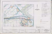
Proposed Mine Plan for the Tom Taylor Mine on the Little Emma Gilsonite Vein - Section 3, T10S, R24E, Uinta County, Utah
1997
Image/StillImage
ucl_maps
2
Uintah County Road 1997 RS2477
1997
Image/StillImage
ucl_maps
3
Vernal Area Map 1997
1997
Image/StillImage
ucl_maps
4
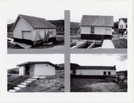
Chicken coop, May 1997
1997-05
Image/StillImage
uum_map
5
Coal shed and feed room, May 1997
1997-05
Image/StillImage
uum_map
6
Endangerment assessment for Herriman, Utah: residential soil-lead removal; Kennecott Utah Copper Corporation Butterfield Canyon site removal action work plan, Site ID#: R2
1997; 1998
Image/StillImage
uum_srcr
7
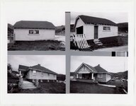
Garage, May 1997
1997-05
Image/StillImage
uum_map
8
Hatchery building, May 1997
1997-05
Image/StillImage
uum_map
9
Meat house, May 1997
1997-05
Image/StillImage
uum_map
10
Ponds, May 1997
1997-05
Image/StillImage
uum_map
11
Raceways, May 1997
1997-05
Image/StillImage
uum_map
12
Residence, May 1997
1997-05
Image/StillImage
uum_map
13
Scallywag's Used & Rare Books, Oct. 1997 [01]
1997-10
Image/StillImage
uum_map
14
Scallywag's Used & Rare Books, Oct. 1997 [02]
1997-10
Image/StillImage
uum_map
15
Scallywag's Used & Rare Books, Oct. 1997 [03]
1997-10
Image/StillImage
uum_map
16
Scallywag's Used & Rare Books, Oct. 1997 [04]
1997-10
Image/StillImage
uum_map
17
Scallywag's Used & Rare Books, Oct. 1997 [05]
1997-10
Image/StillImage
uum_map
18
Scallywag's Used & Rare Books, Oct. 1997 [06]
1997-10
Image/StillImage
uum_map
19
Kennecott property facilities removal action site maps [part two]
1992; 1996; 1997
Image/StillImage
uum_srcr
20
Watercolor southwest, 22nd
1997-10; 1997-11; 1998-12; 1998-01
Text; Image/StillImage
uum_wfws
21
Christmas card picturing Marie, left, and her twin sister Marillyn at Lincoln Center in New York City
1995; 1996; 1997; 1998
Image/StillImage
uum_map
22
Kennecott property facilities removal action site maps [part three]
1992; 1996; 1997; 1998
Image/StillImage
uum_srcr
23
Butterfield Creek, Herriman soil historical investigations, volume 2 [part 1]
1885; 1901; 1905; 1931; 1997
Image/StillImage
uum_srcr
24
Kennecott property facilities removal action site maps [part seven]
1994; 1995; 1997; 2001; 2002
Image/StillImage
uum_srcr
25
Kennecott property facilities removal action site maps [part four]
1934; 1936; 1987; 1996; 1997; 1998
Image/StillImage
uum_srcr
1
-
25
of
91
<
1
2
3
4
>