Home
Browse
Ask Us
Chat
Harmful Language Statement
Log in
Advanced Search
Year
1822
1823
1824
1825
1826
1827
1828
1829
1830
1831
1832
1833
1834
1835
1836
1837
1838
1839
1840
1841
1842
1843
1844
1845
1846
1847
1848
1849
1850
1851
1852
1853
1854
1855
1856
1857
1858
1859
1860
1861
1862
1863
1864
1865
1866
1867
1868
1869
1870
1871
1872
1873
1874
1875
1876
1877
1878
1879
1880
1881
1882
1883
1884
1885
1886
1887
1888
1889
1890
1891
1892
1893
1894
1895
1896
1897
1898
1899
1900
1901
1902
1903
1904
1905
1906
1907
1908
1909
1910
1911
1912
1913
1914
1915
1916
1917
1918
1919
1920
1921
1922
1923
1924
1925
1926
1927
1928
1929
1930
1931
1932
1933
1934
1935
1936
1937
1938
1939
1940
1941
1942
1943
1944
1945
1946
1947
1948
1949
1950
1951
1952
1953
1954
1955
1956
1957
1958
1959
1960
1961
1962
1963
1964
1965
1966
1967
1968
1969
1970
1971
1972
1973
1974
1975
1976
1977
1978
1979
1980
1981
1982
1983
1984
1985
1986
1987
1988
1989
1990
1991
1992
1993
1994
1995
1996
1997
1998
1999
2000
2001
2002
2003
2004
2005
2006
2007
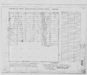
2008
2009
2010
2011
2012
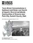
2013
2014
2015
2016
2017
2018
2019
2020
2021
2022
2023
2024
TO
1822
1823
1824
1825
1826
1827
1828
1829
1830
1831
1832
1833
1834
1835
1836
1837
1838
1839
1840
1841
1842
1843
1844
1845
1846
1847
1848
1849
1850
1851
1852
1853
1854
1855
1856
1857
1858
1859
1860
1861
1862
1863
1864
1865
1866
1867
1868
1869
1870
1871
1872
1873
1874
1875
1876
1877
1878
1879
1880
1881
1882
1883
1884
1885
1886
1887
1888
1889
1890
1891
1892
1893
1894
1895
1896
1897
1898
1899
1900
1901
1902
1903
1904
1905
1906
1907
1908
1909
1910
1911
1912
1913
1914
1915
1916
1917
1918
1919
1920
1921
1922
1923
1924
1925
1926
1927
1928
1929
1930
1931
1932
1933
1934
1935
1936
1937
1938
1939
1940
1941
1942
1943
1944
1945
1946
1947
1948
1949
1950
1951
1952
1953
1954
1955
1956
1957
1958
1959
1960
1961
1962
1963
1964
1965
1966
1967
1968
1969
1970
1971
1972
1973
1974
1975
1976
1977
1978
1979
1980
1981
1982
1983
1984
1985
1986
1987
1988
1989
1990
1991
1992
1993
1994
1995
1996
1997
1998
1999
2000
2001
2002
2003
2004
2005
2006
2007
2008
2009
2010
2011
2012
2013
2014
2015
2016
2017
2018
2019
2020
2021
2022
2023
2024
Type
Image/StillImage
125
Text
104
Image
14
Sound
10
Format
application/pdf
234
Collection
American Flame Research Committee
1
Frederick William Reynolds Lectures
1
Life Story Library collection
1
More Than A Flag: Utah State Flag Red...
7
Neighborhood Partners
8
Peoples of Utah Revisited
12
Regional History Center
1
UAIDA Main Collection
56
Uintah County Regional History Center...
115
Utah Historical Society Oral History ...
10
Utah State Constitution and Historica...
1
Water Wise Utah
15
Westminster College Institutional Rep...
6
More
Filters:
Format:
"application/pdf"
Subject:
"Utah"
Setname:
!(ir* OR ehsl*)
176
-
200
of
234
<
1
2
3
4
5
6
7
8
9
10
>
Gallery view
Number of results to display per page
10
25
50
100
200
Sort by Relevance
Sort by Title A-Z
Sort by Title Z-A
Sort by Date Ascending
Sort by Date Descending
Sort by Last Modified Ascending
Sort by Last Modified Descending
Title
Date
Type
Setname
176
Report on Conditions on Uinta Indian Reservation dtd September 24, 1912 - Part II
1912-09-24
Text
uaida_main
177
Reservation Map of Fort Duchesne, Utah, 1907
1907
Image/StillImage
ucl_maps
178
Roosevelt, Duchesne County, Utah - Sanborn Map Company - May 1917 Corrected July 1931 Plate 1
1931
Image/StillImage
ucl_maps
179
Roosevelt, Duchesne County, Utah - Sanborn Map Company - May 1917 Corrected July 1931 Plate 2
1931
Image/StillImage
ucl_maps
180
Roosevelt, Duchesne County, Utah - Sanborn Map Company - May 1917 plate 1
1917
Image/StillImage
ucl_maps
181
Roosevelt, Duchesne County, Utah - Sanborn Map Company - May 1917 plate 2
1917
Image/StillImage
ucl_maps
182
Salt Lake City five-year consolidated plan 2000-2005
2005
Text
uu_np
183
Second grade flag designs from Edith Bowden Laboratory School in Logan, Utah
2022-02-23
Image
dha_mtaf
184
Seepage study of Mapleton Lateral Canal near Mapleton, Utah, 2003
2004
Text
uu_wwu
185
Seepage study of McLeod Creek and East Canyon Creek near Park City, Summit County, Utah, 2004
2005
Text
uu_wwu
186
Selected hydrologic data for Sand Cove Wash, Washington County, Utah
2004
Text
uu_wwu
187
Shoshone Bannock/ Northwestern Soshone Reservations Geothermal Resource Map
2004-01-14
Image/StillImage
uaida_main
188
Social responses to difference: community based research in the Glendale Neighborhood of Salt Lake City, Utah
2005-05-25
Text
uu_np
189
State of Utah, Land Ownership and Public Management - 1973
1973
Image/StillImage
ucl_maps
190
State of Utah, Land Ownership and Public Management - 1974
1974
Image/StillImage
ucl_maps
191
Statement of Nannatcheav regarding killing of Indians in Colorado
1897-11-24
Text
uaida_main
192
Thank You Letter For Gift of Door Prize
2008-02-28
Text
dha_pour
193
Thomas Sasson Smith Diaries
1855; 1878
Text
uaida_main
194
Township 10 South, Range 25 East, of the Salt Lake Meridian, Utah - Dependent ReSurvey
1980
Image/StillImage
ucl_maps
195
Township No 2 South Range No 1 East of the Uintah Special Base & Meridian, Utah
1903; 1904; 1905
Image/StillImage
ucl_maps
196
Township No 2 South Range No 1 East of the Uintah Special Meridian 1875
1875
Image/StillImage
ucl_maps
197
Township No 2 South Range No 1 East of Uinta Special Meridian, Utah - Supplemental Plat
1913; 1914
Image/StillImage
ucl_maps
198
Township No 2 South Range No 2 East of the Uintah Special Meridian - The Strip 1890
1890; 1891
Image/StillImage
ucl_maps
199
Trace-metal concentrations in sediment and water and health of aquatic macroinvertebrate communities of streams near Park City, Summit County, Utah
2001
Text
uu_wwu
200
Uinta, Utah 1885
1885
Image/StillImage
ucl_maps
176
-
200
of
234
<
1
2
3
4
5
6
7
8
9
10
>