Over 70,000 photos covering a variety of topics from Marriott Library Special Collections
TO
1 - 25 of 18
| Title | Collection Number And Name | Photo Number | ||
|---|---|---|---|---|
| 1 |
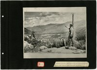 |
Wasatch Mountain Club photo album, Book 7 | P0004 Wasatch Mountain Club Photograph Collection | P0004n14_book |
| 2 |
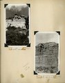 |
Herbert E. Gregory Book 11: Colorado Plateau, 1938-1942 | P0013 Herbert E. Gregory Photograph Collection | P0013n11 |
| 3 |
 |
Herbert E. Gregory Book 12: Colorado Plateau, Province, 1942-1944 | P0013 Herbert E. Gregory Photograph Collection | P0013n12 |
| 4 |
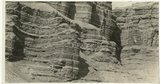 |
Cretaceous shales (tropic formation). Antimony Canyon, Garfield County, UT. 1943 | P0013 Herbert E. Gregory Photograph Collection | P0013n12_010_2854A |
| 5 |
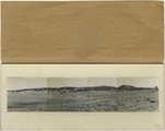 |
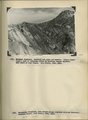
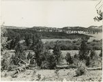
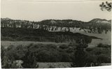
Panorama--4 photographs. Blue Springs meadows. A former valley leading to Mammoth Creek blocked by basalts from Miller Knoll (right skyline) became a lake that eventually cut an outlet northward through the Brian Head formation (upper left). Garfield County, UT, 1944 | P0013 Herbert E. Gregory Photograph Collection | P0013n12_068-069_pan |
| 6 |
 |
Brian Head formation, branch of Asay Creek; lies beneath basalt flows. Garfield County, UT, 1944 | P0013 Herbert E. Gregory Photograph Collection | P0013n12_072_2935 |
| 7 |
 |
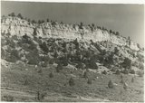
Sevier River formation overlaid by basalt near mouth of Corral Creek on Highway 89, 2 miles east of Panguitch. Garfield County, UT. 1944 | P0013 Herbert E. Gregory Photograph Collection | P0013n12_075_2940A |
| 8 |
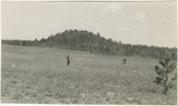 |
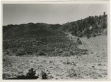
Bowers Knoll; Volcano viewed from northwest. Garfield County, UT. 1944 | P0013 Herbert E. Gregory Photograph Collection | P0013n12_076_2940B |
| 9 |
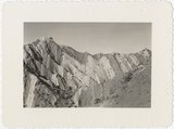 |
Ridge of uptilted strata | P0013 Herbert E. Gregory Photograph Collection | P0013n16_09_01 |
| 10 |
 |
Road and lava field, Rock Creek Valley, Utah | P0013 Herbert E. Gregory Photograph Collection | P0013n16_12_02 |
| 11 |
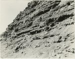 |
Rocky cliff near Hillsdale | P0013 Herbert E. Gregory Photograph Collection | P0013n16_12_03 |
| 12 |
 |
Lava, Black Rock Valley | P0013 Herbert E. Gregory Photograph Collection | P0013n16_12_04 |
| 13 |
 |
White rocks on road to Panquitch, Utah | P0013 Herbert E. Gregory Photograph Collection | P0013n16_12_09 |
| 14 |
 |
End of lava flow 6 miles long in Black Creek Valley | P0013 Herbert E. Gregory Photograph Collection | P0013n16_12_12 |
| 15 |
 |
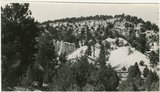
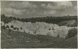
White cliffs along highway south of Asay Creek, Brian Head formation | P0013 Herbert E. Gregory Photograph Collection | P0013n16_12_13 |
| 16 |
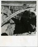 |
Bridge over Dirty Devil River | P0481 Bridges photograph collection | P0481n01_01_002 |
| 17 |
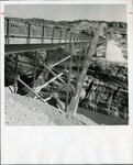 |
Bridge over Colorado River | P0481 Bridges photograph collection | P0481n01_01_003 |
| 18 |
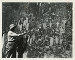 |
Angus Woodbury at Smith Fork petroglyphs | P1194 Everett Ruess Family Photograph Collection | P1194n01_08_023 |
1 - 25 of 18