|
|
Title | Date | Type |
| 1 |
 |
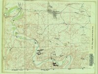
Alma Taylor Plateau Vegetation Management Project | 2005 | Image/StillImage |
| 2 |
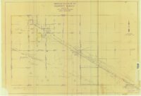 |
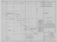
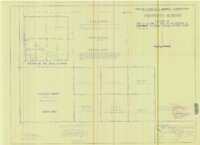
American Gilsonite Co Property Survey Located In Section 15 & 16, T9S R24E, Uintah County, Utah | 1974 | Image/StillImage |
| 3 |
 |
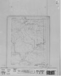
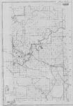
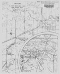
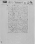
Ashley National Forest - Roosevelt and Duchesne Ranger Districts, Utah - Salt Lake and Uintah Meridians 1971 | 1971 | Image/StillImage |
| 4 |
 |
Ashley National Forest - Utah, Wyoming - Uintah, Salt Lake and Sixth Principal Meridians 1971 | 1971 | Image/StillImage |
| 5 |
 |
Ashley National Forest - Vernal Ranger District - September 2009 - ROD Selected Alternative | 2009 | Image/StillImage |
| 6 |
 |
Ashley National Forest Proposed Travel Alts (Alt. C) Vernal Ranger District April 2009 | 2009 | Image/StillImage |
| 7 |
 |
Ashley National Forest Travel Map - Flaming Gorge Ranger District 2005 | 2005 | Image/StillImage |
| 8 |
 |
Ashley National Forest Travel Map - Flaming Gorge, Vernal, Roosevelt, and Duchesne Ranger Districts 1971 | 1971 | Image/StillImage |
| 9 |
 |
Ashley National Forest Utah - Salt Lake and Uinta Special Meridians 1955 | 1955 | Image/StillImage |
| 10 |
 |
Ashley National Forest Utah and Wyoming - Roosevelt, Flaming Gorge, and Vernal Ranger Districts 1971 | 1971 | Image/StillImage |
| 11 |
 |
Ashley National Forest, Duchesne, Flaming Gorge, Roosevelt and Vernal Ranger Districts 1982 | 1982 | Image/StillImage |
| 12 |
 |
Ashley National Forest, Roosevelt and Duchesne Ranger Districts 1971 | 1971 | Image/StillImage |
| 13 |
 |
Ashley National Forest, Roosevelt, Flaming Gorge & Vernal Ranger Distrs. 1971. UT & WY | 1971 | Image/StillImage |
| 14 |
 |
Ashley National Forest, Utah and Wyoming - Salt Lake, Uinta Special, and Sixth Principal Meridians 1928 | 1928 | Image/StillImage |
| 15 |
 |
Ashley National Forest, Utah and Wyoming - Salt Lake, Uinta Special, and Sixth Principal Meridians 1933 | 1933 | Image/StillImage |
| 16 |
 |
Ashley National Forest, Utah, Salt Lake and Uinta Special Meridians. 1955 - reprint of 1945 edition | 1955 | Image/StillImage |
| 17 |
 |
Ashley Valley | 1977; 1978; 1979 | Image/StillImage |
| 18 |
 |
Ashley Valley 1907 Reconnaissance Map | 1907 | Image/StillImage |
| 19 |
 |
Ashley Valley Survey T5S R20 East SLM, 1880s | 1879; 1880; 1881; 1882; 1883; 1884; 1885; 1886; 1887; 1888; 1889 | Image/StillImage |
| 20 |
 |
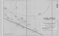
Ashley Valley Survey T5S R21E SLM 1880s | 1880; 1881; 1882; 1883; 1884; 1885; 1886; 1887; 1888; 1889 | Image/StillImage |
| 21 |
 |
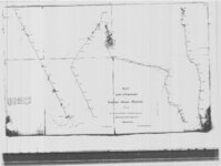
Ashley, Utah reprint edition of Dec. 1885 map | 1885 | Image/StillImage |
| 22 |
 |
Bennett and Leeton Map, Uintah County, Utah | | Image/StillImage |
| 23 |
 |
Black Ridge Gilsonite Mine - Profile View, Plot Plan, Topographical Profile View - February 1971 | 1971 | Image/StillImage |
| 24 |
 |
Bonanza - Rainbow Area Mine | 1973; 1980 | Image/StillImage |
| 25 |
 |
Bonanza Tap - Aerial Photo 2 Drawing No 10314 | | Image/StillImage |
| 26 |
 |
Bonanza Tap - Aerial Photo 2-A Drawing No 10316 | | Image/StillImage |
| 27 |
 |
Bonanza Tap - Aerial Photo 3-A Drawing No 10317 | | Image/StillImage |
| 28 |
 |
Bonanza Tap - Aerial Photo 4-A Drawing No 10318 | | Image/StillImage |
| 29 |
 |
Bonanza Tap - Aerial Photo Drawing No. 10313 | 1968 | Image/StillImage |
| 30 |
 |
Bonanza To Little Bonanza 1-A Drawing No. 10315 | | Image/StillImage |
| 31 |
 |
County And Township Map Of Utah And Nevada | 1884 | Image/StillImage |
| 32 |
 |
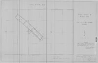
Cowboy #1 Detail of Shaft and Cross Section, 1994 | 1994 | Image/StillImage |
| 33 |
 |
Cowboy - Bandana Gilsonite Vein Plan View and Profile View, 1993 | 1993 | Image/StillImage |
| 34 |
 |
Cowboy Gilsonite Vein Section 33, T8S, R24E, S.L.B.&M. 1994 | 1994 | Image/StillImage |
| 35 |
 |
Cowboy Vein Shaft No 1 Horizontal & Vertical Deviation Plat, 1995 | 1995 | Image/StillImage |
| 36 |
 |
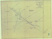
Cowboy Vein Vertical Hole 71-3 Geologic Section | 1975 | Image/StillImage |
| 37 |
 |
Diagram of Township Exteriors - Uintah Indian Reserve | 1875 | Image/StillImage |
| 38 |
 |
Dragon Area, R25E, Property Map | | Image/StillImage |
| 39 |
 |
Dry Fork (aka Mountain Dell or Hallsville) prepared by Oral Merkley & Liz Weist | | Image/StillImage |
| 40 |
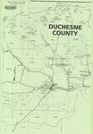 |
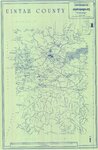
Duchesne County, Utah | | Image/StillImage |
| 41 |
 |
Duchesne, Duchesne County, Utah, Sanborn Map Company, April 1917 | 1917 | Image/StillImage |
| 42 |
 |
Duchesne, Duchesne County, Utah. Sanborn Map Co. April 1917. Corrected July 1931. | 1914; 1931 | Image/StillImage |
| 43 |
 |
East Tavaputs, Utah - Colorado. Reprint edition of Dec. 1885 Map | 1885 | Image/StillImage |
| 44 |
 |
Energy Project Sites, Uintah County 1980s | 1980; 1981; 1982; 1983; 1984; 1985; 1986; 1987; 1988; 1989 | Image/StillImage |
| 45 |
 |
Engineering Cross Section on the Rainbow & Pride-of-the-West Gilsonite Vein | 1978 | Image/StillImage |
| 46 |
 |
Fort Bridger, Original Survey | | Image/StillImage |
| 47 |
 |
Fort Thornburgh, Map of the road from Park City to Ft. Thornburgh. Sept. 1881 | 1881 | Image/StillImage |
| 48 |
 |
Fort Thornburgh, Proposed Reservation for Post | | Image/StillImage |
| 49 |
 |
General Highway Map - Uintah County, Utah No. 24 | | Image/StillImage |
| 50 |
 |
Geologic Cross Section of the Cowboy Gilsonite Vein (Hand Drawn) | 1960 | Image/StillImage |
| 51 |
 |
Gilsonite Map - Gusher Vein 1988 | 1988 | Image/StillImage |
| 52 |
 |
Gilsonite Properties - Bonanza Area 1979 | 1979 | Image/StillImage |
| 53 |
 |
Gilsonite Vein System - Geologic Map of the Ute Area | 1977 | Image/StillImage |
| 54 |
 |
Green River - Flaming Gorge National Recreation Area, Ashley National Forest | | Image/StillImage |
| 55 |
 |
H. Bert and Diana Jensen Home Directions | | Image/StillImage |
| 56 |
 |
Hardaway Load - Mineral Survey #5688 - 1907 | 1907 | Image/StillImage |
| 57 |
 |
Harris Lode - Mineral Survey #5689 - 1907 | 1907 | Image/StillImage |
| 58 |
 |
The Hastings Cutoff in Wyoming | | Image/StillImage |
| 59 |
 |
High Uintas Primitive Area, Wasatch and Ashley National Forests, Utah, Salt Lake and Uinta Special Meridians | 1980 | Image/StillImage |
| 60 |
 |
Independence Vein (Plat of Claim of Arthur W. Sweail; known as the Triumph & Cumberland Land) | | Image/StillImage |
| 61 |
 |
Independence Vein Drilling | 1976 | Image/StillImage |
| 62 |
 |
Independent & Bonanza Gilsonite Veins and the Cowboy Vein - Ziegler Chemical & Mineral Corp | 1996 | Image/StillImage |
| 63 |
 |
Independent Gilsonite Vein 1978-1979 - Engineering Cross Profile Northwest of West Boundary of Ziegler Property | 1979 | Image/StillImage |
| 64 |
 |
Independent Gilsonite Vein 1978-1979 - Engineering Cross Section Northwest to Southeast Independent North Vein | 1979 | Image/StillImage |
| 65 |
 |
Indian Reservation 1856 | 1856 | Image/StillImage |
| 66 |
 |
Indian Reservation, Uintah - Part of the Uncompahgre Indian Reservation | | Image/StillImage |
| 67 |
 |
It All Adds Up To Salt Lake (Tourist Attractions) | | Image/StillImage |
| 68 |
 |
Jensen, Utah - Colorado Edition of June 1910 | 1910 | Image/StillImage |
| 69 |
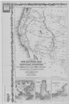 |
Johnson's New Military Map of the US (Western-half) Showing Forts, Military Posts and All Military Division, 1861 | 1861 | Image/StillImage |
| 70 |
 |
Lake Powell and Glen Canyon National Recreation Area | 1969 | Image/StillImage |
| 71 |
 |
Land Map for Pleasant Valley | 1981 | Image/StillImage |
| 72 |
 |
Lease & Structure Map Uintah Basin, Utah for Ziegler Chemical & Mineral Corp (Showing Leases & Lines of Strat Columns) | 1978 | Image/StillImage |
| 73 |
 |
Little Emma Vein - Plane Table Sheet (American Gilsonite, Uintah, Utah) | | Image/StillImage |
| 74 |
 |
Maeser, Plat Map 1935-1945 | 1935; 1936; 1937; 1938; 1939; 1940; 1941; 1942; 1943; 1944; 1945 | Image/StillImage |
| 75 |
 |
Map of Little Bonanza Gilsonite District | | Image/StillImage |
| 76 |
 |
Map of Utah Central Railway - 1890 | 1890 | Image/StillImage |
| 77 |
 |
Map of White River Gilsonite District | 1930 | Image/StillImage |
| 78 |
 |
Map Pages of the White River | | Image/StillImage |
| 79 |
 |
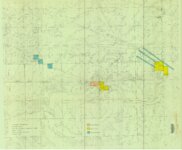
Map Showing Geologic Structure of Rainbow - Bonanza - Black Dragon Areas, Uintah County, Utah | 1978 | Image/StillImage |
| 80 |
 |
Marsh Peak Quad, Utah-Wyoming - Edition of June 1908 (USGS) | 1908 | Image/StillImage |
| 81 |
 |
Marsh Peak Quad, Utah-Wyoming 1905-1906 | 1905; 1906 | Image/StillImage |
| 82 |
 |
Marsh Peak, Utah-Wyoming Edition of June 1908 | 1908 | Image/StillImage |
| 83 |
 |
Massey Ranch and Massey Meadow - Hand Drawn | | Image/StillImage |
| 84 |
 |
Mexico, USGS, Bulletin 817, Plate 6, 1847 | 1847 | Image/StillImage |
| 85 |
 |
Myton, Duchesne County, Utah - Sanborn Map Company, April 1917 - Corrected July 1931 | 1931 | Image/StillImage |
| 86 |
 |
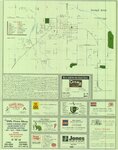
New Millennium 2001 - Utah Relocation Guide - Featuring The City of Vernal and Uintah County | 2001 | Image/StillImage |
| 87 |
 |
Oil & Gas Fields and Pipelines of Utah - Revised 1976 | 1976 | Image/StillImage |
| 88 |
 |
Oil and Gas Wells of Utah 1891-1948 | 1891; 1892; 1893; 1894; 1895; 1896; 1897; 1898; 1899; 1900; 1901; 1902; 1903; 1904; 1905; 1906; 1907; 1908; 1909; 1910; 1911; 1912; 1913; 1914; 1915; 1916; 1917; 1918; 1919; 1920; 1921; 1922; 1923; 1924; 1925; 1926; 1927; 1928; 1929; 1930; 1931; 1932; 1933; 1934; 1935; 1936; 1937; 1938; 1939; 1940; ... | Image/StillImage |
| 89 |
 |
Pariatte-Northwest Castle Peak Area (Ziegler Chemical & Mineral Corp) | | Image/StillImage |
| 90 |
 |
Pioneer Trails 1825-1849 | 1825; 1826; 1827; 1828; 1829; 1830; 1931; 1832; 1833; 1834; 1835; 1836; 1837; 1838; 1839; 1840; 1841; 1842; 1843; 1844; 1845; 1846; 1847; 1848; 1849 | Image/StillImage |
| 91 |
 |
Pony Express Needles Station Camp Floyd | | Image/StillImage |
| 92 |
 |
Pony Express Route - April 3, 1860 to October 24, 1861 | 1860; 1861; 1960 | Image/StillImage |
| 93 |
 |
Pony Express Stations Deep Creek | | Image/StillImage |
| 94 |
 |
Pony Express Stations in Utah - April 3, 1860 - October 24, 1861 | 1860; 1861 | Image/StillImage |
| 95 |
 |
Price River, Utah 1886 | 1886 | Image/StillImage |
| 96 |
 |
Profile Map of the Country Boy Mine (copy of original) | | Image/StillImage |
| 97 |
 |
Property Survey - Ziegler Chemical & Mineral Corp | 2000 | Image/StillImage |
| 98 |
 |
Property Survey of the MS 5688 Hardaway & MS 5689 Harris Mining Claims - Ziegler Chemical & Mineral Corp | 2000 | Image/StillImage |
| 99 |
 |
Proposed Mine Plan for the Tom Taylor Mine on the Little Emma Gilsonite Vein - Section 3, T10S, R24E, Uinta County, Utah | 1997 | Image/StillImage |
| 100 |
 |
Railroads in Utah 1896 | 1896 | Image/StillImage |
| 101 |
 |
Reservation Map of Fort Duchesne, Utah, 1907 | 1907 | Image/StillImage |
| 102 |
 |
Roosevelt, Duchesne County, Utah - Sanborn Map Company - May 1917 Corrected July 1931 Plate 1 | 1931 | Image/StillImage |
| 103 |
 |
Roosevelt, Duchesne County, Utah - Sanborn Map Company - May 1917 Corrected July 1931 Plate 2 | 1931 | Image/StillImage |
| 104 |
 |
Roosevelt, Duchesne County, Utah - Sanborn Map Company - May 1917 plate 1 | 1917 | Image/StillImage |
| 105 |
 |
Roosevelt, Duchesne County, Utah - Sanborn Map Company - May 1917 plate 2 | 1917 | Image/StillImage |
| 106 |
 |
Route of the Mormon Pioneers from Nauvoo to the Great Salt Lake, July 1847 | 1847 | Image/StillImage |
| 107 |
 |
Sketch of Camp Douglas | 1864 | Image/StillImage |
| 108 |
 |
State of Utah, Land Ownership and Public Management - 1973 | 1973 | Image/StillImage |
| 109 |
 |
State of Utah, Land Ownership and Public Management - 1974 | 1974 | Image/StillImage |
| 110 |
 |
Township 10 South, Range 25 East, of the Salt Lake Meridian, Utah - Dependent ReSurvey | 1980 | Image/StillImage |
| 111 |
 |
Township No 2 South Range No 1 East of the Uintah Special Base & Meridian, Utah | 1903; 1904; 1905 | Image/StillImage |
| 112 |
 |
Township No 2 South Range No 1 East of the Uintah Special Meridian 1875 | 1875 | Image/StillImage |
| 113 |
 |
Township No 2 South Range No 1 East of Uinta Special Meridian, Utah - Supplemental Plat | 1913; 1914 | Image/StillImage |
| 114 |
 |
Township No 2 South Range No 1 West of the Uintah Special Meridian - 1875 | 1875 | Image/StillImage |
| 115 |
 |
Township No 2 South Range No 2 East of the Uintah Special Meridian - 1875 | 1875 | Image/StillImage |
| 116 |
 |
Township No 2 South Range No 2 East of the Uintah Special Meridian - The Strip 1890 | 1890; 1891 | Image/StillImage |
| 117 |
 |
Trout Slope Landscape Assessment - Vernal Ranger District | | Image/StillImage |
| 118 |
 |
U.S. Indian Irrigation Service, Uintah Irrigation Project, Uintah Mountains | 1919 | Image/StillImage |
| 119 |
 |
Uinta Basin and Adjacent Areas - 1986 | 1986 | Image/StillImage |
| 120 |
 |
Uinta, Utah 1885 | 1885 | Image/StillImage |
| 121 |
 |
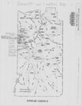
Uintah And Grand Counties 1901 | 1901 | Image/StillImage |
| 122 |
 |
Uintah County Building Blue Prints 1984 | 1984 | Image/StillImage |
| 123 |
 |
Uintah County Library Alterations 1984 | 1984 | Image/StillImage |
| 124 |
 |
Uintah County Road 1997 RS2477 | 1997 | Image/StillImage |
| 125 |
 |
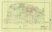
Uintah County School Districts 1900 | 1906; 1907; 1908; 1909; 1910; 1911; 1912; 1913; 1914; 1915; 1916; 1917; 1918; 1919; 1920; 1921; 1922; 1923; 1924; 1925; 1926; 1927; 1928; 1929; 1930; 1931; 1932; 1933; 1934; 1935; 1936; 1937; 1938; 1939; 1940 | Image/StillImage |
| 126 |
 |
Uintah County Sectional Map | | Image/StillImage |
| 127 |
 |
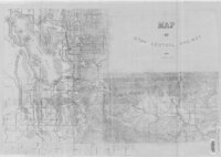
Uintah County Transportation Travel Atlas 2008 | 2008 | Image/StillImage |
| 128 |
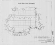 |
Uintah Indian Reservation Boundary | 1875; 1882; 1903; 1949 | Image/StillImage |
| 129 |
 |
Uintah Indian Reserve, Northeast Boundary - Sept. 1875 | 1875 | Image/StillImage |
| 130 |
 |
Uintah Indian Reserve, Utah, North-East Boundary - 1875 | 1875 | Image/StillImage |
| 131 |
 |
United States and Texas, Mexico, and Guatemala - 1839 | 1839 | Image/StillImage |
| 132 |
 |
Unorganized Mining District, Uinta County (7 Separate Claims) | 1922; 1923 | Image/StillImage |
| 133 |
 |
Unorganized Mining District, Uintah County (29 Separate Claims) | 1905 | Image/StillImage |
| 134 |
 |
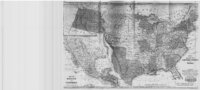
Utah Map | 1861; 1862 | Image/StillImage |
| 135 |
 |
Utah Map of State Roads - State Road Commission 1915 - 1916 | 1915; 1916 | Image/StillImage |
| 136 |
 |
Ute 1, 2, & 3 Mining Claims - Ziegler Chemical & Mineral Corp | 1971 | Image/StillImage |
| 137 |
 |
Vernal Area Map 1997 | 1997 | Image/StillImage |
| 138 |
 |
West from Fort Bridger, Pioneer Trails Across Utah 1846-1850 | 1846; 1947; 1948; 1849; 1850 | Image/StillImage |
| 139 |
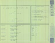 |
Western Park Museum Blue Prints 1990 | 1990 | Image/StillImage |
| 140 |
 |
Workman Gilsonite Mine - Mesa Chemical Company | 1972 | Image/StillImage |
| 141 |
 |
Ziegler Chemical & Mineral Corp Claim Map | 1995 | Image/StillImage |
| 142 |
 |
Ziegler Chemical & Mineral Corporation Property Survey Located In Section 15, T9S, R24E, Uintah County, Utah | 1996 | Image/StillImage |
| 143 |
 |
Ziegler Chemical Inventory Unit Mining Claims - May 21, 1999 | 1999 | Image/StillImage |
| 144 |
 |
Ziegler Chemical Inventory Unit Mining Claims - May 24, 1999 | 1999 | Image/StillImage |
| 145 |
 |
Ziegler Chemical Road Right Of Way On U.S.A. (B.L.M.) Land | 1978 | Image/StillImage |