Home
Browse
Ask Us
Chat
Harmful Language Statement
Log in
Theses & Dissertations
Advanced Search
Year
1953
1954
1955
1956
1957
1958
1959
1960
1961
1962
1963
1964
1965
1966
1967
1968
1969
1970
1971
1972
1973
1974
1975
1976
1977
1978
1979
1980
1981
1982
1983
1984
1985
1986
1987
1988
1989
1990
1991
1992
1993
1994
1995
1996
1997
1998
1999
2000
2001
2002
2003
2004
2005
2006
2007
2008
2009
2010
2011
TO
1953
1954
1955
1956
1957
1958
1959
1960
1961
1962
1963
1964
1965
1966
1967
1968
1969
1970
1971
1972
1973
1974
1975
1976
1977
1978
1979
1980
1981
1982
1983
1984
1985
1986
1987
1988
1989
1990
1991
1992
1993
1994
1995
1996
1997
1998
1999
2000
2001
2002
2003
2004
2005
2006
2007
2008
2009
2010
2011
Publication Type
thesis
42
map
3
School Or College
College of Mines & Earth Sciences
34
College of Architecture + Planning
10
College of Social & Behavioral Science
1
Department
Geology & Geophysics
24
Architecture
10
Materials Science & Engineering
5
Mining Engineering
5
Geography
1
Subject
Designs
1
Geology
1
Geology -- Structural -- Utah -- Willard Peak area
1
Geology -- Utah -- Box Elder County
1
Geology -- Utah -- Kane County -- Paria Northwest quadrangle
1
Geology -- Utah -- Silver Island Mountains
1
Geology--Utah
1
Geology: Stratigraphic-Paleozoic
1
Kenya
1
Lothidok Range
1
Mines and mineral resources-Beaver County
1
Natural gas
1
Petrology -- Utah -- Wasatch Mountains
1
Plans
1
Recreation centers
1
Stratigraphic geology
1
Stratigraphic-Mesozoic
1
Upton area
1
Utah
1
Utah-Star Range
1
geology
1
More
Filters:
Format:
"application/pdf"
Collection:
"ir_etd"
Type:
"Image"
1
-
25
of
45
<
1
2
>
Gallery view
Number of results to display per page
10
25
50
100
200
Sort by Relevance
Sort by Title A-Z
Sort by Title Z-A
Sort by Date Ascending
Sort by Date Descending
Sort by Last Modified Ascending
Sort by Last Modified Descending
Date
Author
Title
Department
Publication Type
1
1953-06
Stark, Norman Paul
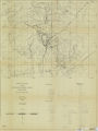
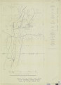
Areal geology of the Upton region, Summit County, Utah-Maps
Geology & Geophysics
thesis
2
2011
Metcalf, Matt
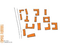
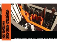
Campus planning: axes, vistas and organizational views
Architecture
thesis
3
1960-08
Rodriguez, Enrique Levy
Economic geology of the sulphur deposits at Sulphurdale, Utah-Maps
Mining Engineering
thesis
4
2011
Carter, Eric Jeffery
Final graduate design studio
Architecture
thesis
5
2011
Arrington, Josh
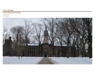
Final Studio: Princeton University
Architecture
thesis
6
1959-06
Baker, Walker Holcombe
Geologic setting and origin of the Grouse Creek pluton, Box Elder County, Utah-Maps
Materials Science & Engineering
thesis
7
1960-08
Blue, Donald McCoy
Geology and ore deposits of the lucin mining district, Box Elder County, Utah, and Elko County, Nevada-Maps
Materials Science & Engineering
thesis
8
1961-06
Schaeffer, Frederick Ernst Jr.
Geology of the Central and Southern silver Island Mountains Tooele County, Utah and Elko County, Nevada-Maps
Geology & Geophysics
thesis
9
1970-08
Blakey, Ronald Clyde
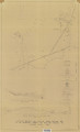
Geology of the Paria Northwest quadrangle Kane County, Utah-Maps
Geology & Geophysics
thesis
10
1964-06
Stifel, Peter Beekman
Geology of the Terrace and Hogup Mountains, Box Elder County, Utah (Maps)
Geology & Geophysics
map
11
2011
Nye, Matthew
Graduate student housing-Princeton
Architecture
thesis
12
2011
Wright, Heather
Not for sale: human trafficking awareness center, New York City highline
Architecture
thesis
13
2011
Soto, Melina
NYC highline hip hop center
Architecture
thesis
14
1969-06
Dalness, William Michael
Parunuweap formation in the vicinity of Zion National Park, Utah-Maps
Geology & Geophysics
thesis
15
1962-11
Neff, Thomas Rodney
Petrology and structure of the Little Willow Series, Wasatch Mountains, Utah-Maps
Geology & Geophysics
thesis
16
1960-08
Rodriguez, Enrique Levy
Plate 1: Geologic map and vertical cross section of the Sulphurdale sulphur deposits, Beaver and Millard Counties, Utah
Mining Engineering
thesis
17
1962-11
Neff, Thomas Rodney
Plate 1: Geologic map of the Little Willow Series, Wasatch Mountains, Utah
Geology & Geophysics
thesis
18
1988-08
Boschetto, Harold Bradley
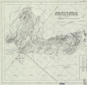
Plate 1: Geologic map of the Lothidok Range, Kenya
Geology & Geophysics
map
19
1970-08
Blakey, Ronald Clyde
Plate 1: Geologic map of the Paria NW quadrangle, Kane County, Utah
Geology & Geophysics
thesis
20
1972-12
Sadeghi, Ali Reza
Plate 1: Geologic map of the Willard Peak area, North-Central Wasatch Mountains, Utah
Geology & Geophysics
thesis
21
1961-06
Schaeffer, Frederick Ernst Jr.
Plate 1B: Geologic map of the Central and Southern Silver Island Mountains, Box Elder and Tooele Counties, Utah, and Elko County, Nevada
Geology & Geophysics
thesis
22
1961-06
Schaeffer, Frederick Ernst Jr.
Plate 1C: Geologic cross sections of the Central and Southern Silver Island Mountains, Box Elder and Tooele Counties, Utah and Elko County, Nevada
Geology & Geophysics
thesis
23
1959-06
Baker, Walker Holcombe
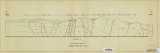
Plate 2: Cross-section A-A'
Materials Science & Engineering
thesis
24
1960-08
Rodriguez, Enrique Levy
Plate 2: Detailed geologic and vertical cross sections map of the Excelsior Orebody and New York Prospect Pit, Millard County, Utah
Mining Engineering
thesis
25
1962-11
Neff, Thomas Rodney
Plate 2: Sections along line A-A' and B-B'
Geology & Geophysics
thesis
1
-
25
of
45
<
1
2
>