Home
Browse
Ask Us
Chat
Harmful Language Statement
Log in
Theses & Dissertations
Advanced Search
Year
1954
1955
1956
1957
1958
1959
1960
1961
1962
1963
1964
1965
1966
1967
1968
1969
1970
1971
1972
1973
1974
1975
1976
1977
1978
1979
1980
1981
1982
1983
1984
1985
1986
1987
1988
1989
1990
1991
1992
1993
1994
1995
1996
1997
1998
1999
2000
2001
2002
2003
2004
2005
2006
2007
2008
2009
2010
2011
2012
2013
2014
2015
2016
2017
2018
TO
1954
1955
1956
1957
1958
1959
1960
1961
1962
1963
1964
1965
1966
1967
1968
1969
1970
1971
1972
1973
1974
1975
1976
1977
1978
1979
1980
1981
1982
1983
1984
1985
1986
1987
1988
1989
1990
1991
1992
1993
1994
1995
1996
1997
1998
1999
2000
2001
2002
2003
2004
2005
2006
2007
2008
2009
2010
2011
2012
2013
2014
2015
2016
2017
2018
School Or College
College of Mines & Earth Sciences
25
Department
Materials Science & Engineering
25
Publication Type
thesis
17
dissertation
6
honors thesis
1
map
1
Subject
Geology
4
Utah
4
Crystalline
3
Geology -- Utah -- Beaver County
3
Granite
3
Metamorphic
3
Millard County
3
Mineral Range (Utah)
3
Mount Ogden
3
Petrology -- Utah -- Beaver County
3
Precambrian
3
Rocks
3
Stratigraphic
3
Thesis and dissertation georeferencing project
2
Thesis and dissertation georeferencing project
2
Adhesive
1
Beaver County
1
Beaver County Utah
1
Biomimetic
1
Calcium phosphate
1
Carbon nanotubes
1
Complex coacervate
1
Fetoscopic defects
1
Geology -- Nevada
1
Geology -- Utah
1
Geology--Utah
1
Grapene
1
Lithium ion battery
1
Materials science
1
Mineralogy
1
Mines and mineral resources
1
Mining
1
Molecular dynamics
1
Nanoemulsion
1
Nanotechnology
1
Nevada
1
Ore deposits
1
Ore deposits -- Nevada
1
Ore deposits -- Utah
1
Oxygen carrier
1
Rashba states
1
Sandcastle worm
1
Self assembly
1
Simulations
1
Soft tissue adhesive
1
Solid state electrolyte
1
Soy lecithin
1
Spin injection
1
Spintronics
1
Supercapacitor
1
Surface coating
1
Ternary phase diagram
1
White Pine County
1
White Pine County, Nevada
1
diffusion and defect
1
spin caloritronics
1
spin transport
1
substrate charge doping
1
topological insulator
1
More
Filters:
Department:
"Materials Science & Engineering"
School Or College:
"College of Mines & Earth Sciences"
Collection:
ir_etd
1
-
25
of
25
Gallery view
Number of results to display per page
10
25
50
100
200
Sort by Relevance
Sort by Title A-Z
Sort by Title Z-A
Sort by Date Ascending
Sort by Date Descending
Sort by Last Modified Ascending
Sort by Last Modified Descending
Title
Setname
Type
1
A crystal chemical classification of the chlorite minerals
ir_etd
Text
2
A molecular dynamics study of effect of polyethylene oxide architecture on self-assembly of carbon nanotubes
ir_etd
Text
3
Adhesive complex coacervate inspired by the sandcastle worm as a sealant for fetoscopic defects
ir_etd
Text
4
Advanced materials and concepts for energy storage devices
ir_etd
Text
5
Advanced materials and concepts for spintronics, 2D electronics, and biosensors
ir_etd
Text
6
Advanced materials and methods for next generation spintronics
ir_etd
Text
7
Atomistic simulation of charge effects: from tunable thin film growth to isolation of surface states with spin-orbit coupling
ir_etd
Text
8
The calcium phosphate coating of soy lecithin nanoemulsion with performance in stability and as an oxygen carrier
ir_etd
Text
9
Geologic map and sections of the Cherry Creek District, Nevada
ir_etd
10
Geologic setting and origin of the Grouse Creek pluton, Box Elder County, Utah-Maps
ir_etd
Image
11
Geology and mineralogy of the Milford Flat Quadrangle and the Old Moscow Mine Star District, Beaver County, Utah
ir_etd
Text
12
Geology and ore deposits of the lucin mining district, Box Elder County, Utah, and Elko County, Nevada
ir_etd
Text
13
Geology and ore deposits of the lucin mining district, Box Elder County, Utah, and Elko County, Nevada-Maps
ir_etd
Image
14
Geology and ore deposits of the Rebel Mine area Beaver County, Utah
ir_etd
Text
15
Geology of the Cherry Creek Districk, Nevada
ir_etd
Text
16
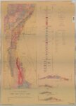
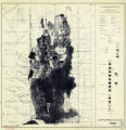
Map 1 Geologic map of the Mineral Range, Utah (Google Earth map overlay KMZ file)
ir_etd
Image
17
Mount Ogden granite (Thesis and maps)
ir_etd
Text; Image
18
Mount Ogden granite: Georeferenced map files
ir_etd
Image
19
Petrogeneis of the Mineral Range Pluton, Southwestern Utah
ir_etd
Text; Image
20
Petrogeneis of the Mineral Range Pluton, Southwestern Utah: Georeferenced map files
ir_etd
Image
21
Plate 1: Lucin mining district and vicinity, Northern Pilot Range, Box Elder County, Utah - Elko County, Nevada (Google Earth map overlay KMZ file)
ir_etd
Image
22
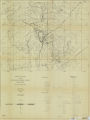
Plate 2: Cross-section A-A'
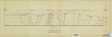
ir_etd
Image
23
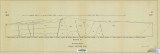
Plate 3: Cross-section B-B'
ir_etd
Image
24
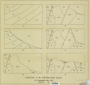
Plate 4: Evolution of the eastern fault block
ir_etd
Image
25
Plates 2-3 Geologic map of the Mount Ogden granite, Weber County, Utah and Geologic sections to accompany the Geologic map of the Mount Ogden granite, Weber County, Utah (Google Earth map overlay KMZ file)
ir_etd
Image
1
-
25
of
25