|
|
Author | Title | Subject | Date | Publication Type |
| 226 |
 | Stouffer, Stephen Gerald | Landslides in the Coal Hill area, Kane County, Utah: Georeferenced map files | Landslides -- Utah -- Kane County; Geology -- Utah -- Kane County | 1964-06 | thesis |
| 227 |
 | Xue, Yanwei | Least squares datuming and surface waves prediction with interferometry | Geophysics | 2010 | dissertation |
| 228 |
 | Good, Thomas Roger | Life in an ancient sea of sand: trace fossil associations and their paleoecological implications in the Upper Triassic/Lower Jurassic Nugget Sandstone, Northeastern Utah | Entradichnus; Fossils; Ichnology; Nugget; Sandstone; Trace | 2013-12 | thesis |
| 229 |
 | Gammans, Christine Naomi Louise | Low-angle normal faulting in the basin and range-Colorado plateau transition zone during the January 3, 2011 circleville, UT earthquake sequence | Low-angle normal faulting | 2013-08 | thesis |
| 230 |
 | Morris, Elliot Cobia | Map 1 Geologic map and sections of Big Piney Area, Utah (Google Earth map overlay KMZ file) | Geology -- Utah -- Summit County | 1953-06 | thesis |
| 231 |
 | Moussa, Mounir Tawfik | Map 1 Geologic map of the Soldier Summit Quadrangle, Utah (Google Earth map overlay KMZ file) | Geology; Utah; Utah County; Carbon County; Wasatch County | 1965-06 | thesis |
| 232 |
 | Eriksson, Yves | Map 1 Geology of the upper Ogden Canyon, Weber County, Utah (Google Earth map overlay KMZ file) | Geology -- Utah -- Weber County; Thesis and dissertation georeferencing project | 1960-06 | thesis |
| 233 |
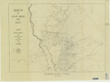 | Amin, Surendra R. | Map 1: Geologic map of Antelope intrusive and vicinity | | 1950 | thesis |
| 234 |
 | Amin, Surendra R. | Map 1: Geologic map of Antelope intrusive and vicinity (Google Earth map overlay KMZ file) | Thesis and dissertation georeferencing project | 1950 | map |
| 235 |
 | Paddock, Robert Edwards | Map1 Geologic map and sections of Newfoundland Mountains, Box Elder County, Utah (Google Earth map overlay KMZ file) | Geology; Utah; Newfoundland Mountains; Box Elder County; Thesis and dissertation georeferencing project | 1956-12 | thesis |
| 236 |
 | Root, Robert L. | Map1 Geologic map and sections of Smith and Morehouse-Hayden Fork area, Utah (Google Earth map overlay KMZ file) | Geology; Utah; Summit County; Thesis and dissertation georeferencing project | 1952 | thesis |
| 237 |
 | Cotton, Michelle Marie | Mapping subglacial geomorphology and structure in a collisional orogen: an example from the Malaspina Glacier, Alaska | Alaska; Feature tracking; Glaciology; Malapsina Glacier; Saint Elias Mountians; Subglacial geomorphology; Subglacial structure; Collisional orogen | 2011-12 | thesis |
| 238 |
 | Manangon, Lucia Eliana | Mass recoveries in nano to microparticle analysis of environmental samples via flow field flow fractionation-inductively-coupled plasma mass spectometry | Field flow fractionation; ICP-MS; Microparticles; Nanoparticles | 2013-08 | thesis |
| 239 |
 | Putman, Annie L. | Meta-Analytic approaches to learn about hydroclimatic processes and change from stable isotopes | | 2019 | dissertation |
| 240 |
 | Loury, Patrick C. | Metamorphism and fluid-rock interaction in the alta, Utah contact aureole: identification of forsterite reaction pathways, evaluation of reaction overstepping, and trace element characterization | Alta Stock; Metamorphism; Mineral Exploration; Oxygen Isotopes; Trace Elements | 2015-08 | thesis |
| 241 |
 | Black, Brooks M. & Swanson, Neil P. | Methyl mercury hotsports and sources in the Great Salt Lake, Utah, Adjacent freshwater bays and impounded wetlands | Great Salt Lake; Methylation; Methyl Mercury; Wetlands | 2013-12 | thesis |
| 242 |
 | Adiya, Tsolmon | Microbial-caddisfly bioherm association of the lower cretaceous shinekhudag formation, mongolia | bioherm; caddisfly; carbonate; lacustrine; microbialite; Geology | 2017 | thesis |
| 243 |
 | Cai, Hongzhu | Migration and inversion of magnetic and magnetic gradiometry data | 3-D focusing inversion; Integral transformation; Magnetic gradiometry; Potential field migration; Smooth inversion; Topography | 2012-05 | thesis |
| 244 |
 | Liu, Shengdong | Migration and tomographic imaging of colluvial wedges and faults over the Washington Fault, Arizona | Colluvial wedges; Migration; Tomographic imaging; Washington fault | 2015-12 | thesis |
| 245 |
 | Thomson, Kenneth Clair | Mineral deposits of the Deep Creek Mountains, Tooele and Juab Counties, Utah (Google Earth map overlay KMZ file) | Mines and mineral resources -- Utah -- Deep Creek Mountains | 1970-08 | map |
| 246 |
 | Thomson, Kenneth Clair | Mineral deposits of the Deep Creek Mountains, Tooele and Juab Counties, Utah (Thesis and maps) | Mines and mineral resources -- Utah -- Deep Creek Mountains | 1970-08 | thesis |
| 247 |
 | Thomson, Kenneth Clair | Mineral deposits of the Deep Creek Mountains, Tooele and Juab Counties, Utah: Georeferenced map files | Mines and mineral resources -- Utah -- Deep Creek Mountains | 1970-08 | thesis |
| 248 |
 | Hynek, Scott Anthony | Mio-Pliocene geology of the Southern Puna Plateau Margin, Argentina | C4; Geochronology; Paleoecology; Puna; South America; Tephrostratigraphy | 2011-08 | dissertation |
| 249 |
 | Rijo, Luiz | Modeling of Electric and Electromagnetic Data | | 1977 | dissertation |
| 250 |
 | Wang, Xin | Multisource crosstalk reduction and plane-wave least-squares kirchhoff migration | Crosstalk; Kirchhoff; Least-squares; Migration; Multisource; Plane-wave | 2014-08 | dissertation |