| | Title | Date | Type | Setname |
|---|
| 151 |  | Boating past Bert Loper's Homestead. | 1957; 1958; 1959; 1960; 1961; 1962 | | uum_map_rr |
| 152 |  | Boats in last rapid on Colorado | 1957; 1958; 1959; 1960; 1961; 1962 | | uum_map_rr |
| 153 | 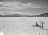 | The Bonneville Salt Flats Raceway circa 1940s-1950s. | 1940; 1941; 1942; 1943; 1944; 1945; 1946; 1947; 1948; 1949; 1950; 1951; 1952; 1953; 1954; 1955; 1956; 1957; 1958; 1959 | Image | uum_map |
| 154 | 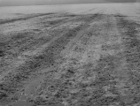 | The Bonneville Salt Flats Raceway circa 1940s-1950s. [1] | 1940; 1941; 1942; 1943; 1944; 1945; 1946; 1947; 1948; 1949; 1950; 1951; 1952; 1953; 1954; 1955; 1956; 1957; 1958; 1959 | Image | uum_map |
| 155 | 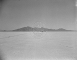 | The Bonneville Salt Flats Raceway circa 1940s-1950s. [3] | 1940; 1941; 1942; 1943; 1944; 1945; 1946; 1947; 1948; 1949; 1950; 1951; 1952; 1953; 1954; 1955; 1956; 1957; 1958; 1959 | Image | uum_map |
| 156 | 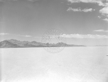 | The Bonneville Salt Flats Raceway circa 1940s-1950s. [4] | 1940; 1941; 1942; 1943; 1944; 1945; 1946; 1947; 1948; 1949; 1950; 1951; 1952; 1953; 1954; 1955; 1956; 1957; 1958; 1959 | Image | uum_map |
| 157 | 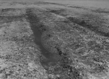 | The Bonneville Salt Flats Raceway circa 1940s-1950s. [5] | 1940; 1941; 1942; 1943; 1944; 1945; 1946; 1947; 1948; 1949; 1950; 1951; 1952; 1953; 1954; 1955; 1956; 1957; 1958; 1959 | Image | uum_map |
| 158 | 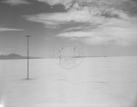 | The Bonneville Salt Flats Raceway circa 1940s-1950s. [6] | 1940; 1941; 1942; 1943; 1944; 1945; 1946; 1947; 1948; 1949; 1950; 1951; 1952; 1953; 1954; 1955; 1956; 1957; 1958; 1959 | Image | uum_map |
| 159 |  | The Bonneville Salt Flats Raceway circa 1940s-1950s. [8] | 1940; 1941; 1942; 1943; 1944; 1945; 1946; 1947; 1948; 1949; 1950; 1951; 1952; 1953; 1954; 1955; 1956; 1957; 1958; 1959 | Image | uum_map |
| 160 |  | Boundary of Shoshone Indian Territory and Neighboring Tribes | 1957 | Image/StillImage | uaida_main |
| 161 |  | Boundary of Shoshone Indian Territory, showing the locations of the Bannock | 1957 | Image/StillImage | uaida_main |
| 162 |  | Boundary of Shoshone Indian Territory, showing the locations of the Bannock from 1819 to 1951 | 1957 | Image/StillImage | uaida_main |
| 163 |  | Boundary of Shoshone Indian Territory, showing the locations where the Bannock and Shoshone reported together 1819-1956 | 1957 | Image/StillImage | uaida_main |
| 164 |  | Boundary of Shoshone Indian Territory; Doty Map of 1863 Indian Claims Commission | 1957 | Image/StillImage | uaida_main |
| 165 |  | Bowen, Ross C. | 1957 | Image/StillImage | dha_uslp |
| 166 |  | Brewster, Sheldon R. | 1957 | Image/StillImage | dha_uslp |
| 167 | 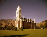 | Brigham City Tabernacle | 1950; 1951; 1952; 1953; 1954; 1955; 1956; 1957; 1958; 1959; 1960 | Image/StillImage | dha_alwmc |
| 168 |  | Broken rock, unidentified location, southern Utah [1] | 1940; 1941; 1942; 1943; 1944; 1945; 1946; 1947; 1948; 1949; 1950; 1951; 1952; 1953; 1954; 1955; 1956; 1957; 1958; 1959 | Image | uum_map |
| 169 |  | Broken rock, unidentified location, southern Utah [2] | 1940; 1941; 1942; 1943; 1944; 1945; 1946; 1947; 1948; 1949; 1950; 1951; 1952; 1953; 1954; 1955; 1956; 1957; 1958; 1959 | Image | uum_map |
| 170 | 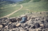 | Broken rock, unidentified location, southern Utah [3] | 1940; 1941; 1942; 1943; 1944; 1945; 1946; 1947; 1948; 1949; 1950; 1951; 1952; 1953; 1954; 1955; 1956; 1957; 1958; 1959 | Image | uum_map |
| 171 |  | Browns Park, Utah-Colorado [01] | 1950; 1951; 1952; 1953; 1954; 1955; 1956; 1957; 1958; 1959; 1960; 1961; 1962; 1963; 1964; 1965; 1966; 1967; 1968; 1969; 1970; 1971; 1972; 1973; 1974; 1975 | Image/StillImage | uum_map |
| 172 |  | Browns Park, Utah-Colorado [02] | 1950; 1951; 1952; 1953; 1954; 1955; 1956; 1957; 1958; 1959; 1960; 1961; 1962; 1963; 1964; 1965; 1966; 1967; 1968; 1969; 1970; 1971; 1972; 1973; 1974; 1975 | Image/StillImage | uum_map |
| 173 |  | Browns Park, Utah-Colorado [03] | 1950; 1951; 1952; 1953; 1954; 1955; 1956; 1957; 1958; 1959; 1960; 1961; 1962; 1963; 1964; 1965; 1966; 1967; 1968; 1969; 1970; 1971; 1972; 1973; 1974; 1975 | Image/StillImage | uum_map |
| 174 | 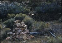 | Browns Park, Utah-Colorado [04] | 1950; 1951; 1952; 1953; 1954; 1955; 1956; 1957; 1958; 1959; 1960; 1961; 1962; 1963; 1964; 1965; 1966; 1967; 1968; 1969; 1970; 1971; 1972; 1973; 1974; 1975 | Image/StillImage | uum_map |
| 175 |  | Browns Park, Utah-Colorado [05] | 1950; 1951; 1952; 1953; 1954; 1955; 1956; 1957; 1958; 1959; 1960; 1961; 1962; 1963; 1964; 1965; 1966; 1967; 1968; 1969; 1970; 1971; 1972; 1973; 1974; 1975 | Image/StillImage | uum_map |