| Title | Date | Type | Setname | ||
|---|---|---|---|---|---|
| 1 |
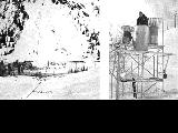 |
Avalanche tower and map | 1940; 1941; 1942; 1943; 1944; 1945; 1946; 1947; 1948; 1949; 1950; 1951; 1952; 1953; 1954; 1955; 1956; 1957; 1958; 1959; 1960; 1961; 1962; 1963; 1964; 1965; 1966; 1967; 1968; 1969 | Image | uum_map_usa |
| 2 |
 |
Boundary of Shoshone Indian Territory, Linguistic Boundaries of Shoshone and Bannock. | 1941 | Image/StillImage | uaida_main |
| 3 |
 |
Capitol Building-Exhibits P.1 | 1920; 1921; 1922; 1923; 1924; 1925; 1926; 1927; 1928; 1929; 1930; 1931; 1932; 1933; 1934; 1935; 1936; 1937; 1938; 1939; 1940; 1941; 1942; 1943; 1944; 1945; 1946; 1947; 1948; 1949; 1950 | Image/StillImage | dha_cp |
| 4 |
 |
Colorado River -- Excursions p.14 | 1935; 1936; 1937; 1938; 1939; 1940; 1941; 1942; 1943; 1944; 1945 | Image/StillImage | dha_cp |
| 5 |
 |
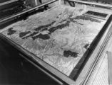
Father Escalante's Map | 1941 | Text | uaida_main |
| 6 |
 |
Map showing the boundary of the Shoshone Indian territory | 1941 | Image/StillImage | uaida_main |
| 7 |
 |
Utah Highway Patrol p. 1 | 1935; 1936; 1937; 1938; 1939; 1940; 1941; 1942; 1943; 1944; 1945; 1946; 1947 | Image/StillImage | dha_cp |