| | Title | Date | Type | Setname |
|---|
| 201 |  | Sandstone landform | 1925; 1926; 1927; 1928; 1929; 1930; 1931; 1932; 1933; 1934; 1935; 1936; 1937; 1938; 1939; 1940; 1941; 1942; 1943; 1944; 1945; 1946; 1947; 1948; 1949 | Image | uum_map_rr |
| 202 | 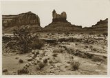 | Setting Hen, Monument Valley | 1935; 1936; 1937; 1938; 1939; 1940; 1941; 1942; 1943; 1944; 1945; 1946; 1947; 1948; 1949 | Image/StillImage | uum_map_rr |
| 203 | 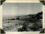 | Settlement of Moccasin Springs looking eastward toward Kaibab Indian School. Kaibab Plateau on skyline. Mohave County, AZ. 1939 | 1939 | Image | uum_map |
| 204 |  | Sheep beneath arch | 1935; 1936; 1937; 1938; 1939; 1940; 1941; 1942; 1943; 1944; 1945; 1946; 1947; 1948; 1949 | Image/StillImage | uum_map_rr |
| 205 |  | Shinarump and Moenkopi beds disturbed by a local fault 3 miles north of Fredonia, Coconino County, AZ. 1939 | 1939 | Image | uum_map |
| 206 |  | Short Creek near the exit from its canyon, in Vermillion Cliffs. Alluvial terraces and broad channel made during past 50 years, Mohave County, AZ, 1939 | 1939 | Image | uum_map |
| 207 |  | South wall of Rock Canyon. Kaibab (on valley floor and up to first ledge), conglomerate, Moenkopi (upper part of slope and the cliffs), Mohave County, AZ, 1939 | 1939 | Image | uum_map |
| 208 | 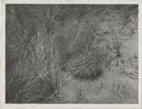 | Spiny desert vegetation | 1920; 1921; 1922; 1923; 1924; 1925; 1926; 1927; 1928; 1929; 1930; 1931; 1932; 1933; 1934; 1935; 1936; 1937; 1938; 1939; 1940; 1941; 1942; 1943; 1944; 1945; 1946; 1947; 1948; 1949 | Image | uum_map_rr |
| 209 | 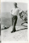 | Squire Coop [5] | 1930; 1931; 1932; 1933; 1934; 1935; 1936; 1937; 1938; 1939; 1940 | Image/StillImage | uum_map |
| 210 |  | The Steamboat. Shnabkaib (bottom) and upper red level of Moenkopi capped in part by Shinarump 2 miles west of Fredonia, Coconino County, AZ. 1939 | 1939 | Image | uum_map |
| 211 |  | The Steamboat. Shnabkaib (bottom) and upper red level of Moenkopi capped in part by Shinarump 2 miles west of Fredonia, Coconino County, AZ. 1939 | 1939 | Image | uum_map |
| 212 | 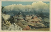 | Storm in Grand Canyon | 1930; 1931; 1932; 1933; 1934; 1935; 1936; 1937; 1938; 1939; 1940; 1941; 1942; 1943; 1944; 1945 | Image | uum_map |
| 213 | 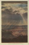 | Storm in the canyon: Grand Canyon National Park, Arizona | 1930; 1931; 1932; 1933; 1934; 1935; 1936; 1937; 1938; 1939; 1940; 1941; 1942; 1943; 1944; 1945 | Image | uum_map |
| 214 | 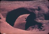 | Sun's Eye, Monument Valley | 1934; 1935; 1936; 1937; 1938; 1939; 1940; 1941; 1942; 1943; 1944; 1945; 1946; 1947; 1948; 1949 | Image/StillImage | uum_map_rr |
| 215 |  | Sun's Eye, Monument Valley | 1934; 1935; 1936; 1937; 1938; 1939; 1940; 1941; 1942; 1943; 1944; 1945; 1946; 1947; 1948; 1949 | Image/StillImage | uum_map_rr |
| 216 |  | Sun's Eye, Monument Valley | 1934; 1935; 1936; 1937; 1938; 1939; 1940; 1941; 1942; 1943; 1944; 1945; 1946; 1947; 1948; 1949 | Image/StillImage | uum_map_rr |
| 217 |  | Surface of Uinkaret Plateau southwest of Cane Beds, Mohave County, AZ, Aug. 2, 1939 | 1939 | Image | uum_map |
| 218 |  | Thor's Hammer, Grand Canyon National Park, Arizona | 1930; 1931; 1932; 1933; 1934; 1935; 1936; 1937; 1938; 1939; 1940; 1941; 1942; 1943; 1944; 1945 | Image | uum_map |
| 219 | 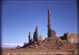 | Totem Pole, Monument Valley | 1934; 1935; 1936; 1937; 1938; 1939; 1940; 1941; 1942; 1943; 1944; 1945; 1946; 1947; 1948; 1949 | Image/StillImage | uum_map_rr |
| 220 |  | Totem Pole, Monument Valley | 1934; 1935; 1936; 1937; 1938; 1939; 1940; 1941; 1942; 1943; 1944; 1945; 1946; 1947; 1948; 1949 | Image/StillImage | uum_map_rr |
| 221 | 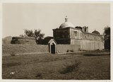 | Tumacácori mission | 1935; 1936; 1937; 1938; 1939; 1940; 1941; 1942; 1943; 1944; 1945; 1946; 1947; 1948; 1949 | Image/StillImage | uum_map_rr |
| 222 | 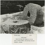 | Two mill stones located in Pipe Spring National Monument, Arizona | 1930; 1931; 1932; 1933; 1934; 1935; 1936; 1937; 1938; 1939; 1940; 1941; 1942; 1943; 1944; 1945; 1946; 1947; 1948; 1949; 1950; 1951; 1952; 1953; 1954; 1955; 1956; 1957; 1958; 1959; 1960; 1961; 1962; 1963; 1964; 1965; 1966; 1967; 1968; 1969 | Image | uum_map |
| 223 |  | Unidentified southern Utah scenery | 1937; 1938; 1939; 1940; 1941; 1942; 1943; 1944; 1945; 1946; 1947; 1948; 1949; 1950; 1951; 1952; 1953; 1954; 1955; 1956; 1957; 1958; 1959; 1960; 1961; 1962; 1963; 1964; 1965; 1966; 1967; 1968; 1969; 1970; 1971; 1972; 1973; 1974; 1975; 1976; 1977; 1978; 1979; 1980 | Image | uum_map_rr |
| 224 | 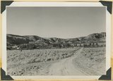 | View northward over Moccasin Springs along Sevier fault. Navajo (left) and Chinle (right), on skyline. 1939. Deep alluvium trenched by stream from springs (foreground) | 1939 | Image | uum_map |
| 225 |  | Wallace and Mary Stegner, Grand Canyon | 1935; 1936; 1937; 1938; 1939; 1940; 1941; 1942; 1943; 1944; 1945; 1946; 1947; 1948; 1949; 1950 | Image | uum_map |