|
|
Title | Collection Number And Name | Photo Number |
| 126 |
 |
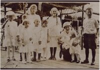
Lees Family [03] | P0005 C. Lowell Lees Photograph Collection | P0005n06_25_003 |
| 127 |
 |
Lees Family [05] | P0005 C. Lowell Lees Photograph Collection | P0005n06_25_005 |
| 128 |
 |
Lees Family [06] | P0005 C. Lowell Lees Photograph Collection | P0005n06_25_006 |
| 129 |
 |
Dog [01] | P0005 C. Lowell Lees Photograph Collection | P0005n06_25_009 |
| 130 |
 |
Dog [02] | P0005 C. Lowell Lees Photograph Collection | P0005n06_25_010 |
| 131 |
 |
Lees Family [11] | P0005 C. Lowell Lees Photograph Collection | P0005n06_25_014 |
| 132 |
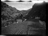 |
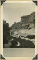
Little Creek Canyon road | P0008 Mark A. Pendleton Photograph Collection | P0008n01_10_090 |
| 133 |
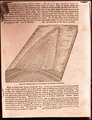 |
Generalized diagram showing relations of the formations near Silver Reef | P0008 Mark A. Pendleton Photograph Collection | P0008n01_10_094 |
| 134 |
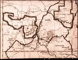 |
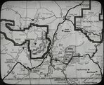
Map of southwestern Utah | P0008 Mark A. Pendleton Photograph Collection | P0008n01_10_095 |
| 135 |
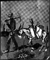 |
Illustration of a miner and his pack mule | P0008 Mark A. Pendleton Photograph Collection | P0008n01_10_096 |
| 136 |
 |
Map of southwestern Utah | P0008 Mark A. Pendleton Photograph Collection | P0008n01_11_097 |
| 137 |
 |
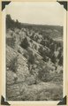
Solution channels in Wingate sandstone, Capitol Gorge. Wayne County, UT | P0013 Herbert E. Gregory Photograph Collection | P0013n11_035_2582 |
| 138 |
 |
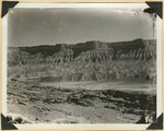
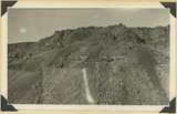
View along Notom-Cainesville road. Jurassic and Cretaceous formations. Fremont River in middle distance. Wayne County, UT | P0013 Herbert E. Gregory Photograph Collection | P0013n11_036_2583 |
| 139 |
 |
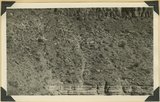
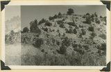
Erosion on Mancos shales, branch of Fremont River above Cainesville. Wayne County, UT | P0013 Herbert E. Gregory Photograph Collection | P0013n11_036_2584 |
| 140 |
 |
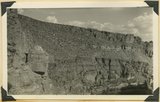
Fault at Mt. Carmel Junction, looking southeast. Carmel limestone on upthrown side (middle); Entrada (foreground). Kane County, UT, 1939 | P0013 Herbert E. Gregory Photograph Collection | P0013n11_037_2585 |
| 141 |
 |
Timpoweap member of Moenkopi formation in Timpoweap Canyon at intake of La Verkin irrigation ditch. Rests on Kaibab extreme lower right. Washington County, UT, 1939 | P0013 Herbert E. Gregory Photograph Collection | P0013n11_037_2586 |
| 142 |
 |
Contact of fossiliferous Kaibab (base) and fossiliferous Moenkopi (top), Isom Wash, Washington Co., UT, 1939. Exact contact not placed | P0013 Herbert E. Gregory Photograph Collection | P0013n11_038_2587 |
| 143 |
 |
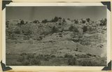
Consolidated river gravel (Wisconsin age?) overlying eroded Entrada(?) 300 feet above Paria River 2 miles south of Cannonville, Kane County, UT, 1939 | P0013 Herbert E. Gregory Photograph Collection | P0013n11_038_2588 |
| 144 |
 |
Entrada sandstone (bottom) in contact with shales and gypsum of Curtis formation, Paria Valley 4 miles south of Cannonville, Kane County, UT. 1939 | P0013 Herbert E. Gregory Photograph Collection | P0013n11_040_2589 |
| 145 |
 |
Ancient talus (right foreground) and talus now forming at base of Kinesava mountain, Zion National Park, Washington County, UT, 1939 | P0013 Herbert E. Gregory Photograph Collection | P0013n11_041_2590 |
| 146 |
 |
Bed of little Creek, sunk 10 feet to 40 feet into alluvium since 1890, Kane County, UT, 1939 | P0013 Herbert E. Gregory Photograph Collection | P0013n11_041_2591 |
| 147 |
 |
Wasatch cliff (top, Kaiparowits (slope) and upper beds of Wahweap formations, Wilson Point, Sunset Cliffs, head of Hillsdale Canyon, Garfield County, UT, 1939 | P0013 Herbert E. Gregory Photograph Collection | P0013n11_042_2592 |
| 148 |
 |
Contact of old and recent basalt flows near head of Gould Canyon, Washington County, UT, 1939 | P0013 Herbert E. Gregory Photograph Collection | P0013n11_042_2593 |
| 149 |
 |
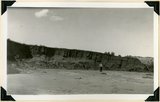
Edge of basalt flow over eroded Moenkopi along highway west of Grafton, Washington County, UT, 1939 | P0013 Herbert E. Gregory Photograph Collection | P0013n11_043_2594 |
| 150 |
 |
Carmel formation in Mineral Gulch. Typical arrangement of shaly and massive beds, Kane County, UT. 1939 | P0013 Herbert E. Gregory Photograph Collection | P0013n11_043_2595 |