Over 70,000 photos covering a variety of topics from Marriott Library Special Collections
TO
Filters: Date: "1936" Collection: "uum_map"
| Title | Collection Number And Name | Photo Number | ||
|---|---|---|---|---|
| 451 |
 |
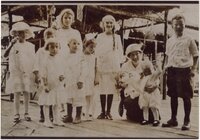
Lees Family [04] | P0005 C. Lowell Lees Photograph Collection | P0005n06_25_004 tif; P0005n06_25_004b.tif |
| 452 |
 |
Lees Family [05] | P0005 C. Lowell Lees Photograph Collection | P0005n06_25_005 |
| 453 |
 |
Lees Family [06] | P0005 C. Lowell Lees Photograph Collection | P0005n06_25_006 |
| 454 |
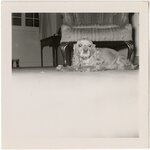 |
Dog [01] | P0005 C. Lowell Lees Photograph Collection | P0005n06_25_009 |
| 455 |
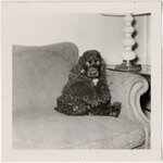 |
Dog [02] | P0005 C. Lowell Lees Photograph Collection | P0005n06_25_010 |
| 456 |
 |
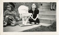
Lees Family [11] | P0005 C. Lowell Lees Photograph Collection | P0005n06_25_014 |
| 457 |
 |
Lees Family, unidentified woman | P0005 C. Lowell Lees Photograph Collection | P0005n06_25_016.tif; P0005n06_25_016a.tif |
| 458 |
 |
Augustus P. Hardy | P0008 Mark A. Pendleton Photograph Collection | P0008n01_09_075 |
| 459 |
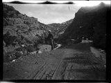 |
Little Creek Canyon road | P0008 Mark A. Pendleton Photograph Collection | P0008n01_10_090 |
| 460 |
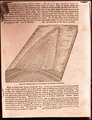 |
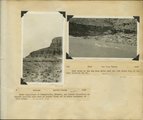
Generalized diagram showing relations of the formations near Silver Reef | P0008 Mark A. Pendleton Photograph Collection | P0008n01_10_094 |
| 461 |
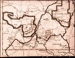 |
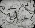
Map of southwestern Utah | P0008 Mark A. Pendleton Photograph Collection | P0008n01_10_095 |
| 462 |
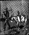 |
Illustration of a miner and his pack mule | P0008 Mark A. Pendleton Photograph Collection | P0008n01_10_096 |
| 463 |
 |
Map of southwestern Utah | P0008 Mark A. Pendleton Photograph Collection | P0008n01_11_097 |
| 464 |
 |
Herbert E. Gregory Book 10: San Juan, Zion, Capitol Reef, 1915-1938 | P0013 Herbert E. Gregory Photograph Collection | P0013n10 |
| 465 |
 |
Colorado River looking up stream from the mouth of Moki Canyon. | P0013 Herbert E. Gregory Photograph Collection | P0013n10_003_2095 |
| 466 |
 |
Colorado River looking down stream from the mouth of Moki Canyon (at the left). | P0013 Herbert E. Gregory Photograph Collection | P0013n10_004_2096 |
| 467 |
 |
Mouth of Moki Canyon. Colorado River would be at the right. | P0013 Herbert E. Gregory Photograph Collection | P0013n10_005_2097 |
| 468 |
 |
Looking into Moki Canyon 25 mi. up from the mouth. It is the only entrance except a trail nearby and one at the head. There is no way to get into the canyon between this point and the mouth 25 mi. below. | P0013 Herbert E. Gregory Photograph Collection | P0013n10_005_2098 |
| 469 |
 |
Wash of Virgin River at Grafton, 30 feet wide in 1860, now 1000 feet wide, Moenkopi forms banks, Navajo beyond, Washington County, Utah, 1930. | P0013 Herbert E. Gregory Photograph Collection | P0013n10_057_2188 |
| 470 |
 |
The Watchman at the mouth of Zion Canyon. | P0013 Herbert E. Gregory Photograph Collection | P0013n10_058_2189 |
| 471 |
 |
The Great White Throne, Zion Canyon. | P0013 Herbert E. Gregory Photograph Collection | P0013n10_059_2190 |
| 472 |
 |
Waterfall from hanging valley during rain storm. Temple of Sinawava, Zion Canyon. | P0013 Herbert E. Gregory Photograph Collection | P0013n10_059_2191 |
| 473 |
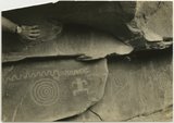 |
Indian pictographs near Mt. Carmel road. | P0013 Herbert E. Gregory Photograph Collection | P0013n10_061_2192 |
| 474 |
 |
Village of Hurricane, Utah, from Hurricane Hill. Cinder cones in middle distance. Pine Valley Mountain on horizon. Fertility in foreground. | P0013 Herbert E. Gregory Photograph Collection | P0013n10_062_2193 |
| 475 |
 |
Old abandoned cotton mill at Washington, Utah. | P0013 Herbert E. Gregory Photograph Collection | P0013n10_062_2194 |