TO
Filters: Date: "1913"
| Title | Date | Type | Setname | ||
|---|---|---|---|---|---|
| 351 |
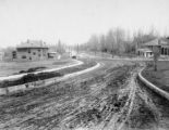 |
S.L.C. - South Temple Street P.52 | 1900; 1901; 1902; 1903; 1904; 1905; 1906; 1907; 1908; 1909; 1910; 1911; 1912; 1913; 1914; 1915 | Image/StillImage | dha_cp |
| 352 |
 |
S.L.C. - South Temple Street P.56 | 1900; 1901; 1902; 1903; 1904; 1905; 1906; 1907; 1908; 1909; 1910; 1911; 1912; 1913; 1914; 1915 | Image/StillImage | dha_cp |
| 353 |
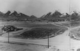 |
S.L.C. - Thirteenth East P.7 | 1911; 1912; 1913; 1914; 1915; 1916; 1917; 1918; 1919; 1920 | Image/StillImage | dha_cp |
| 354 |
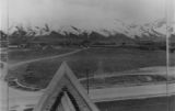 |
S.L.C. - Thirteenth East P.8 | 1911; 1912; 1913; 1914; 1915; 1916; 1917; 1918; 1919; 1920 | Image/StillImage | dha_cp |
| 355 |
 |
S.L.C. - Thirteenth East P.9 | 1911; 1912; 1913; 1914; 1915; 1916; 1917; 1918; 1919; 1920 | Image/StillImage | dha_cp |
| 356 |
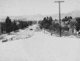 |
S.L.C. - Twelfth East P.3 | 1910; 1911; 1912; 1913; 1914; 1915; 1916; 1917; 1918; 1919; 1920 | Image/StillImage | dha_cp |
| 357 |
 |
S.L.C. - Twelfth East P.4 | 1910; 1911; 1912; 1913; 1914; 1915; 1916; 1917; 1918; 1919; 1920 | Image/StillImage | dha_cp |
| 358 |
 |
Salt Lake City Panoramic View-East P.3 | 1911; 1912; 1913; 1914; 1915; 1916; 1917; 1918; 1919; 1920 | Image/StillImage | dha_cp |
| 359 |
 |
Threshing Machines | 1905; 1906; 1907; 1908; 1909; 1910; 1911; 1912; 1913; 1914; 1915 | Image | ucl_rhc |
| 360 |
 |
Uintah Development Company Records, | 1907; 1908; 1909; 1910; 1911; 1912; 1913; 1914; 1915 | dha_ead | |
| 361 |
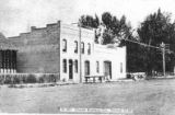 |
Uintah Railway Station | 1905; 1906; 1907; 1908; 1909; 1910; 1911; 1912; 1913; 1914; 1915 | Image | ucl_rhc |
| 362 |
 |
View of Savage Basin showing Camp Bird Divide | 1910; 1911; 1912; 1913; 1914; 1915; 1916; 1917; 1918; 1919; 1920 | Image | uum_map |
| 363 |
 |
Cuzco Valley | 1911; 1912; 1913; 1914; 1915 | Image | uum_map |
| 364 |
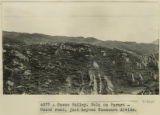 |
Cuzco Valley. Fold on Paruro-Cuzco road, just beyond Huancaro divide. | 1912; 1913; 1914; 1915 | Image | uum_map |
| 365 |
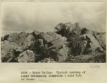 |
Cuzco Valley. Typical outcrop of lower Cretaceous limestone, 1 mile NE of Cuzco | 1912; 1913; 1914; 1915 | Image | uum_map |
| 366 |
 |
Cuzco Valley. Vilcanata Canyon, looking down stream NW from Sierra Bella. | 1912; 1913; 1914; 1915 | Image | uum_map |
| 367 |
 |
Cuzco, looking S from heights above Ttica-ttica. | 1912; 1913; 1914; 1915 | Image | uum_map |
| 368 |
 |
Dolores below Tse-na-kahn. East side of Chin lee wash | 1913 | Image | uum_map |
| 369 |
 |
Fort Sacsuahman | 1911; 1912; 1913; 1914; 1915 | Image | uum_map |
| 370 |
 |
Man on a horse overlooking the desert valley and mountains | 1910; 1911; 1912; 1913; 1914; 1915; 1916; 1917; 1918; 1919; 1920; 1921; 1922; 1923; 1924; 1925; 1926; 1927; 1928; 1929; 1930; 1931; 1932; 1933; 1934; 1935; 1936; 1937; 1938; 1939; 1940; 1941; 1942; 1943; 1944; 1945; 1946; 1947; 1948; 1949; 1950; 1951; 195 | uum_map_rr | |
| 371 |
 |
Peru mountain | 1912; 1913; 1914; 1915 | Image | uum_map |
| 372 |
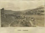 |
Rodadero | 1911; 1912; 1913; 1914; 1915 | Image | uum_map |
| 373 |
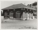 |
Station building, Murdock Plant on the Provo River | 1910; 1911; 1912; 1913; 1914; 1915 | Image | uum_map |
| 374 |
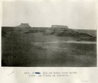 |
Tse-na-kahn from north side. La Plata on Dolores. | 1913 | Image | uum_map |
| 375 |
 |
Uintah County School Districts 1900 | 1906; 1907; 1908; 1909; 1910; 1911; 1912; 1913; 1914; 1915; 1916; 1917; 1918; 1919; 1920; 1921; 1922; 1923; 1924; 1925; 1926; 1927; 1928; 1929; 1930; 1931; 1932; 1933; 1934; 1935; 1936; 1937; 1938; 1939; 1940 | Image/StillImage | ucl_maps |
