Over 70,000 photos covering a variety of topics from Marriott Library Special Collections
TO
| Title | Collection Number And Name | Photo Number | ||
|---|---|---|---|---|
| 126 |
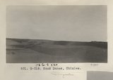 |
Sand Dunes, Chinlee (Photo G318) | P0013 Herbert E. Gregory Photograph Collection | P0013n06_013_0847 |
| 127 |
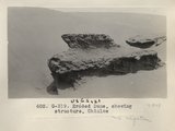 |
Eroded Dune, showing structure, Chinlee (Photo G319) | P0013 Herbert E. Gregory Photograph Collection | P0013n06_013_0848 |
| 128 |
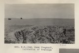 |
Dune fragment, initiation of drainage (Photo N-M146) | P0013 Herbert E. Gregory Photograph Collection | P0013n06_014_0849 |
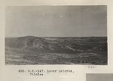
| 129 |
 |
Lower Dolores, Chinlee (Photo G320) | P0013 Herbert E. Gregory Photograph Collection | P0013n06_014_0850 |
| 130 |
 |
Lower Dolores, Chinlee (Photo N-M147) | P0013 Herbert E. Gregory Photograph Collection | P0013n06_015_0851 |
| 131 |
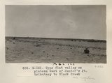 |
Type flat valley on plateau west of Hunter's Pt. tributary to Black Creek (Photo G321) | P0013 Herbert E. Gregory Photograph Collection | P0013n06_015_0852 |
| 132 |
 |
Vegetation, plateau west of Hunter's Pt. Noon camp. May 29 (Photo N-M148) | P0013 Herbert E. Gregory Photograph Collection | P0013n06_016_0853 |
| 133 |
 |
Unconformity, Permian-Shinarump. Fort Defiance (Photo G322) | P0013 Herbert E. Gregory Photograph Collection | P0013n06_016_0854 |
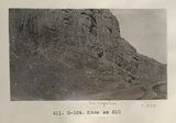
| 134 |
 |
Same as 608 (Unconformity, Permian-Shinarump, Photo N-M149) | P0013 Herbert E. Gregory Photograph Collection | P0013n06_016_0855 |
| 135 |
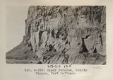 |
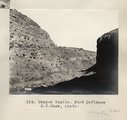
Upper Permian, Bonito Canyon, Fort Defiance (Photo G323) | P0013 Herbert E. Gregory Photograph Collection | P0013n06_017_0856 |
| 136 |
 |
Wash and Permian cliffs capped by Shinarump. Bonito Canyon (Photo G325) | P0013 Herbert E. Gregory Photograph Collection | P0013n06_017_0857 |
| 137 |
 |
Same as 610 (Upper Permian, Bonito Canyon, Photo G324) | P0013 Herbert E. Gregory Photograph Collection | P0013n06_017_0858 |
| 138 |
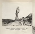 |
Kit Carson Monument. Fort Defiance. E.C.Case, photo | P0013 Herbert E. Gregory Photograph Collection | P0013n06_018_0859 |
| 139 |
 |
Canyon Bonito. Fort Defiance E.C. Case, photo | P0013 Herbert E. Gregory Photograph Collection | P0013n06_018_0860 |
| 140 |
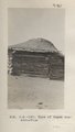 |
Type of Hogan construction (Photo N-M150) | P0013 Herbert E. Gregory Photograph Collection | P0013n06_019_0861 |
| 141 |
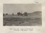 |
Part of buildings Chinlee. W.B.Emery, photo (Photo N-M151) | P0013 Herbert E. Gregory Photograph Collection | P0013n06_019_0862 |
| 142 |
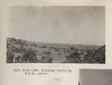 |
Chinlee vicinity W.B.E. photo (Photo N-M152) | P0013 Herbert E. Gregory Photograph Collection | P0013n06_020_0863 |
| 143 |
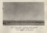 |
Looking west across Chinlee Wash from Point 5 mi. north of Chinlee (Photo N-M153) | P0013 Herbert E. Gregory Photograph Collection | P0013n06_020_0864 |
| 144 |
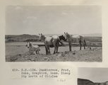 |
Packhorses, Fred, Duke, Greybird, Bess. Sheep Dip north of Chinlee (Photo N-M154) | P0013 Herbert E. Gregory Photograph Collection | P0013n06_021_0865 |
| 145 |
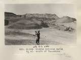 |
Middle Dolores marls 5± mi. south of Tsenakahn (Photo G326) | P0013 Herbert E. Gregory Photograph Collection | P0013n06_021_0866 |
| 146 |
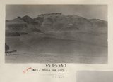 |
Same as 620 (Dolores marls, Photo G326a) | P0013 Herbert E. Gregory Photograph Collection | P0013n06_022_0867 |
| 147 |
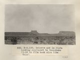 |
Dolores and La Plata looking southeast to Tsenakahn (I-48 in film book also like this) (Photo N-M155) | P0013 Herbert E. Gregory Photograph Collection | P0013n06_022_0868 |
| 148 |
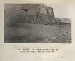 |
La Plata west side of Chinlee Wash, below Chinlee (Photo G327) | P0013 Herbert E. Gregory Photograph Collection | P0013n06_023_0869 |
| 149 |
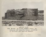 |
La Plata, bedded Lower, on Dolores and massive Upper; junction of Chinlee and Carrizo Washes (Photo G328) | P0013 Herbert E. Gregory Photograph Collection | P0013n06_024_0870 |
| 150 |
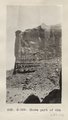 |
Shows part of 624 (La Plata sandstone, junction of Chinlee and Carrizo Washes, Photo G329) | P0013 Herbert E. Gregory Photograph Collection | P0013n06_024_0871 |