Over 70,000 photos covering a variety of topics from Marriott Library Special Collections
TO
| Title | Collection Number And Name | Photo Number | ||
|---|---|---|---|---|
| 151 |
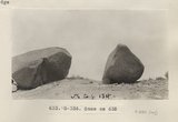 |
Same as 632 (Erratics, Garnet Ridge, Photo G336) | P0013 Herbert E. Gregory Photograph Collection | P0013n06_028_0880 |
| 152 |
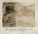 |
Wash-filling structure, Lower Chinlee (Photo N-M157) | P0013 Herbert E. Gregory Photograph Collection | P0013n06_029_0881 |
| 153 |
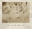 |
Same as 634 (Wash-filling structure, Lower Chinlee, Photo N-M158) | P0013 Herbert E. Gregory Photograph Collection | P0013n06_029_0882 |
| 154 |
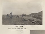 |
Same as 632 (Photo G337) | P0013 Herbert E. Gregory Photograph Collection | P0013n06_030_0883 |
| 155 |
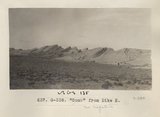 |
"Comb" from Dike H (Photo G338) | P0013 Herbert E. Gregory Photograph Collection | P0013n06_030_0884 |
| 156 |
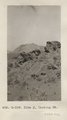 |
Dike J, looking NE (Photo G339) | P0013 Herbert E. Gregory Photograph Collection | P0013n06_031_0885 |
| 157 |
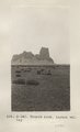 |
Church Rock, Laguna valley (Photo G340) | P0013 Herbert E. Gregory Photograph Collection | P0013n06_031_0886 |
| 158 |
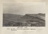 |
Dolores-LaPlata contact, Kayenta (Photo G341) | P0013 Herbert E. Gregory Photograph Collection | P0013n06_032_0887 |
| 159 |
 |
Dolores, 2 mi. north of Kayenta (Photo G343) | P0013 Herbert E. Gregory Photograph Collection | P0013n06_032_0888 |
| 160 |
 |
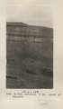
Looking south across Kayenta flat. LaPlata foreground. Black Mt. background (Photo G342) | P0013 Herbert E. Gregory Photograph Collection | P0013n06_032_0889 |
| 161 |
 |
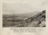
Distant view of Chaezkla [that is, Agathla] (3 mi.) and Comb with dike (7 mi.). Dolores foreground (Photo G345) | P0013 Herbert E. Gregory Photograph Collection | P0013n06_033_0890 |
| 162 |
 |
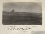
Distant (6 mi.) view of Agathla [that is, Chaezkla] from southwest (Photo G344) | P0013 Herbert E. Gregory Photograph Collection | P0013n06_033_0891 |
| 163 |
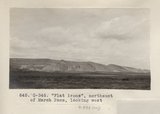 |
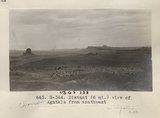
"Flat irons", northeast of Marsh Pass, looking west (Photo G346) | P0013 Herbert E. Gregory Photograph Collection | P0013n06_034_0892 |
| 164 |
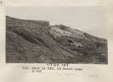 |
Same as 645, at Marsh Pass (Photo G347) | P0013 Herbert E. Gregory Photograph Collection | P0013n06_034_0893 |
| 165 |
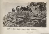 |
Pack train, Sagy canyon (Photo G348) | P0013 Herbert E. Gregory Photograph Collection | P0013n06_035_0894 |
| 166 |
 |
PahUte canyon. Navaho Mountain in distance (Photo G349) | P0013 Herbert E. Gregory Photograph Collection | P0013n06_035_0895 |
| 167 |
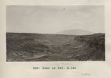 |
Same as 648 (Piute Canyon, Navajo Mtn., photo G350) | P0013 Herbert E. Gregory Photograph Collection | P0013n06_036_0896 |
| 168 |
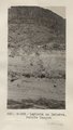 |
LaPlata on Dolores, PahUte Canyon (Photo G351) | P0013 Herbert E. Gregory Photograph Collection | P0013n06_036_0897 |
| 169 |
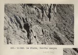 |
La Plata, PahUte canyon (Photo G352) | P0013 Herbert E. Gregory Photograph Collection | P0013n06_037_0898 |
| 170 |
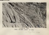 |
Same as 651 (LaPlata, Paiute Canyon, Photo G353) | P0013 Herbert E. Gregory Photograph Collection | P0013n06_037_0899 |
| 171 |
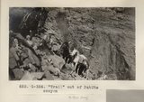 |
"Trail" out of PahUte canyon (Photo G354) | P0013 Herbert E. Gregory Photograph Collection | P0013n06_038_0900 |
| 172 |
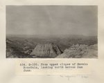 |
From upper slopes of Navaho Mountain, looking north across San Juan (Photo G355) | P0013 Herbert E. Gregory Photograph Collection | P0013n06_038_0901 |
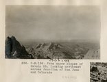
| 173 |
 |
Pinnacles, La Plata and McElmo (?), north side of Navaho Mountain (I-33 is same) (Photo G356) | P0013 Herbert E. Gregory Photograph Collection | P0013n06_039_0902 |
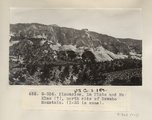
| 174 |
 |
From upper slopes of Navaho Mt. looking northwest across Junction of San Juan and Colorado (Photo N-M158) | P0013 Herbert E. Gregory Photograph Collection | P0013n06_040_0903 |
| 175 |
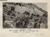 |
Contact of LaPlata and McElmo (?) or Dakokta (?) (Photo G357) | P0013 Herbert E. Gregory Photograph Collection | P0013n06_040_0904 |