Over 70,000 photos covering a variety of topics from Marriott Library Special Collections
TO
Filters: Date: "1913" Format: "image/jpeg" Collection: "uum_map" Format: image Setname: !(ir* OR ehsl*)
| Title | Collection Number And Name | Photo Number | ||
|---|---|---|---|---|
| 226 |
 |
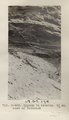
Alluvium with peat. Top wall of Black Creek (VIII-66) (Photo G389) | P0013 Herbert E. Gregory Photograph Collection | P0013n06_058_0942 |
| 227 |
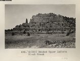 |
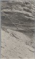
Banded Upper LaPlata Black Creek (Photo G390) | P0013 Herbert E. Gregory Photograph Collection | P0013n06_058_0943 |
| 228 |
 |
LaPlata cliffs, Todilto (Note horse) (N-M165) | P0013 Herbert E. Gregory Photograph Collection | P0013n06_059_0944 |
| 229 |
 |
Southeast edge of Todilto looking northeast from rim south of Dike "B" (Photo G393) | P0013 Herbert E. Gregory Photograph Collection | P0013n06_059_0945 |
| 230 |
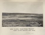 |
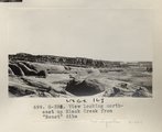
View from "Beast" dike north across Red Lake (Photo G391) | P0013 Herbert E. Gregory Photograph Collection | P0013n06_060_0946 |
| 231 |
 |
View from "Beast" dike north across Red Lake (Photo G391) | P0013 Herbert E. Gregory Photograph Collection | P0013n06_060_0946 |
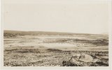
| 232 |
 |
View looking northeast up Black Creek from "Beast" dike (Photo G392) | P0013 Herbert E. Gregory Photograph Collection | P0013n06_060_0947 |
| 233 |
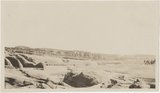 |
View looking northeast up Black Creek from "Beast" dike (Photo G392) | P0013 Herbert E. Gregory Photograph Collection | P0013n06_060_0947 |
| 234 |
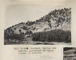 |
Contact, McElmo and Dakota, northeast of upper corner of Todilto (Photo G394) | P0013 Herbert E. Gregory Photograph Collection | P0013n06_061_0948 |
| 235 |
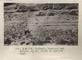 |
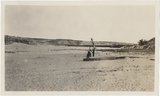
Contact, Tertiary and McElmo, 2± mi. north of Sunrise Spgs. (Photo N-M166) | P0013 Herbert E. Gregory Photograph Collection | P0013n06_061_0949 |
| 236 |
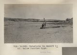 |
Waterhole in desert 1± mi. below Sunrise Spgs. (Photo G395) | P0013 Herbert E. Gregory Photograph Collection | P0013n06_062_0950 |
| 237 |
 |
Waterhole in desert 1± mi. below Sunrise Spgs. (Photo G395) | P0013 Herbert E. Gregory Photograph Collection | P0013n06_062_0950 |
| 238 |
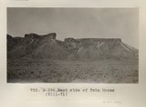 |
East side of Twin Mesas (VIII-71) (Photo G396) | P0013 Herbert E. Gregory Photograph Collection | P0013n06_062_0951 |
| 239 |
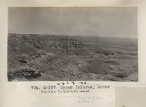 |
Upper Dolores, Lower Pueblo Colorado wash (Photo G397) | P0013 Herbert E. Gregory Photograph Collection | P0013n06_063_0952 |
| 240 |
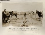 |
Camp in Pueblo Colorado Wash. Case digging for water (Photo N-M167) | P0013 Herbert E. Gregory Photograph Collection | P0013n06_063_0953 |
| 241 |
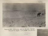 |
Dolores marls 8± mi. below Tanner's Spgs. E.C.Case in photo (Photo G398) | P0013 Herbert E. Gregory Photograph Collection | P0013n06_064_0954 |
| 242 |
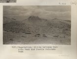 |
Vegetation, divide between Carrizo Wash and Pueblo Colorado Wash | P0013 Herbert E. Gregory Photograph Collection | P0013n06_064_0955 |
| 243 |
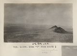 |
Dike "T" from south 1/2 (Photo G399) | P0013 Herbert E. Gregory Photograph Collection | P0013n06_065_0956 |
| 244 |
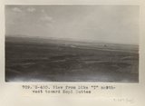 |
View from Dike "T" northwest toward Hopi Buttes (Photo G400) | P0013 Herbert E. Gregory Photograph Collection | P0013n06_065_0957 |
| 245 |
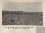 |
Dead cattle at water hole 15 mi. northeast of Holbrook (Photo N-M168) | P0013 Herbert E. Gregory Photograph Collection | P0013n06_066_0958 |
| 246 |
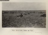 |
Same as 710 (Dead cattle, Photo N-M169) | P0013 Herbert E. Gregory Photograph Collection | P0013n06_066_0959 |
| 247 |
 |
Upper Permian, typical exposure, Holbrook (Photo G401) | P0013 Herbert E. Gregory Photograph Collection | P0013n06_067_0960 |
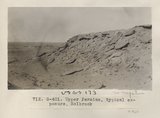
| 248 |
 |
Gypsum in Permian. 2± mi. east of Holbrook (Photo G402) | P0013 Herbert E. Gregory Photograph Collection | P0013n06_067_0961 |
| 249 |
 |
Gypsum in Permian. 2± mi. east of Holbrook (Photo G402) | P0013 Herbert E. Gregory Photograph Collection | P0013n06_067_0961 |
| 250 |
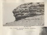 |
Gypsum bands, Permian, Holbrook (Photo G403) | P0013 Herbert E. Gregory Photograph Collection | P0013n06_068_0962 |