|
|
Title | Collection Number And Name | Photo Number |
| 126 |
 |
Cuzco Valley. End of abandoned moraine. Largest glacier of Cuzco Valley, Elev. 13,500-13,700 ft. Upper right hand branch of Junajaneha | P0013 Herbert E. Gregory Photograph Collection | P0013n13_013_9-2971 |
| 127 |
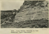 |
Cuzco Valley. Faulting in Pink Sandstone. Upper Junajaneha | P0013 Herbert E. Gregory Photograph Collection | P0013n13_013_9-2972 |
| 128 |
 |
Cuzco Valley. San Geronimo Facade of church (Juancatio basalt) | P0013 Herbert E. Gregory Photograph Collection | P0013n13_014_9-2973 |
| 129 |
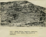 |
Cuzco Valley. Deposits limestone, clay, and Cast. shale. Near mouth of Huancaro | P0013 Herbert E. Gregory Photograph Collection | P0013n13_014_9-2974 |
| 130 |
 |
Cuzco. Near the railway station. A bluff washed by the Huantanay River. Shows Lieutenant Sotomayor pointing to a stratum containing fossil shells | P0013 Herbert E. Gregory Photograph Collection | P0013n13_015_9-2975 |
| 131 |
 |
Cuzco. Similar place farther up the Anta road. Dr. Eaton pointing to the spot where a rib was found interstratified with the gravel | P0013 Herbert E. Gregory Photograph Collection | P0013n13_015_9-2976 |
| 132 |
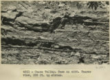 |
Cuzco Valley. Same as 2976. Nearer view, 200 ft. upstream | P0013 Herbert E. Gregory Photograph Collection | P0013n13_016_9-2977 |
| 133 |
 |
Cuzco Valley. Cirque & Moraine facing Carao Valley. Elev. 13,500-14,000 ft. | P0013 Herbert E. Gregory Photograph Collection | P0013n13_016_9-2978 |
| 134 |
 |
Cuzco Valley. Divided spurs. Carao Valley | P0013 Herbert E. Gregory Photograph Collection | P0013n13_017_9-2979 |
| 135 |
 |
Cuzco Valley. Abandoned moraine. Looking down Junapincha. Elev. 15,000 ft. | P0013 Herbert E. Gregory Photograph Collection | P0013n13_017_9-2980 |
| 136 |
 |
Cuzco Valley. Erosion feature. Pink sandstone. 3 miles north of Angostura | P0013 Herbert E. Gregory Photograph Collection | P0013n13_018_9-2981 |
| 137 |
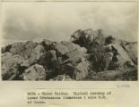 |
Cuzco Valley. Typical outcrop of lower Cretaceous limestone, 1 mile NE of Cuzco | P0013 Herbert E. Gregory Photograph Collection | P0013n13_018_9-2982 |
| 138 |
 |
Cuzco Valley. Huancaro, S. bank just below mouth of Huatanay. Material of lowest terrace. | P0013 Herbert E. Gregory Photograph Collection | P0013n13_019_9-2983 |
| 139 |
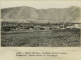 |
Cuzco Valley. Looking south across Huancaro, below mouth of Huatanay | P0013 Herbert E. Gregory Photograph Collection | P0013n13_019_9-2984 |
| 140 |
 |
Cuzco Valley. Detail alluvium. N. of San Sebastian [1] | P0013 Herbert E. Gregory Photograph Collection | P0013n13_020_9-2985 |
| 141 |
 |
Cuzco Valley. Detail alluvium. N. of San Sebastian [2] | P0013 Herbert E. Gregory Photograph Collection | P0013n13_020_9-2986 |
| 142 |
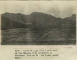 |
Cuzco Valley. Fold (syncline) on the Choquo, SE tributary of Huancaro. Looking east [1] | P0013 Herbert E. Gregory Photograph Collection | P0013n13_021_9-2987 |
| 143 |
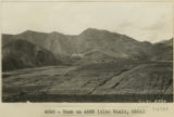 |
Cuzco Valley. Fold (syncline) on the Choquo, SE tributary of Huancaro. Looking east [2] | P0013 Herbert E. Gregory Photograph Collection | P0013n13_021_9-2988 |
| 144 |
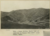 |
Cuzco Valley. North limb of syncline on Choquo | P0013 Herbert E. Gregory Photograph Collection | P0013n13_022_9-2989 |
| 145 |
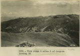 |
From ridge 2 miles S of Cropesa looking SE | P0013 Herbert E. Gregory Photograph Collection | P0013n13_023_9-2991 |
| 146 |
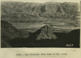 |
San Geronimo from foot of Mt. Picol | P0013 Herbert E. Gregory Photograph Collection | P0013n13_023_9-2992 |
| 147 |
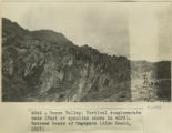 |
Cuzco Valley. Vertical conglomerate beds (part of syncline shown in 2987). Extreme heads of Ongapata | P0013 Herbert E. Gregory Photograph Collection | P0013n13_024_9-2993 |
| 148 |
 |
Cuzco Valley, Terrace. Ongapata. Looking upstream from 1/2 mile above mouth. Camera pointing south | P0013 Herbert E. Gregory Photograph Collection | P0013n13_024_9-2994 |
| 149 |
 |
Cuzco Valley. North limb, vertical, of syncline west of Ongapata (same as syncline shown in 2996-2997) but three miles further south | P0013 Herbert E. Gregory Photograph Collection | P0013n13_025_9-2995 |
| 150 |
 |
Cuzco Valley. Choquo branch. Looking S or SE across Huancaro from west side. | P0013 Herbert E. Gregory Photograph Collection | P0013n13_025_9-2996 |