Home
Browse
Ask Us
Chat
Harmful Language Statement
Log in
Advanced Search
Year
1880
1881
1882
1883
1884
1885
1886
1887
1888
1889
1890
1891
1892
1893
1894
1895
1896
1897
1898
1899
1900
1901
1902
1903
1904
1905
1906
1907
1908
1909
1910
1911
1912
1913
1914
1915
1916
1917
1918
1919
1920
1921
1922
1923
1924
1925
1926
1927
1928
1929
1930
1931
1932
1933
1934
1935
1936
1937
1938
1939
1940
1941
1942
1943
1944
TO
1880
1881
1882
1883
1884
1885
1886
1887
1888
1889
1890
1891
1892
1893
1894
1895
1896
1897
1898
1899
1900
1901
1902
1903
1904
1905
1906
1907
1908
1909
1910
1911
1912
1913
1914
1915
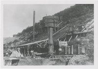
1916
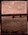
1917
1918
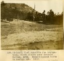
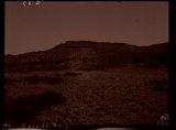
1919
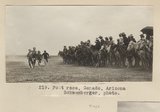
1920
1921
1922
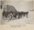
1923
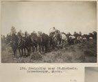
1924
1925
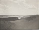
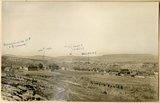
1926
1927
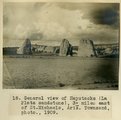
1928
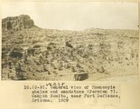
1929
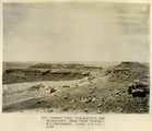
1930
1931
1932
1933
1934
1935
1936
1937
1938
1939
1940
1941
1942
1943
1944
Type
Image
403
Image/StillImage
34
Text
5
Format
image/jpeg
409
application/pdf
18
Collection
Classified Photographs
4
Mormon Settlement in Arizona
5
Photo Archives
417
UAIDA Main Collection
16
Filters:
Date:
"1909"
Spatial Coverage:
"Arizona"
101
-
125
of
442
<
1
2
3
4
5
6
7
8
9
10
>
Gallery view
Number of results to display per page
10
25
50
100
200
Sort by Relevance
Sort by Title A-Z
Sort by Title Z-A
Sort by Date Ascending
Sort by Date Descending
Sort by Last Modified Ascending
Sort by Last Modified Descending
Title
Date
Type
Setname
101
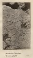
Dinosaur tracks (Janus photo)
1909
Image
uum_map
102
Dinosaur tracks (Stephen Janus photo, 1909. Same locality as G185)
1909
Image
uum_map
103
Dinosaur tracks (Stephen Janus photo, 1909. Same locality as G185)
1909
Image
uum_map
104
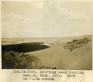
Drifting sand burying canyon, Tuba, Ariz., 1909, La Plata strata (photo G-100)
1909
Image
uum_map
105
Drifting sand burying canyon, Tuba, Ariz., 1909, La Plata strata (photo G-100)
1909
Image
uum_map
106
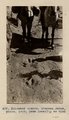
Driving well point, Navajo reservation, Ariz. Schwemberger, photo.
1909
Image
uum_map
107
Dug well, cornfields south of Ganado, Ariz., 1909
1909
Image/StillImage
uum_map
108
Dug well, Cornfields, Ganado, Ariz. (Negative for photo G-40)
1909
Image
uum_map
109
Dug well, Cornfields, south of Ganado, Ariz., 1909 (photo G-40)
1909
Image
uum_map
110
Early smelter, Bisbee, Arizona
1900; 1901; 1902; 1903; 1904; 1905; 1906; 1907; 1908; 1909; 1910; 1911; 1912; 1913; 1914; 1915; 1916; 1917; 1918; 1919; 1920; 1921; 1922; 1923; 1924; 1925; 1926; 1927; 1928; 1929; 1930; 1931; 1932; 1933; 1934; 1935; 1936; 1937; 1938; 1939; 1940
Image
uum_map
111
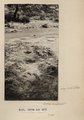
First Mesa Wash, near Walpi, Arizona, after shower, Aug. 1909 (photo G-94)
1909
Image
uum_map
112
First Mesa Wash, Walpi (Negative for photo G-94)
1909
Image
uum_map
113
Flat possible for irrigation. Wheat fields near Sonsola Buttes, Ariz. Basalt-capped butte in background, 1909 (photo G-103)
1909
Image
uum_map
114
Foot race, Ganado, Arizona. Schwemberger, photo.
1909
Image
uum_map
115
Foot race, Ganado, Arizona. Schwemberger, photo.
1909
Image
uum_map
116
Fort Defiance, Ariz., looking northeast across upturned edges of Dolores and La Plata. Mesa in distance is Mesa Verde, 1908 (Schwemberger photo)
1909
Image
uum_map
117
Freighting in winter between Gallup and St. Michaels, Ariz. Schwemberger, photo.
1909
Image
uum_map
118
Freighting near St. Michaels. Schwemberger, photo.
1909
Image
uum_map
119
Ganado, Ariz. (Negative for photo G-37)
1909
Image
uum_map
120
General view near Many Waters Lakes, 16± mi., northeast of Leupp, Arizona (photo G-87)
1909
Image
uum_map
121
General view near Many Waters Lakes, 16± mi., northeast of Leupp, Arizona (photo G-87)
1909
Image
uum_map
122
General view of Haystacks (La Plata sandstone), 3+ miles east of St. Michaels, Ariz., 1909 (Townsend photo)
1909
Image
uum_map
123
General view of Moencopie shales and sandstone (Permian?). Canyon Bonito, near Fort Defiance, Arizona, 1909
1909
Image
uum_map
124
General view, Mishonginivi and Shipauiluvi (Mesa Verde strata), W. C. Mendenhall phot, 1909
1909
Image
uum_map
125
Globe, copper mining town
1900; 1901; 1902; 1903; 1904; 1905; 1906; 1907; 1908; 1909; 1910; 1911; 1912; 1913; 1914; 1915; 1916; 1917; 1918; 1919; 1920; 1921; 1922; 1923; 1924; 1925; 1926; 1927; 1928; 1929; 1930; 1931; 1932; 1933; 1934; 1935; 1936; 1937; 1938; 1939; 1940
Image
uum_map
101
-
125
of
442
<
1
2
3
4
5
6
7
8
9
10
>