Home
Browse
Ask Us
Chat
Harmful Language Statement
Log in
Advanced Search
Year
1880
1881
1882
1883
1884
1885
1886
1887
1888
1889
1890
1891
1892
1893
1894
1895
1896
1897
1898
1899
1900
1901
1902
1903
1904
1905
1906
1907
1908
1909
1910
1911
1912
1913
1914
1915
1916
1917
1918
1919
1920
1921
1922
1923
1924
1925
1926
1927
1928
1929
1930
1931
1932
1933
1934
1935
1936
1937
1938
1939
1940
1941
1942
1943
1944
TO
1880
1881
1882
1883
1884
1885
1886
1887
1888
1889
1890
1891
1892
1893
1894
1895
1896
1897
1898
1899
1900
1901
1902
1903
1904
1905
1906
1907
1908
1909
1910
1911
1912
1913
1914
1915
1916
1917
1918
1919
1920
1921
1922
1923
1924
1925
1926
1927
1928
1929
1930
1931
1932
1933
1934
1935
1936
1937
1938
1939
1940
1941
1942
1943
1944
Type
Image
403
Image/StillImage
34
Text
5
Format
image/jpeg
409
application/pdf
18
Collection
Classified Photographs
4
Mormon Settlement in Arizona
5
Photo Archives
417
UAIDA Main Collection
16
Filters:
Date:
"1909"
Spatial Coverage:
"Arizona"
401
-
425
of
442
<
9
10
11
12
13
14
15
16
17
18
>
Gallery view
Number of results to display per page
10
25
50
100
200
Sort by Relevance
Sort by Title A-Z
Sort by Title Z-A
Sort by Date Ascending
Sort by Date Descending
Sort by Last Modified Ascending
Sort by Last Modified Descending
Title
Date
Type
Setname
401
Tuff (Tertiary) resting on red sandstone (La Plata? or McElmo?) between Sunrise Spgs. and Biddehoche (Indian Wells), Ariz., 1909 (photo G-50)
1909
Image
uum_map
402
Tuff on unevenly eroded sandstone (La Plata? or McElmo?), Lucasaca Springs, Ariz., 1909 (photo G-56)
1909
Image
uum_map
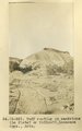
403
Tuff resting on sandstone (La Plata? or McElmo?), Lucasaca Spgs., Ariz. (photo G-55)
1909
Image
uum_map
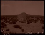
404
Twin Buttes (negative for photo G-62)
1909
Image
uum_map
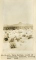
405
Twin Buttes south of Biddehoche, Arizona, looking west, 1909 (photo G-60)
1909
Image
uum_map
406
Twin Buttes south of Biddehoche, Arizona, looking west, 1909 (photo G-60)
1909
Image
uum_map
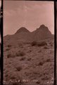
407
Twin Buttes, 1909 (negative for photo G-61)
1909
Image
uum_map
408
Twin Buttes, Ariz. (Negative for photo G-60)
1909
Image
uum_map
409
Twin Buttes, near view from southeast, 1909 (photo G-61)
1909
Image
uum_map
410
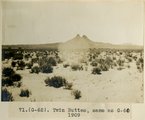
Twin Buttes, same as G-60, 1909 (photo G-62)
1909
Image
uum_map
411
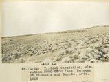
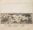
Typical vegetation, elevation 5000-5500 feet, between St. Michaels and Ganado, Ariz., 1909 (photo G-34)
1909
Image
uum_map
412
Typical vegetation, elevation 5000-5500 feet, between St. Michaels and Ganado, Ariz., 1909 (photo G-34)
1909
Image
uum_map
413
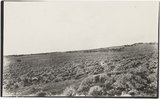
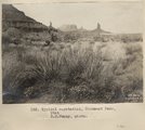
Typical vegetation, Monument Pass, Utah. S. M. Young, photo.
1909
Image
uum_map
414
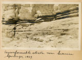
Unconformable strata near Sunrise Springs, 1909
1909
Image
uum_map
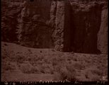
415
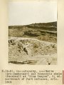
Unconformity (indicated by hammer) between quartzite (pre-Cambrian) and Moencopie shales (Permian?), "Blue Canyon," 2± mil. northwest of Fort Defiance, Ariz., 1909 (photo G-4)
1909
Image
uum_map
416
Unconformity, McElmo (?) on La Plata (?) or in 2± mil. southwest of Sunrise Spgs., Arizona (photo G-43)
1909
Image
uum_map
417
Unconformity, McElmo (?) on La Plata (?) or in 2± mil. southwest of Sunrise Spgs., Arizona (photo G-43)
1909
Image
uum_map
418
Unconformity, quartzite (pre-Cambrian?) and Moencopie shale (Permian?) at "Blue Canyon," 2± mil. northwest of Fort Defiance, Ariz., 1909 (photo G-5)
1909
Image
uum_map
419
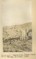
Vegetation, Black Creek Valley, Arizona, 1909 (photo G-11)
1909
Image
uum_map
420
Vegetation, Lower Oraibi Wash, Arizona, 1909
1909
Image
uum_map
421
Vermillion Cliffs, west of Fredonia
1907; 1908; 1909; 1910; 1911; 1912; 1913; 1914; 1915; 1916; 1917; 1918; 1919; 1920; 1921; 1922; 1923; 1924; 1925; 1926; 1927; 1928; 1929; 1930; 1931; 1932; 1933; 1934; 1935
Image/StillImage
uum_map
422
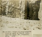
Volcanic conglomerate forming part of Black Rock; igneous mass, Ft. Defiance, Ariz., 1909 (photo G-16)
1909
Image
uum_map
423
Volcanic conglomerate, Ariz. (negative for photo G-16)
1909
Image
uum_map
424
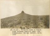
Volcanic neck on wagon road between Sunrise Spgs. and Biddehoche (Indian Wells), Ariz., 1909 (photo G-48)
1909
Image
uum_map
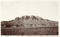
425
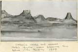
Volcanic necks and mesas, Hopi Buttes from painting by Edna Hope Gregory, 1909
1909
Image
uum_map
401
-
425
of
442
<
9
10
11
12
13
14
15
16
17
18
>