Home
Browse
Ask Us
Chat
Harmful Language Statement
Log in
Advanced Search
Year
1880
1881
1882
1883
1884
1885
1886
1887
1888
1889
1890
1891
1892
1893
1894
1895
1896
1897
1898
1899
1900
1901
1902
1903
1904
1905
1906
1907
1908
1909
1910
1911
1912
1913
1914
1915
1916
1917
1918
1919
1920
1921
1922
1923
1924
1925
1926
1927
1928
1929
1930
1931
1932
1933
1934
1935
1936
1937
1938
1939
1940
1941
1942
1943
1944
TO
1880
1881
1882
1883
1884
1885
1886
1887
1888
1889
1890
1891
1892
1893
1894
1895
1896
1897
1898
1899
1900
1901
1902
1903
1904
1905
1906
1907
1908
1909
1910
1911
1912
1913
1914
1915
1916
1917
1918
1919
1920
1921
1922
1923
1924
1925
1926
1927
1928
1929
1930
1931
1932
1933
1934
1935
1936
1937
1938
1939
1940
1941
1942
1943
1944
Type
Image
403
Image/StillImage
34
Text
5
Format
image/jpeg
409
application/pdf
18
Collection
Classified Photographs
4
Mormon Settlement in Arizona
5
Photo Archives
417
UAIDA Main Collection
16
Filters:
Date:
"1909"
Spatial Coverage:
"Arizona"
376
-
400
of
442
<
9
10
11
12
13
14
15
16
17
18
>
Gallery view
Number of results to display per page
10
25
50
100
200
Sort by Relevance
Sort by Title A-Z
Sort by Title Z-A
Sort by Date Ascending
Sort by Date Descending
Sort by Last Modified Ascending
Sort by Last Modified Descending
Title
Date
Type
Setname
376
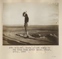
Snake priest ready to run from Mesa after dance, Walpi, Ariz. August 1909
1909
Image
uum_map
377
Snake priest; Walpi, Ariz. , August 1909, Vroman, photo.
1909
Image
uum_map
378
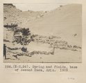
Spring and fields, base of Second Mesa, Ariz. 1909
1909
Image
uum_map
379
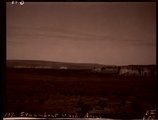
Steamboat Wash, Ariz. (Negative for photo G-93)
1909
Image
uum_map
380
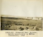
Steamboat Wash, Arizona. Dakota unconformity on McElmo (Jurassic?), 1909 (photo G-93)
1909
Image
uum_map
381
Stiles' Ranch, Moqui Buttes, Ariz. 1909
1909
Image
uum_map
382
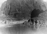
Stone Expedition, 1909 P.1
1909
Image
dha_cp
383
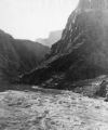
Stone Expedition, 1909 P.2
1909
Image
dha_cp
384
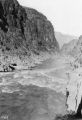
Stone Expedition, 1909 P.3
1909
Image
dha_cp
385
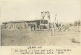
Store and well, Cornfields south of Ganado, Ariz., 1909 (sheet G-61)
1909
Image
uum_map
386
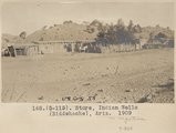
Store, Indian Wells (Biddehoche), Ariz. 1909
1909
Image
uum_map
387
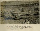
Structure of alluvium, Canyon Bonito, near Fort Defiance, Ariz., 1909 (photo G-10)
1909
Image
uum_map
388
Structure of alluvium, Canyon Bonito, near Fort Defiance, Ariz., 1909 (photo G-10)
1909
Image
uum_map
389
SW Sunrise Springs, Arizona (Negative for photo G-43)
1909
Image
uum_map
390
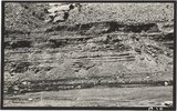
Tertiary clay shales interbedded with tuff. "Black Rock" between Sunrise Springs and Biddehoche (Indian wells), Ariz., 1909 (photo G-45)
1909
Image
uum_map
391
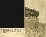
Tertiary clay shales interbeddied with tuff, 2± mi. south of Biddehoche, Ariz., 1909 (photo G-52)
1909
Image
uum_map
392
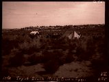
Top of Black Mesa at Onion Spgs., 12± mi. northeast of Oraibi, Ariz. (Mesa Verde strata), 1909 (photo G-95)
1909
Image
uum_map
393
Top of Black Mesa, Onion Spgs. (Negative for photo G-95)
1909
Image
uum_map
394
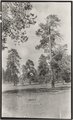
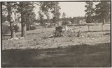
Top of plateau between St. Michaels and Ganado, Ariz. Trees are yellow pines, 1909 (photo G-33)
1909
Image
uum_map
395
Top of plateau between St. Michaels and Ganado, Ariz. Trees are yellow pines, 1909 (photo G-33)
1909
Image
uum_map
396
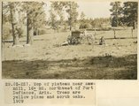
Top of plateau near Sawmill, 16± mi. northwest of Fort Defiance, Ariz. Trees are yellow pines and scrup oaks, 1909 (photo G-22)
1909
Image
uum_map
397
Top of plateau near Sawmill, 16± mi. northwest of Fort Defiance, Ariz. Trees are yellow pines and scrup oaks, 1909 (photo G-22)
1909
Image
uum_map
398
Tourist sitting on lookout point, taken in early 20th century
1900; 1901; 1902; 1903; 1904; 1905; 1906; 1907; 1908; 1909; 1910; 1911; 1912; 1913; 1914; 1915; 1916; 1917; 1918; 1919; 1920; 1921; 1922; 1923; 1924; 1925; 1926; 1927; 1928; 1929; 1930
Image/StillImage
uum_map
399
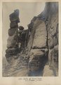
Trail up First Mesa. A. C. Vroman, photo
1909
Image
uum_map
400
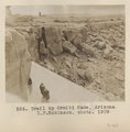
Trail up Oraibi Mesa, Arizona. H. F. Robinson, photo. 1909
1909
Image
uum_map
376
-
400
of
442
<
9
10
11
12
13
14
15
16
17
18
>