| Title | Date | Type | Setname | ||
|---|---|---|---|---|---|
| 1 | 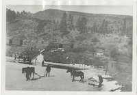 | "How the Horse Helped Build America." Chapter 16, No. 11. Ice cutting, 1904 | 1904 | Image | uum_map |
| 2 |  | Bennett Peak, NM, looking northwest. Shaler, photo | 1890; 1891; 1892; 1893; 1894; 1895; 1896; 1897; 1898; 1899; 1900; 1901; 1902; 1903; 1904; 1905 | Image | uum_map |
| 3 |  | Flat-lying Tertiary on tilted Mesa-verde Choiskai Mesa; looking north at Choiskai Peak, NM. Shaler, photo | 1890; 1891; 1892; 1893; 1894; 1895; 1896; 1897; 1898; 1899; 1900; 1901; 1902; 1903; 1904; 1905 | Image | uum_map |
| 4 |  | Ford Peak, NM, looking northeast. Shaler, photo | 1890; 1891; 1892; 1893; 1894; 1895; 1896; 1897; 1898; 1899; 1900; 1901; 1902; 1903; 1904; 1905 | Image | uum_map |
| 5 |  | Lava lying on Tertiary, Cottonwood Pass, Choiskai Mesa, east of Manning's store, NM. Shaler, photo | 1890; 1891; 1892; 1893; 1894; 1895; 1896; 1897; 1898; 1899; 1900; 1901; 1902; 1903; 1904; 1905 | Image | uum_map |
| 6 |  | Lava remnants and Mesaverde sandstone-capped mesas, looking north 35° west from 3 mi. north of mouth of Cottonwood Arroyo, NM. Shiprock farthest peaks to left. Shaler, photo | 1890; 1891; 1892; 1893; 1894; 1895; 1896; 1897; 1898; 1899; 1900; 1901; 1902; 1903; 1904; 1905 | Image | uum_map |
| 7 |  | Miscellaneous Schools p.5 | 1904 | Image | dha_cp |
| 8 |  | Monchiquite dike, looking south from Needle Peak, NM. Shaler, photo | 1890; 1891; 1892; 1893; 1894; 1895; 1896; 1897; 1898; 1899; 1900; 1901; 1902; 1903; 1904; 1905 | Image | uum_map |
| 9 |  | Needle Peak (Shiprock) looking north 68° west from a distance of 1 1/2 mi. south of Shiprock, NM. Shaler, photo | 1890; 1891; 1892; 1893; 1894; 1895; 1896; 1897; 1898; 1899; 1900; 1901; 1902; 1903; 1904; 1905 | Image | uum_map |