1 - 25 of 15
| Title | Date | Type | ||
|---|---|---|---|---|
| 1 |
 | H. Bert and Diana Jensen Home Directions | Image/StillImage | |
| 2 |
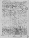
 | Marsh Peak Quad, Utah-Wyoming - Edition of June 1908 (USGS) | 1908 | Image/StillImage |
| 3 |
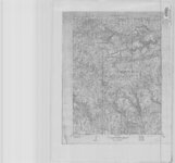
 | Marsh Peak Quad, Utah-Wyoming 1905-1906 | 1905; 1906 | Image/StillImage |
| 4 |
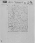 | Marsh Peak, Utah-Wyoming Edition of June 1908 | 1908 | Image/StillImage |
| 5 |
 | Massey Ranch and Massey Meadow - Hand Drawn | Image/StillImage | |
| 6 |
 | Mexico, USGS, Bulletin 817, Plate 6, 1847 | 1847 | Image/StillImage |
| 7 |
 | Myton, Duchesne County, Utah - Sanborn Map Company, April 1917 - Corrected July 1931 | 1931 | Image/StillImage |
| 8 |
 | Oil & Gas Fields and Pipelines of Utah - Revised 1976 | 1976 | Image/StillImage |
| 9 |
 | Oil and Gas Wells of Utah 1891-1948 | 1891; 1892; 1893; 1894; 1895; 1896; 1897; 1898; 1899; 1900; 1901; 1902; 1903; 1904; 1905; 1906; 1907; 1908; 1909; 1910; 1911; 1912; 1913; 1914; 1915; 1916; 1917; 1918; 1919; 1920; 1921; 1922; 1923; 1924; 1925; 1926; 1927; 1928; 1929; 1930; 1931; 1932; 1933; 1934; 1935; 1936; 1937; 1938; 1939; 1940; ... | Image/StillImage |
| 10 |
 | Pioneer Trails 1825-1849 | 1825; 1826; 1827; 1828; 1829; 1830; 1931; 1832; 1833; 1834; 1835; 1836; 1837; 1838; 1839; 1840; 1841; 1842; 1843; 1844; 1845; 1846; 1847; 1848; 1849 | Image/StillImage |
| 11 |
 | Pony Express Needles Station Camp Floyd | Image/StillImage | |
| 12 |
 | Pony Express Route - April 3, 1860 to October 24, 1861 | 1860; 1861; 1960 | Image/StillImage |
| 13 |
 | Pony Express Stations in Utah - April 3, 1860 - October 24, 1861 | 1860; 1861 | Image/StillImage |
| 14 |
 | Route of the Mormon Pioneers from Nauvoo to the Great Salt Lake, July 1847 | 1847 | Image/StillImage |
| 15 |
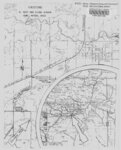
 | West from Fort Bridger, Pioneer Trails Across Utah 1846-1850 | 1846; 1947; 1948; 1849; 1850 | Image/StillImage |
1 - 25 of 15